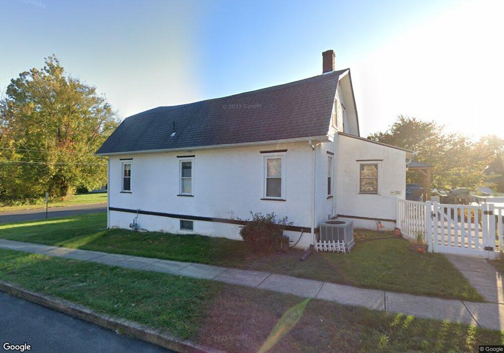
217 Ford Ave Langhorne, PA 19047
Estimated Value: $400,475 - $473,000
3
Beds
1
Bath
1,976
Sq Ft
$219/Sq Ft
Est. Value
About This Home
This home is located at 217 Ford Ave, Langhorne, PA 19047 and is currently estimated at $432,369, approximately $218 per square foot. 217 Ford Ave is a home located in Bucks County with nearby schools including Hoover Elementary School, Maple Point Middle School, and Neshaminy High School.
Ownership History
Date
Name
Owned For
Owner Type
Purchase Details
Closed on
Jan 8, 2018
Sold by
Bahr Kristina
Bought by
Bahr Edward H
Current Estimated Value
Home Financials for this Owner
Home Financials are based on the most recent Mortgage that was taken out on this home.
Original Mortgage
$138,000
Outstanding Balance
$116,396
Interest Rate
3.92%
Mortgage Type
New Conventional
Estimated Equity
$315,973
Purchase Details
Closed on
Jun 24, 1970
Sold by
Miller John C and Miller Albertus L
Bought by
Bahr Ewald H and Bahr Roswitha K
Create a Home Valuation Report for This Property
The Home Valuation Report is an in-depth analysis detailing your home's value as well as a comparison with similar homes in the area
Home Values in the Area
Average Home Value in this Area
Purchase History
| Date | Buyer | Sale Price | Title Company |
|---|---|---|---|
| Bahr Edward H | $260,000 | Lake Abstract | |
| Bahr Ewald H | -- | -- |
Source: Public Records
Mortgage History
| Date | Status | Borrower | Loan Amount |
|---|---|---|---|
| Open | Bahr Edward H | $138,000 |
Source: Public Records
Tax History Compared to Growth
Tax History
| Year | Tax Paid | Tax Assessment Tax Assessment Total Assessment is a certain percentage of the fair market value that is determined by local assessors to be the total taxable value of land and additions on the property. | Land | Improvement |
|---|---|---|---|---|
| 2025 | $4,551 | $21,200 | $4,880 | $16,320 |
| 2024 | $4,551 | $21,200 | $4,880 | $16,320 |
| 2023 | $4,477 | $21,200 | $4,880 | $16,320 |
| 2022 | $4,358 | $21,200 | $4,880 | $16,320 |
| 2021 | $4,358 | $21,200 | $4,880 | $16,320 |
| 2020 | $4,305 | $21,200 | $4,880 | $16,320 |
| 2019 | $4,207 | $21,200 | $4,880 | $16,320 |
| 2018 | $4,161 | $21,200 | $4,880 | $16,320 |
| 2017 | $4,053 | $21,200 | $4,880 | $16,320 |
| 2016 | $4,022 | $21,200 | $4,880 | $16,320 |
| 2015 | -- | $21,200 | $4,880 | $16,320 |
| 2014 | -- | $21,200 | $4,880 | $16,320 |
Source: Public Records
Map
Nearby Homes
- 524 Washington Ave
- 0 Main St
- 301 Main St
- 164 Trenton Rd
- 927 Bellevue Ave
- 5813 Edge Ave
- L:003 Newportville Rd
- 1018 Wildwood Ave
- 2718 Avenue C
- L:070 Trenton Rd
- 0 Fir Ave
- 5817 Cricket Ln
- 38 Plumtree Rd
- 154 Juniper Dr
- 94 Juniper Dr
- 35 Parkside Cir
- 19 Prunewood Rd
- 1639 Briarwood Dr Unit 145
- 2548 Nashua Rd
- 2623 Ave Unit E
- 215 Ford Ave
- 213 Ford Ave
- 211 Ford Ave
- 345 Ford Ave
- 0 Ford Ave Unit 7181663
- 0 Ford Ave Unit 7181647
- 311 Ford Ave
- 525 Lincoln Ave
- 524 Lincoln Ave
- 218 Ford Ave
- 209 Ford Ave
- 323 Ford Ave
- 523 Lincoln Ave
- 207 Ford Ave
- 520 Lincoln Ave
- 209 Webster Ave
- 519 Lincoln Ave
- 518 Lincoln Ave
- 205 Ford Ave
- 517 Lincoln Ave