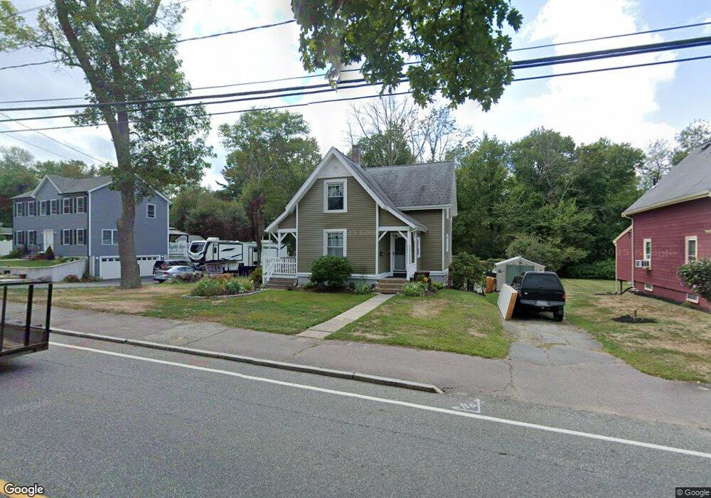
217 Franklin St Whitman, MA 02382
Estimated Value: $490,000 - $541,000
3
Beds
1
Bath
1,322
Sq Ft
$389/Sq Ft
Est. Value
About This Home
This home is located at 217 Franklin St, Whitman, MA 02382 and is currently estimated at $513,686, approximately $388 per square foot. 217 Franklin St is a home located in Plymouth County with nearby schools including St Bridget School.
Ownership History
Date
Name
Owned For
Owner Type
Purchase Details
Closed on
Jul 15, 2010
Sold by
Sullivan Kevin J and Sullivan Donna M
Bought by
Begin Keith D
Current Estimated Value
Home Financials for this Owner
Home Financials are based on the most recent Mortgage that was taken out on this home.
Original Mortgage
$226,943
Outstanding Balance
$151,559
Interest Rate
4.82%
Mortgage Type
Purchase Money Mortgage
Estimated Equity
$362,127
Purchase Details
Closed on
May 17, 2006
Sold by
Sullivan Donna
Bought by
Sullivan Kevin J and Sullivan Donna M
Home Financials for this Owner
Home Financials are based on the most recent Mortgage that was taken out on this home.
Original Mortgage
$211,050
Interest Rate
6.42%
Mortgage Type
Purchase Money Mortgage
Purchase Details
Closed on
Nov 1, 2001
Sold by
Brown Mary
Bought by
Sullivan Donna
Create a Home Valuation Report for This Property
The Home Valuation Report is an in-depth analysis detailing your home's value as well as a comparison with similar homes in the area
Home Values in the Area
Average Home Value in this Area
Purchase History
| Date | Buyer | Sale Price | Title Company |
|---|---|---|---|
| Begin Keith D | $230,000 | -- | |
| Sullivan Kevin J | -- | -- | |
| Sullivan Donna | $185,000 | -- |
Source: Public Records
Mortgage History
| Date | Status | Borrower | Loan Amount |
|---|---|---|---|
| Open | Begin Keith D | $226,943 | |
| Previous Owner | Sullivan Donna | $211,050 | |
| Previous Owner | Sullivan Donna | $20,000 |
Source: Public Records
Tax History Compared to Growth
Tax History
| Year | Tax Paid | Tax Assessment Tax Assessment Total Assessment is a certain percentage of the fair market value that is determined by local assessors to be the total taxable value of land and additions on the property. | Land | Improvement |
|---|---|---|---|---|
| 2025 | $5,442 | $414,800 | $197,400 | $217,400 |
| 2024 | $5,162 | $405,200 | $193,400 | $211,800 |
| 2023 | $5,068 | $373,500 | $177,100 | $196,400 |
| 2022 | $4,996 | $343,100 | $160,800 | $182,300 |
| 2021 | $4,619 | $298,000 | $135,400 | $162,600 |
| 2020 | $4,440 | $280,100 | $123,100 | $157,000 |
| 2019 | $4,177 | $271,600 | $123,100 | $148,500 |
| 2018 | $3,889 | $242,900 | $117,000 | $125,900 |
| 2017 | $3,663 | $242,900 | $117,000 | $125,900 |
| 2016 | $3,410 | $218,700 | $106,900 | $111,800 |
| 2015 | $3,414 | $218,700 | $106,900 | $111,800 |
Source: Public Records
Map
Nearby Homes
- 35 Dana St
- 214 Winter St
- 131 Holly Ridge Dr
- 684 South Ave
- 23 Reed Place
- 40 Lazel St
- 54-56 Stetson St
- 1057 Whitman St
- 170 Pleasant St
- 55 Plymouth St Unit A5
- 417 Birchbark Dr
- 20 Elm Place
- 48 Day St
- 110 South Ave Unit 14
- 110 South Ave
- 22 Old Coach Rd
- 84 Washington St
- 608 Plymouth St
- 532 Washington St
- 842 Whitman St
- 209 Franklin St
- 225 Franklin St
- 201 Franklin St
- 212 Franklin St
- 220 Franklin St
- 235 Franklin St
- 195 Franklin St
- 195 Franklin St Unit 2
- 195 Franklin St Unit 1
- 198 Franklin St
- 198 Franlin St
- 236 Franklin St
- 192 Franklin St
- 22 Dana St
- 185 Franklin St
- 27 Dana St
- 12 Foster Ave
- 255 Franklin St
- 26 Dana St
- 186 Franklin St