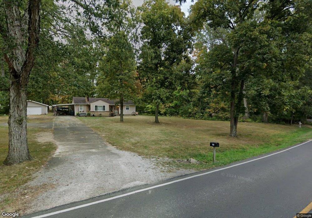
217 Free Soil Rd Georgetown, OH 45121
Estimated Value: $282,090 - $337,000
3
Beds
2
Baths
1,456
Sq Ft
$213/Sq Ft
Est. Value
About This Home
This home is located at 217 Free Soil Rd, Georgetown, OH 45121 and is currently estimated at $310,523, approximately $213 per square foot. 217 Free Soil Rd is a home located in Brown County with nearby schools including Georgetown Elementary School and Georgetown Jr/Sr High School.
Ownership History
Date
Name
Owned For
Owner Type
Purchase Details
Closed on
Oct 19, 2018
Sold by
Woodruff Barry Lynn and Woodruff Karen Sue
Bought by
Fisher Stephanie R
Current Estimated Value
Purchase Details
Closed on
Sep 18, 2015
Sold by
Watson George B and Watson Courtney Morgan
Bought by
Woodruff Barry Lynn and Woodruff Karen Sue
Purchase Details
Closed on
Mar 21, 2014
Sold by
Watson Amanda K
Bought by
Watson George B
Home Financials for this Owner
Home Financials are based on the most recent Mortgage that was taken out on this home.
Original Mortgage
$85,450
Interest Rate
4.29%
Purchase Details
Closed on
Nov 18, 2008
Sold by
Watson George B and Watson Amanda K
Bought by
Watson George B and Watson Amanda K
Purchase Details
Closed on
Jul 13, 2005
Sold by
Calvert James W and Calvert Deanna
Bought by
Watson George B
Home Financials for this Owner
Home Financials are based on the most recent Mortgage that was taken out on this home.
Original Mortgage
$85,000
Interest Rate
6.5%
Create a Home Valuation Report for This Property
The Home Valuation Report is an in-depth analysis detailing your home's value as well as a comparison with similar homes in the area
Home Values in the Area
Average Home Value in this Area
Purchase History
| Date | Buyer | Sale Price | Title Company |
|---|---|---|---|
| Fisher Stephanie R | -- | None Available | |
| Woodruff Barry Lynn | $233,333 | Attorney | |
| Watson George B | -- | None Available | |
| Watson George B | -- | Attorney | |
| Watson George B | $25,500 | -- |
Source: Public Records
Mortgage History
| Date | Status | Borrower | Loan Amount |
|---|---|---|---|
| Previous Owner | Watson George B | $85,450 | |
| Previous Owner | Watson George B | $85,000 |
Source: Public Records
Tax History
| Year | Tax Paid | Tax Assessment Tax Assessment Total Assessment is a certain percentage of the fair market value that is determined by local assessors to be the total taxable value of land and additions on the property. | Land | Improvement |
|---|---|---|---|---|
| 2024 | $2,972 | $83,940 | $12,950 | $70,990 |
| 2023 | $2,974 | $54,690 | $8,650 | $46,040 |
| 2022 | $2,109 | $54,690 | $8,650 | $46,040 |
| 2021 | $2,090 | $54,690 | $8,650 | $46,040 |
| 2020 | $1,850 | $45,600 | $7,230 | $38,370 |
| 2019 | $1,837 | $45,600 | $7,230 | $38,370 |
| 2018 | $1,824 | $45,600 | $7,230 | $38,370 |
| 2017 | $1,355 | $39,090 | $7,330 | $31,760 |
| 2016 | $1,354 | $39,090 | $7,330 | $31,760 |
| 2015 | $1,405 | $39,090 | $7,330 | $31,760 |
| 2014 | $1,405 | $38,420 | $6,660 | $31,760 |
| 2013 | $1,401 | $38,420 | $6,660 | $31,760 |
Source: Public Records
Map
Nearby Homes
- 155 Free Soil Rd
- 20 Heritage Hill Dr
- 20 Douglas Cir
- 470 Free Soil Rd
- 175 Douglas Cir
- 505 S Water St
- 25 Douglas Ln
- 666 E State St
- 510 W State St
- 0 St Rt 221 & Footbridge Unit 1826509
- 708 E State St
- 406 E North St
- 405 N Main St
- 60 New St
- 399 Elmwood Ct
- 508 Mount Orab Pike
- 7029 Free Soil Rd
- 427 Kenwood Ave
- 1 N Kenwood Ave
- 2 N Kenwood Ave
- 216 Free Soil Rd
- 192 Free Soil Rd
- 187 Free Soil Rd
- 219 Free Soil Rd
- 28 Carrington Dr
- 234 Free Soil Rd
- 164 Free Soil Rd
- 239 Free Soil Rd
- 30 Carrington Dr
- 246 Free Soil Rd
- 52 Carrington Dr
- 45 Carrington Dr
- 115 Lauray Dr
- 266 Free Soil Rd
- 106 Lauray Dr
- 174 Free Soil Rd
- 209 Free Soil Rd
- 209 Free Soil Rd
- 209 Free Soil Rd
- 209 Free Soil Rd
Your Personal Tour Guide
Ask me questions while you tour the home.