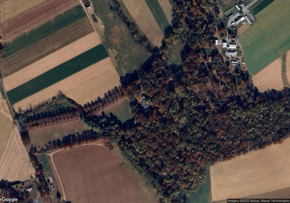
217 King Rd Atglen, PA 19310
West Fallowfield Township NeighborhoodEstimated Value: $338,000 - $1,218,000
6
Beds
3
Baths
5,721
Sq Ft
$162/Sq Ft
Est. Value
About This Home
This home is located at 217 King Rd, Atglen, PA 19310 and is currently estimated at $924,019, approximately $161 per square foot. 217 King Rd is a home located in Chester County with nearby schools including Octorara Elementary School, Octorara Primary Learning Center, and Octorara Intermediate School.
Ownership History
Date
Name
Owned For
Owner Type
Purchase Details
Closed on
Jun 29, 2018
Sold by
Irwin Robert H and Robert H Irwin Revocable Trust
Bought by
Hawthorne Judson E and Hawthorne Stayce D
Current Estimated Value
Home Financials for this Owner
Home Financials are based on the most recent Mortgage that was taken out on this home.
Original Mortgage
$725,000
Outstanding Balance
$629,710
Interest Rate
4.6%
Mortgage Type
Future Advance Clause Open End Mortgage
Estimated Equity
$294,309
Create a Home Valuation Report for This Property
The Home Valuation Report is an in-depth analysis detailing your home's value as well as a comparison with similar homes in the area
Home Values in the Area
Average Home Value in this Area
Purchase History
| Date | Buyer | Sale Price | Title Company |
|---|---|---|---|
| Hawthorne Judson E | $1,550,000 | Pennsylvania Land Exchange C |
Source: Public Records
Mortgage History
| Date | Status | Borrower | Loan Amount |
|---|---|---|---|
| Open | Hawthorne Judson E | $725,000 |
Source: Public Records
Tax History Compared to Growth
Tax History
| Year | Tax Paid | Tax Assessment Tax Assessment Total Assessment is a certain percentage of the fair market value that is determined by local assessors to be the total taxable value of land and additions on the property. | Land | Improvement |
|---|---|---|---|---|
| 2025 | $18,985 | $448,200 | $61,160 | $387,040 |
| 2024 | $18,985 | $448,200 | $61,160 | $387,040 |
| 2023 | $18,873 | $448,200 | $61,160 | $387,040 |
| 2022 | $18,357 | $448,200 | $61,160 | $387,040 |
| 2021 | $18,384 | $448,200 | $61,160 | $387,040 |
| 2020 | $18,275 | $448,200 | $61,160 | $387,040 |
| 2019 | $17,946 | $448,200 | $61,160 | $387,040 |
| 2018 | $17,771 | $448,200 | $61,160 | $387,040 |
| 2017 | $17,438 | $448,200 | $61,160 | $387,040 |
| 2016 | $1,537 | $448,200 | $61,160 | $387,040 |
| 2015 | $1,537 | $448,200 | $61,160 | $387,040 |
| 2014 | $1,537 | $448,200 | $61,160 | $387,040 |
Source: Public Records
Map
Nearby Homes
- 23 Rosewood Dr
- 300 Brook Rd
- 203 Cochran St
- 675 Glen Run Dr
- 301 High Point Rd
- 40 Hurley Rd
- 7 Station Rd
- 502 Ivy Hill Path
- 230 Honeycroft Blvd
- 604 Greenbriar Path
- 607 Greenbriar Path
- 606 Greenbriar Path
- 219 Honeycroft Blvd
- 610 Greenbriar Path
- 19 Becky Ln
- 618 Greenbriar Path
- 833 Summer Breeze Path
- 301 E Bridge St
- 843 Summer Breeze Path
- 222 Old Racetrack Rd
- 40 Umble Rd
- 205 King Rd
- 2251 Steelville Rd
- 2241 Steelville Rd
- 2751 Steelville Rd
- 37 Umble Rd
- 198 King Rd
- 2752 Steelville Rd
- 194 King Rd
- 2756 Steelville Rd
- 946 Fallowfield Rd
- 190 King Rd
- 33 Umble Rd
- 960 Fallowfield Rd
- 180 King Rd
- 29 Umble Rd
- 976 Fallowfield Rd
- 25 Rosewood Dr Unit A7
- 25 Rosewood Dr
- 5 Rosewood Dr
