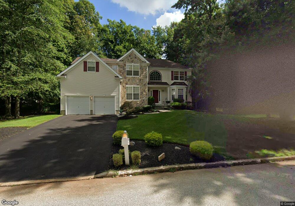
217 Laurel Ln Mount Laurel, NJ 08054
Estimated Value: $725,093 - $780,000
--
Bed
--
Bath
2,684
Sq Ft
$281/Sq Ft
Est. Value
About This Home
This home is located at 217 Laurel Ln, Mount Laurel, NJ 08054 and is currently estimated at $754,273, approximately $281 per square foot. 217 Laurel Ln is a home located in Burlington County with nearby schools including Hillside Elementary School, T.E. Harrington Middle School, and Mount Laurel Hartford School.
Ownership History
Date
Name
Owned For
Owner Type
Purchase Details
Closed on
Dec 18, 2003
Sold by
Abrams Barbara L and Abrams Stewart H
Bought by
Abrams Stewart H and Abrams Barbara L
Current Estimated Value
Home Financials for this Owner
Home Financials are based on the most recent Mortgage that was taken out on this home.
Original Mortgage
$200,000
Outstanding Balance
$92,288
Interest Rate
5.82%
Mortgage Type
New Conventional
Estimated Equity
$661,985
Purchase Details
Closed on
Jul 10, 1998
Sold by
Peter S Tocco Building & Remodeling Llc
Bought by
Abrams Stewart L and Abrams Barbara H
Home Financials for this Owner
Home Financials are based on the most recent Mortgage that was taken out on this home.
Original Mortgage
$190,000
Interest Rate
6.99%
Create a Home Valuation Report for This Property
The Home Valuation Report is an in-depth analysis detailing your home's value as well as a comparison with similar homes in the area
Home Values in the Area
Average Home Value in this Area
Purchase History
| Date | Buyer | Sale Price | Title Company |
|---|---|---|---|
| Abrams Stewart H | -- | -- | |
| Abrams Stewart L | $284,322 | Lawyers Title Insurance Corp |
Source: Public Records
Mortgage History
| Date | Status | Borrower | Loan Amount |
|---|---|---|---|
| Open | Abrams Stewart H | $200,000 | |
| Closed | Abrams Stewart L | $190,000 |
Source: Public Records
Tax History Compared to Growth
Tax History
| Year | Tax Paid | Tax Assessment Tax Assessment Total Assessment is a certain percentage of the fair market value that is determined by local assessors to be the total taxable value of land and additions on the property. | Land | Improvement |
|---|---|---|---|---|
| 2025 | $13,540 | $428,900 | $127,000 | $301,900 |
| 2024 | $13,030 | $428,900 | $127,000 | $301,900 |
| 2023 | $13,030 | $428,900 | $127,000 | $301,900 |
| 2022 | $12,987 | $428,900 | $127,000 | $301,900 |
| 2021 | $12,742 | $428,900 | $127,000 | $301,900 |
| 2020 | $12,494 | $428,900 | $127,000 | $301,900 |
| 2019 | $12,365 | $428,900 | $127,000 | $301,900 |
| 2018 | $12,271 | $428,900 | $127,000 | $301,900 |
| 2017 | $11,953 | $428,900 | $127,000 | $301,900 |
| 2016 | $11,773 | $428,900 | $127,000 | $301,900 |
| 2015 | $11,636 | $428,900 | $127,000 | $301,900 |
| 2014 | $11,520 | $428,900 | $127,000 | $301,900 |
Source: Public Records
Map
Nearby Homes
- 27 Marter Ave
- 810 Mount Laurel Rd
- 21 Hillside Ln
- 324 Mount Laurel Rd
- 329 Mount Laurel Rd
- 2 Watson Dr
- 16 Naples Ln
- 10 Naples Ln
- 212 Dogwood Dr
- 11 Rolling Glen Ct
- 7 Buttonbush Ct
- 120 Canterbury Rd
- 1302 Ginger Dr
- 1201A Ginger Ct
- 420 Elderberry Ct
- 570 Walton Ave
- 53 Saw Mill Dr
- 35 Sisters Farmstead Dr
- 17 Peppergrass Dr N
- 6 Leighton Dr