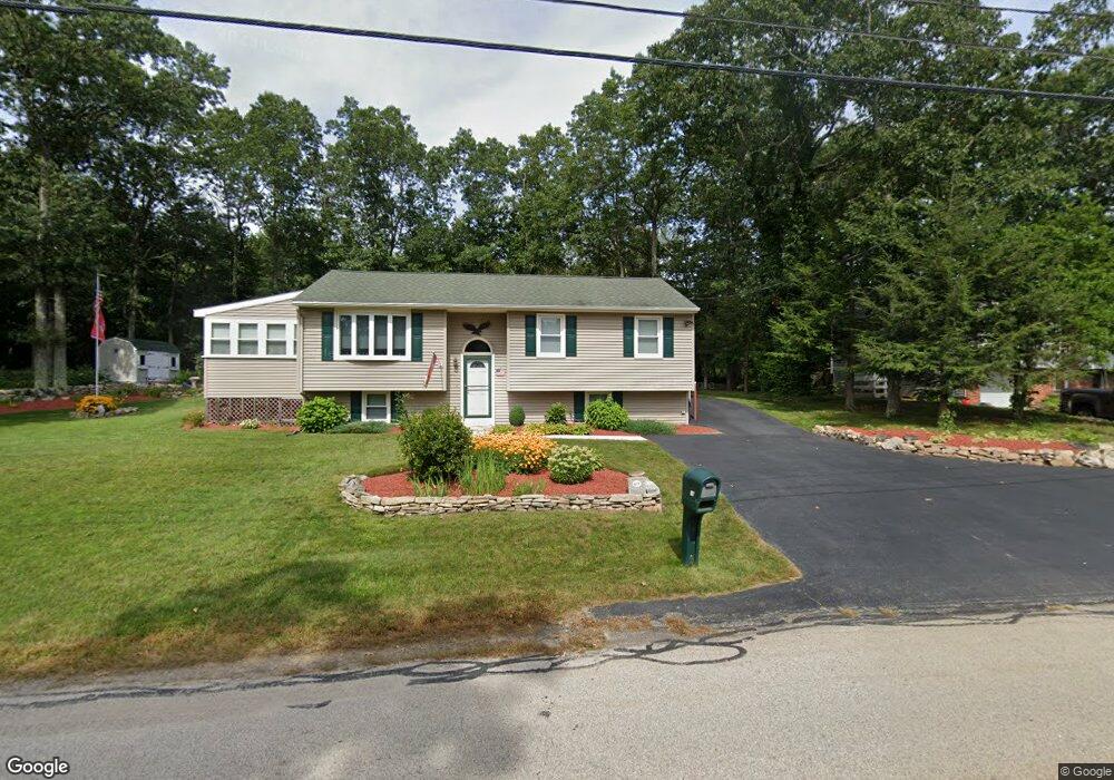
217 Lower Gore Rd Webster, MA 01570
Estimated Value: $420,000 - $460,000
3
Beds
1
Bath
1,481
Sq Ft
$297/Sq Ft
Est. Value
About This Home
This home is located at 217 Lower Gore Rd, Webster, MA 01570 and is currently estimated at $439,689, approximately $296 per square foot. 217 Lower Gore Rd is a home located in Worcester County with nearby schools including Park Avenue Elementary School, Webster Middle School, and Bartlett High School.
Ownership History
Date
Name
Owned For
Owner Type
Purchase Details
Closed on
Nov 7, 2018
Sold by
Bianculli Brenda M
Bought by
Johnson Rt
Current Estimated Value
Purchase Details
Closed on
Apr 1, 1999
Sold by
Freniere William M
Bought by
Johnson Russell W and Johnson Judith A
Home Financials for this Owner
Home Financials are based on the most recent Mortgage that was taken out on this home.
Original Mortgage
$35,000
Interest Rate
6.78%
Mortgage Type
Purchase Money Mortgage
Purchase Details
Closed on
Sep 30, 1997
Sold by
Thurber Donald and Jette Christine
Bought by
Freniere William M
Home Financials for this Owner
Home Financials are based on the most recent Mortgage that was taken out on this home.
Original Mortgage
$70,000
Interest Rate
7.47%
Mortgage Type
Purchase Money Mortgage
Purchase Details
Closed on
Dec 24, 1991
Sold by
Ward Construction
Bought by
Thurber Donald and Christine Jette
Home Financials for this Owner
Home Financials are based on the most recent Mortgage that was taken out on this home.
Original Mortgage
$105,400
Interest Rate
8.68%
Mortgage Type
Purchase Money Mortgage
Create a Home Valuation Report for This Property
The Home Valuation Report is an in-depth analysis detailing your home's value as well as a comparison with similar homes in the area
Home Values in the Area
Average Home Value in this Area
Purchase History
| Date | Buyer | Sale Price | Title Company |
|---|---|---|---|
| Johnson Rt | -- | -- | |
| Bianculli Brenda M | -- | -- | |
| Johnson Russell W | $124,000 | -- | |
| Freniere William M | $120,000 | -- | |
| Thurber Donald | $111,000 | -- |
Source: Public Records
Mortgage History
| Date | Status | Borrower | Loan Amount |
|---|---|---|---|
| Previous Owner | Thurber Donald | $35,000 | |
| Previous Owner | Thurber Donald | $70,000 | |
| Previous Owner | Thurber Donald | $103,500 | |
| Previous Owner | Thurber Donald | $105,400 |
Source: Public Records
Tax History Compared to Growth
Tax History
| Year | Tax Paid | Tax Assessment Tax Assessment Total Assessment is a certain percentage of the fair market value that is determined by local assessors to be the total taxable value of land and additions on the property. | Land | Improvement |
|---|---|---|---|---|
| 2025 | $4,631 | $389,800 | $79,700 | $310,100 |
| 2024 | $4,490 | $368,600 | $76,700 | $291,900 |
| 2023 | $4,118 | $329,400 | $73,000 | $256,400 |
| 2022 | $3,983 | $285,300 | $70,900 | $214,400 |
| 2021 | $4,054 | $268,500 | $70,900 | $197,600 |
| 2020 | $3,946 | $262,000 | $70,900 | $191,100 |
| 2019 | $3,248 | $211,900 | $70,900 | $141,000 |
| 2018 | $3,726 | $201,800 | $70,900 | $130,900 |
| 2017 | $2,835 | $187,400 | $69,400 | $118,000 |
| 2016 | $2,728 | $180,200 | $66,100 | $114,100 |
| 2015 | $2,515 | $171,300 | $64,800 | $106,500 |
Source: Public Records
Map
Nearby Homes
- 16 Hilltop Dr
- 169 Upper Gore Rd
- 171 Upper Gore Rd
- 24 Cooper Rd
- 26 Wakefield Ave
- 38 Colonial Rd
- 9 Scenic Ave
- 14 Colonial Rd
- 57 Upper Gore Rd
- 6 Henry Rd
- 13 S Point Rd
- 1 Ernest St
- 215 Sand Dam Rd
- 27 Douglas Rd
- 14 Browns Brook Rd
- 20 Lakeview Rd
- 23 Lakeview Rd
- 27 Lakeview Rd
- 194 Killdeer Rd
- 597 E Thompson Rd Unit Lot 10C
- 219 Lower Gore Rd
- 218 Lower Gore Rd
- 216 Lower Gore Rd
- 2 Hilltop Dr
- 220 Lower Gore Rd
- 215 Lower Gore Rd
- 214 Lower Gore Rd
- 222 Lower Gore Rd
- 212 Lower Gore Rd
- 6 Hilltop Dr
- 224 Lower Gore Rd
- 210 Lower Gore Rd
- 10 Hilltop Dr
- 7 Hilltop Dr
- 4 Longview Ave
- 11 Hilltop Dr
- 208 Lower Gore Rd
- 209 Lower Gore Rd
- 87 High St
- 15 Hilltop Dr