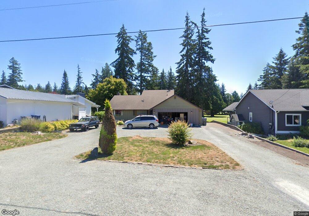
217 Mackenzie Dr Camano Island, WA 98282
Estimated Value: $629,758 - $681,000
2
Beds
3
Baths
1,641
Sq Ft
$395/Sq Ft
Est. Value
About This Home
This home is located at 217 Mackenzie Dr, Camano Island, WA 98282 and is currently estimated at $647,690, approximately $394 per square foot. 217 Mackenzie Dr is a home located in Island County with nearby schools including Utsalady Elementary School, Port Susan Middle School, and Stanwood High School.
Ownership History
Date
Name
Owned For
Owner Type
Purchase Details
Closed on
Oct 18, 2018
Sold by
Cashman Diane and Lafreniere Diane
Bought by
Higdon Daniel
Current Estimated Value
Home Financials for this Owner
Home Financials are based on the most recent Mortgage that was taken out on this home.
Original Mortgage
$368,600
Outstanding Balance
$321,441
Interest Rate
4.5%
Mortgage Type
New Conventional
Estimated Equity
$326,249
Purchase Details
Closed on
Mar 24, 2006
Sold by
Whittaker John A
Bought by
Whittaker John A
Create a Home Valuation Report for This Property
The Home Valuation Report is an in-depth analysis detailing your home's value as well as a comparison with similar homes in the area
Home Values in the Area
Average Home Value in this Area
Purchase History
| Date | Buyer | Sale Price | Title Company |
|---|---|---|---|
| Higdon Daniel | $380,000 | First American Title Of Isla | |
| Whittaker John A | -- | None Available |
Source: Public Records
Mortgage History
| Date | Status | Borrower | Loan Amount |
|---|---|---|---|
| Open | Higdon Daniel | $368,600 |
Source: Public Records
Tax History Compared to Growth
Tax History
| Year | Tax Paid | Tax Assessment Tax Assessment Total Assessment is a certain percentage of the fair market value that is determined by local assessors to be the total taxable value of land and additions on the property. | Land | Improvement |
|---|---|---|---|---|
| 2024 | $4,558 | $620,682 | $300,000 | $320,682 |
| 2023 | $4,558 | $584,781 | $260,000 | $324,781 |
| 2022 | $4,303 | $507,809 | $210,000 | $297,809 |
| 2021 | $3,804 | $457,413 | $200,000 | $257,413 |
| 2020 | $3,764 | $390,653 | $140,000 | $250,653 |
| 2019 | $3,158 | $381,637 | $200,000 | $181,637 |
| 2018 | $3,152 | $319,522 | $145,000 | $174,522 |
| 2017 | $2,817 | $295,620 | $120,000 | $175,620 |
| 2016 | $2,626 | $292,815 | $115,000 | $177,815 |
| 2015 | $2,558 | $261,974 | $115,000 | $146,974 |
| 2013 | -- | $251,231 | $100,000 | $151,231 |
Source: Public Records
Map
Nearby Homes
- 0 E Shumway Rd
- 230 Heather Dr
- 335 Heather Dr
- 269 E Lochwood Dr
- 355 Selkirk Dr
- 302 Melrose Dr
- 251 Goodrich Rd
- 362 N Sunrise Blvd
- 474 Stirling Dr
- 245 David St
- 105 N Sunrise Blvd
- 244 David St
- 563 Waynes Ridge Cir
- 0 Dodge Rd Unit NWM2434437
- 0 Dodge Rd Unit NWM2434435
- 230 Rocky Mountain High Rd
- 289 E Driftwood Shores Rd
- 441 Windsun Way
- 446 Lehman Dr
- 169 Driftwood Shores Rd
- 213 Mackenzie Dr
- 221 Mackenzie Dr
- 209 Mackenzie Dr
- 225 Mackenzie Dr
- 218 Mackenzie Dr
- 214 Mackenzie Dr
- 205 Mackenzie Dr
- 210 Mackenzie Dr
- 229 Mackenzie Dr
- 221 Edinburgh Dr
- 232 Mackenzie Dr
- 213 Edinburgh Dr
- 206 Mackenzie Dr
- 254 Dundee Dr
- 233 Mackenzie Dr
- 249 Edinburgh Dr
- 209 Edinburgh Dr
- 242 Mackenzie Dr
- 256 Dundee Dr
- 255 Dundee Dr