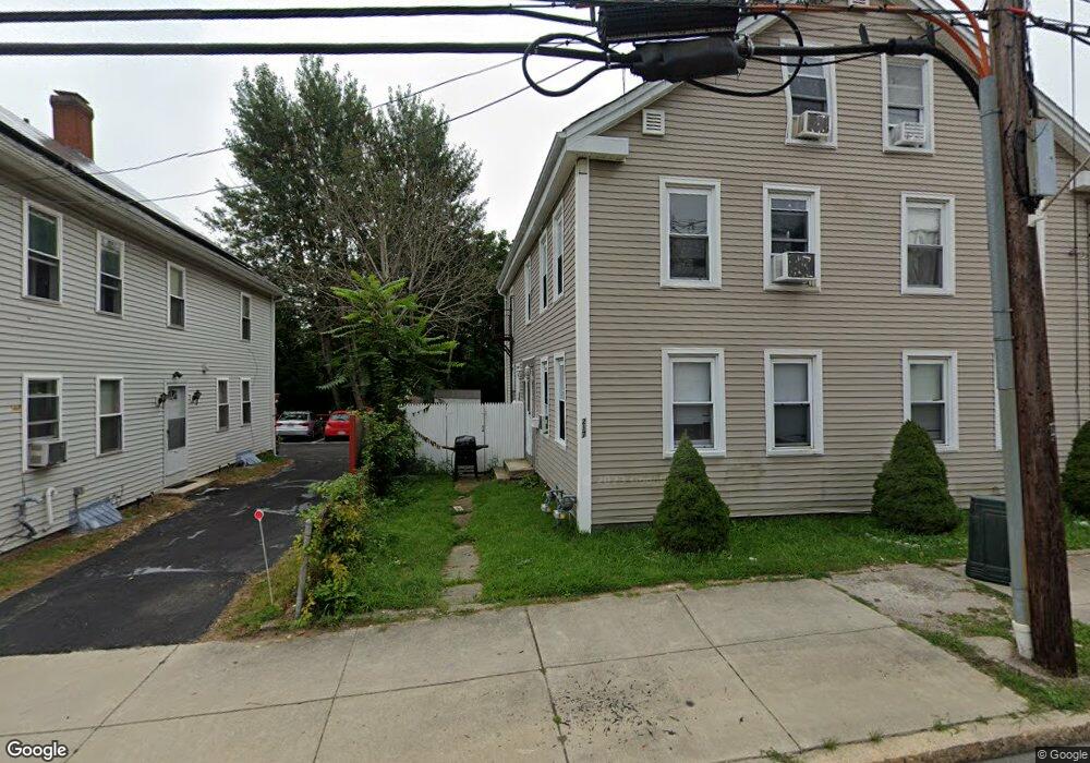
217 Main St Unit 219 Blackstone, MA 01504
Estimated Value: $433,857 - $525,000
8
Beds
2
Baths
2,660
Sq Ft
$185/Sq Ft
Est. Value
About This Home
This home is located at 217 Main St Unit 219, Blackstone, MA 01504 and is currently estimated at $493,214, approximately $185 per square foot. 217 Main St Unit 219 is a home located in Worcester County with nearby schools including Blackstone-Millville Regional High School, Rise Prep Mayoral Academy Middle School, and Founders Academy.
Ownership History
Date
Name
Owned For
Owner Type
Purchase Details
Closed on
Sep 16, 2022
Sold by
Nair-Anger Brenda and Anger Michael R
Bought by
Pride Apt & Hm Rlty Llc
Current Estimated Value
Home Financials for this Owner
Home Financials are based on the most recent Mortgage that was taken out on this home.
Original Mortgage
$277,500
Outstanding Balance
$263,779
Interest Rate
4.99%
Mortgage Type
Purchase Money Mortgage
Estimated Equity
$229,435
Purchase Details
Closed on
Apr 1, 2019
Sold by
Divine Favor Llc
Bought by
Anger Michael R and Anger Brenda N
Home Financials for this Owner
Home Financials are based on the most recent Mortgage that was taken out on this home.
Original Mortgage
$216,600
Interest Rate
4.3%
Mortgage Type
New Conventional
Purchase Details
Closed on
Oct 6, 2017
Sold by
Sandys Blackstone Ret and Toutounjian
Bought by
Divine Favor Llc
Home Financials for this Owner
Home Financials are based on the most recent Mortgage that was taken out on this home.
Original Mortgage
$125,000
Interest Rate
3.86%
Mortgage Type
New Conventional
Purchase Details
Closed on
Jun 29, 2006
Sold by
Pinheiro Nancy and Toutounjian Sevan
Bought by
Sandys Blackstone Rt
Purchase Details
Closed on
Dec 7, 2004
Sold by
Pinheiro Nancy
Bought by
Pinheiro Nancy and Toutounjian Sevan
Purchase Details
Closed on
Dec 23, 2002
Sold by
Mckernan Charles J
Bought by
Pinheiro Nancy
Home Financials for this Owner
Home Financials are based on the most recent Mortgage that was taken out on this home.
Original Mortgage
$234,000
Interest Rate
6.16%
Mortgage Type
Purchase Money Mortgage
Purchase Details
Closed on
Apr 11, 2000
Sold by
Crook Christopher
Bought by
Mckernan Charles J
Purchase Details
Closed on
Jan 20, 1994
Sold by
Jolicoeur Gary
Bought by
Crook Christopher
Purchase Details
Closed on
Dec 31, 1993
Sold by
Fdic and Richardson Mary
Bought by
Jolicoeur Gary
Create a Home Valuation Report for This Property
The Home Valuation Report is an in-depth analysis detailing your home's value as well as a comparison with similar homes in the area
Home Values in the Area
Average Home Value in this Area
Purchase History
| Date | Buyer | Sale Price | Title Company |
|---|---|---|---|
| Pride Apt & Hm Rlty Llc | $370,000 | None Available | |
| Anger Michael R | $228,000 | -- | |
| Divine Favor Llc | $117,000 | -- | |
| Sandys Blackstone Rt | -- | -- | |
| Sandys Blackstone Rt | -- | -- | |
| Pinheiro Nancy | -- | -- | |
| Pinheiro Nancy | -- | -- | |
| Pinheiro Nancy | $290,000 | -- | |
| Mckernan Charles J | $118,000 | -- | |
| Crook Christopher | $50,000 | -- | |
| Jolicoeur Gary | $33,000 | -- |
Source: Public Records
Mortgage History
| Date | Status | Borrower | Loan Amount |
|---|---|---|---|
| Open | Pride Apt & Hm Rlty Llc | $277,500 | |
| Previous Owner | Anger Michael R | $216,600 | |
| Previous Owner | Divine Favor Llc | $125,000 | |
| Previous Owner | Jolicoeur Gary | $234,000 | |
| Previous Owner | Jolicoeur Gary | $32,000 |
Source: Public Records
Tax History Compared to Growth
Tax History
| Year | Tax Paid | Tax Assessment Tax Assessment Total Assessment is a certain percentage of the fair market value that is determined by local assessors to be the total taxable value of land and additions on the property. | Land | Improvement |
|---|---|---|---|---|
| 2025 | $5,151 | $341,100 | $94,200 | $246,900 |
| 2024 | $5,916 | $362,300 | $89,300 | $273,000 |
| 2023 | $4,396 | $271,700 | $94,200 | $177,500 |
| 2022 | $4,509 | $251,900 | $82,000 | $169,900 |
| 2021 | $4,620 | $246,800 | $84,600 | $162,200 |
| 2020 | $4,709 | $249,700 | $75,500 | $174,200 |
| 2019 | $4,300 | $227,400 | $67,100 | $160,300 |
| 2018 | $4,397 | $225,600 | $72,600 | $153,000 |
| 2017 | $4,189 | $217,500 | $72,600 | $144,900 |
| 2016 | $4,054 | $209,600 | $66,800 | $142,800 |
| 2015 | $3,353 | $172,100 | $67,400 | $104,700 |
Source: Public Records
Map
Nearby Homes
- 225-227 Main St
- 6 Old Mendon St
- 8 Old Mendon St Unit 8
- 122 Canal St
- 1 Tupperware Dr Unit 226
- 1 Tupperware Dr Unit 138
- 1 Tupperware Dr Unit 108
- 259 Main St
- 175 Saint Paul St
- 22 Colerick Ave
- 0 Main St
- 96 Main St Unit 1
- 81 Fountain St
- 24 Reilly Ave
- 29 Graves Ave
- 15 Blackstone St
- 12 Keough St
- 4 Sharon Pkwy
- 3 Federal St
- 11 Federal St
- 217-219 Main St
- 215 Main St
- 215 Main St Unit 1
- 215 Main St Unit 2
- 9 Church St Unit 9
- 9 Church St Unit 2
- 9 Church St Unit 1
- 9 Church St
- 221 Main St Unit 223
- 221 Main St Unit 1
- 223 Main St Unit R
- 223 Main St
- 11 Church St
- 222 Main St
- 225 Main St Unit 227
- 8 Church St
- 4 Church St
- 2 Middle St
- lot-42 Middle
- 207 Main St