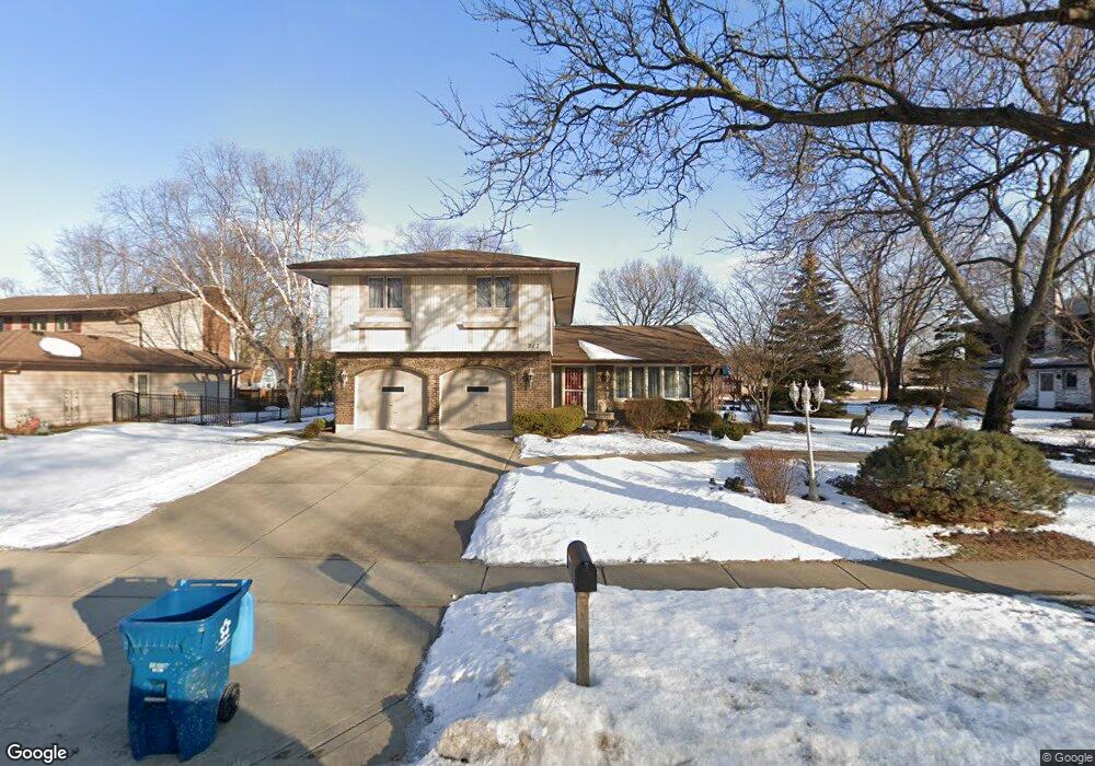
217 Mendon Ln Schaumburg, IL 60193
West Schaumburg NeighborhoodEstimated Value: $514,000 - $575,000
4
Beds
3
Baths
2,300
Sq Ft
$235/Sq Ft
Est. Value
About This Home
This home is located at 217 Mendon Ln, Schaumburg, IL 60193 and is currently estimated at $539,813, approximately $234 per square foot. 217 Mendon Ln is a home located in Cook County with nearby schools including Campanelli Elementary School, Jane Addams Junior High School, and Hoffman Estates High School.
Ownership History
Date
Name
Owned For
Owner Type
Purchase Details
Closed on
Aug 4, 2003
Sold by
Choi Bob Y and Choi Eun Kyoung
Bought by
Bob Y & Eun Kyoung Choi Declaration Tr
Current Estimated Value
Purchase Details
Closed on
Aug 16, 2002
Sold by
Evers William E
Bought by
Choi Bob Y and Choi Fun Kyoung
Home Financials for this Owner
Home Financials are based on the most recent Mortgage that was taken out on this home.
Original Mortgage
$300,700
Outstanding Balance
$127,332
Interest Rate
6.56%
Estimated Equity
$412,481
Create a Home Valuation Report for This Property
The Home Valuation Report is an in-depth analysis detailing your home's value as well as a comparison with similar homes in the area
Home Values in the Area
Average Home Value in this Area
Purchase History
| Date | Buyer | Sale Price | Title Company |
|---|---|---|---|
| Bob Y & Eun Kyoung Choi Declaration Tr | -- | -- | |
| Choi Bob Y | $382,000 | 1St American Title |
Source: Public Records
Mortgage History
| Date | Status | Borrower | Loan Amount |
|---|---|---|---|
| Open | Choi Bob Y | $300,700 |
Source: Public Records
Tax History Compared to Growth
Tax History
| Year | Tax Paid | Tax Assessment Tax Assessment Total Assessment is a certain percentage of the fair market value that is determined by local assessors to be the total taxable value of land and additions on the property. | Land | Improvement |
|---|---|---|---|---|
| 2024 | $10,426 | $40,534 | $9,979 | $30,555 |
| 2023 | $10,081 | $40,534 | $9,979 | $30,555 |
| 2022 | $10,081 | $40,534 | $9,979 | $30,555 |
| 2021 | $7,776 | $28,987 | $7,172 | $21,815 |
| 2020 | $7,710 | $28,987 | $7,172 | $21,815 |
| 2019 | $7,714 | $32,208 | $7,172 | $25,036 |
| 2018 | $8,543 | $31,903 | $5,925 | $25,978 |
| 2017 | $8,427 | $31,903 | $5,925 | $25,978 |
| 2016 | $8,606 | $33,651 | $5,925 | $27,726 |
| 2015 | $8,030 | $29,463 | $5,301 | $24,162 |
| 2014 | $7,958 | $29,463 | $5,301 | $24,162 |
| 2013 | $7,736 | $29,463 | $5,301 | $24,162 |
Source: Public Records
Map
Nearby Homes
- 136 Caryville Ln
- 227 S Walnut Ln
- 1933 Whittier Ln
- 135 S Walnut Ln
- 1939 Weston Ln
- 8181 Northway Dr
- 8138 N Carrolton Ct
- 2404 Baldwin Ct
- 231 Webster Ln
- 630 S Walnut Ln
- 2317 Broadway Ln
- 200 Columbia Ct Unit 5
- 1614 Kingston Ln
- 7843 Kensington Ln
- 630 Clover Ln
- 7873 Asbury Cir S
- 133 White Branch Ct S Unit 539
- 519 S Springinsguth Rd
- 7837 Huntington Cir S
- 521 Auburn Ln