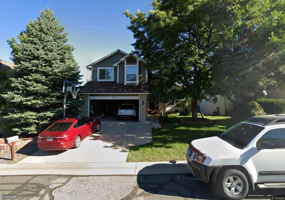
217 Monarch Trail Broomfield, CO 80020
The Outlook NeighborhoodEstimated Value: $705,404 - $825,000
4
Beds
4
Baths
1,820
Sq Ft
$431/Sq Ft
Est. Value
About This Home
This home is located at 217 Monarch Trail, Broomfield, CO 80020 and is currently estimated at $784,101, approximately $430 per square foot. 217 Monarch Trail is a home located in Broomfield County with nearby schools including Aspen Creek K-8 School, Broomfield High School, and Nativity: Faith and Reason.
Ownership History
Date
Name
Owned For
Owner Type
Purchase Details
Closed on
Sep 11, 2006
Sold by
Engel Christi Lynn and Brown Christi Lynn
Bought by
Garner Gregory P and Garner Tammy B
Current Estimated Value
Home Financials for this Owner
Home Financials are based on the most recent Mortgage that was taken out on this home.
Original Mortgage
$68,980
Interest Rate
6.28%
Mortgage Type
Stand Alone Second
Purchase Details
Closed on
Mar 15, 2005
Sold by
Swearngain Patricia Harding
Bought by
Brown Christi Lynn and Engel Christi Lynn
Purchase Details
Closed on
Jul 25, 1995
Purchase Details
Closed on
Aug 6, 1993
Purchase Details
Closed on
Jul 13, 1992
Purchase Details
Closed on
Jan 24, 1992
Create a Home Valuation Report for This Property
The Home Valuation Report is an in-depth analysis detailing your home's value as well as a comparison with similar homes in the area
Home Values in the Area
Average Home Value in this Area
Purchase History
| Date | Buyer | Sale Price | Title Company |
|---|---|---|---|
| Garner Gregory P | $344,900 | North Amer Title Co Of Co | |
| Brown Christi Lynn | -- | -- | |
| -- | $190,000 | -- | |
| -- | $176,500 | -- | |
| -- | $82,500 | -- | |
| -- | $696,000 | -- |
Source: Public Records
Mortgage History
| Date | Status | Borrower | Loan Amount |
|---|---|---|---|
| Closed | Garner Gregory P | $68,980 | |
| Open | Garner Gregory P | $275,920 |
Source: Public Records
Tax History Compared to Growth
Tax History
| Year | Tax Paid | Tax Assessment Tax Assessment Total Assessment is a certain percentage of the fair market value that is determined by local assessors to be the total taxable value of land and additions on the property. | Land | Improvement |
|---|---|---|---|---|
| 2025 | $4,401 | $47,300 | $11,060 | $36,240 |
| 2024 | $4,401 | $46,970 | $10,560 | $36,410 |
| 2023 | $4,393 | $52,550 | $11,820 | $40,730 |
| 2022 | $3,500 | $36,200 | $8,340 | $27,860 |
| 2021 | $3,482 | $37,240 | $8,580 | $28,660 |
| 2020 | $3,189 | $33,900 | $7,870 | $26,030 |
| 2019 | $3,183 | $34,130 | $7,920 | $26,210 |
| 2018 | $2,813 | $29,800 | $6,840 | $22,960 |
| 2017 | $2,770 | $32,950 | $7,560 | $25,390 |
| 2016 | $2,703 | $28,660 | $7,440 | $21,220 |
| 2015 | $2,609 | $24,830 | $7,440 | $17,390 |
| 2014 | $2,311 | $24,830 | $7,440 | $17,390 |
Source: Public Records
Map
Nearby Homes
- 36 Carla Way
- 267 Powderhorn Trail
- 146 Keystone Trail
- 14 N Douglas Dr
- 147 Keystone Trail
- 1719 Daisy Ct
- 30 Douglas Dr N
- 46 Douglas Dr S
- 53 Douglas Dr S
- 1660 Emerald St
- 23 Scott Dr N
- 1732 Peregrine Ln
- 13971 Telluride Dr
- 20 Scott Dr N
- 1677 Hemlock Way
- 583 Redstone Dr
- 1607 Garnet St
- 1490 Saint Andrews Dr
- 114 E 14th Ct
- 57 Scott Dr S
- 213 Monarch Trail
- 221 Monarch Trail
- 209 Monarch Trail
- 216 Powderhorn Trail
- 212 Powderhorn Trail
- 220 Powderhorn Trail
- 224 Powderhorn Trail
- 208 Powderhorn Trail
- 0 Monarch Trail
- 228 Powderhorn Trail
- 205 Monarch Trail
- 218 Monarch Trail
- 214 Monarch Trail
- 222 Monarch Trail
- 204 Powderhorn Trail
- 210 Monarch Trail
- 232 Powderhorn Trail
- 226 Monarch Trail
- 206 Monarch Trail
- 201 Monarch Trail