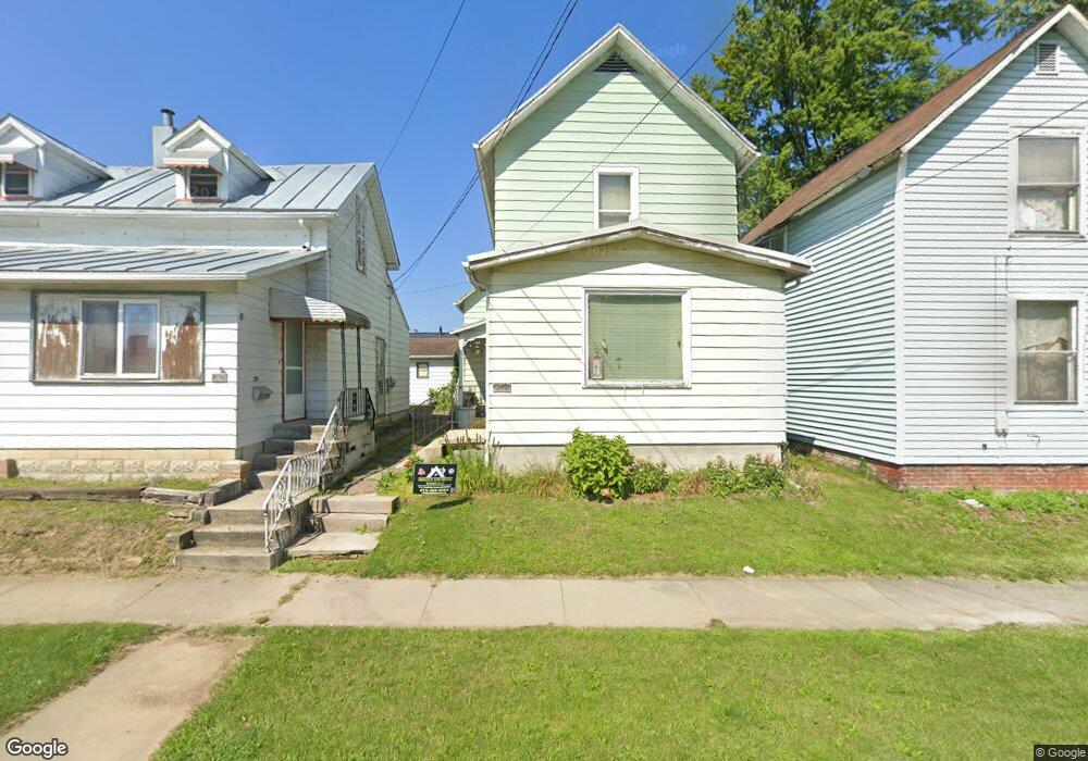
217 N Lane St Bucyrus, OH 44820
Estimated Value: $76,327 - $110,000
2
Beds
1
Bath
822
Sq Ft
$111/Sq Ft
Est. Value
About This Home
This home is located at 217 N Lane St, Bucyrus, OH 44820 and is currently estimated at $91,332, approximately $111 per square foot. 217 N Lane St is a home located in Crawford County with nearby schools including Bucyrus Elementary School, Bucyrus Secondary School, and Holy Trinity School.
Ownership History
Date
Name
Owned For
Owner Type
Purchase Details
Closed on
Aug 16, 2022
Sold by
Harris Gary P and Harris Susan E
Bought by
Jeffrey Elizabeth A and Jeffrey Paul M
Current Estimated Value
Home Financials for this Owner
Home Financials are based on the most recent Mortgage that was taken out on this home.
Original Mortgage
$37,000
Outstanding Balance
$31,265
Interest Rate
4.45%
Mortgage Type
New Conventional
Estimated Equity
$60,067
Create a Home Valuation Report for This Property
The Home Valuation Report is an in-depth analysis detailing your home's value as well as a comparison with similar homes in the area
Home Values in the Area
Average Home Value in this Area
Purchase History
| Date | Buyer | Sale Price | Title Company |
|---|---|---|---|
| Jeffrey Elizabeth A | $59,700 | None Listed On Document |
Source: Public Records
Mortgage History
| Date | Status | Borrower | Loan Amount |
|---|---|---|---|
| Open | Jeffrey Elizabeth A | $37,000 |
Source: Public Records
Tax History Compared to Growth
Tax History
| Year | Tax Paid | Tax Assessment Tax Assessment Total Assessment is a certain percentage of the fair market value that is determined by local assessors to be the total taxable value of land and additions on the property. | Land | Improvement |
|---|---|---|---|---|
| 2024 | $398 | $18,850 | $1,410 | $17,440 |
| 2023 | $398 | $7,990 | $1,410 | $6,580 |
| 2022 | $426 | $7,990 | $1,410 | $6,580 |
| 2021 | $425 | $7,990 | $1,410 | $6,580 |
| 2020 | $402 | $7,150 | $1,410 | $5,740 |
| 2019 | $411 | $7,150 | $1,410 | $5,740 |
| 2018 | $409 | $7,150 | $1,410 | $5,740 |
| 2017 | $471 | $7,950 | $1,410 | $6,540 |
| 2016 | $456 | $7,950 | $1,410 | $6,540 |
| 2015 | $450 | $7,950 | $1,410 | $6,540 |
| 2014 | $448 | $7,950 | $1,410 | $6,540 |
| 2013 | $448 | $7,950 | $1,410 | $6,540 |
Source: Public Records
Map
Nearby Homes
- 407 E Mansfield St
- 412 E Rensselaer St
- 124 N Spring St
- 520 E Warren St
- 303 W Galen St
- 444 Woodlawn Ave
- 316 W Warren St
- 317 S Spring St
- 319 Sheckler St
- 550 S Walnut St
- 531 S Poplar St
- 346 Hopley Ave
- 511 Plymouth St
- 517 Plymouth St
- 508 W Charles St
- 450 Sears St
- 325 W Liberty St
- 711 Plymouth St
- 622 S Poplar St
- 703 S Poplar St
- 217 N Lane St
- 219 N Lane St
- 215 N Lane St
- 215 N Lane St Unit 1
- 241 E Mary St
- 231 E Mary St
- 205 E Mary St
- 304 N Lane St
- 200 N Lane St
- 212 Norton Way
- 232 N Walnut St
- 210 N Walnut St
- 400 Norton Way
- 408 Norton Way
- 108 N Lane St
- 412 Norton Way
- 307 N Walnut St
- 312 E Mansfield St
- 310 E Mansfield St
- 314 E Mansfield St