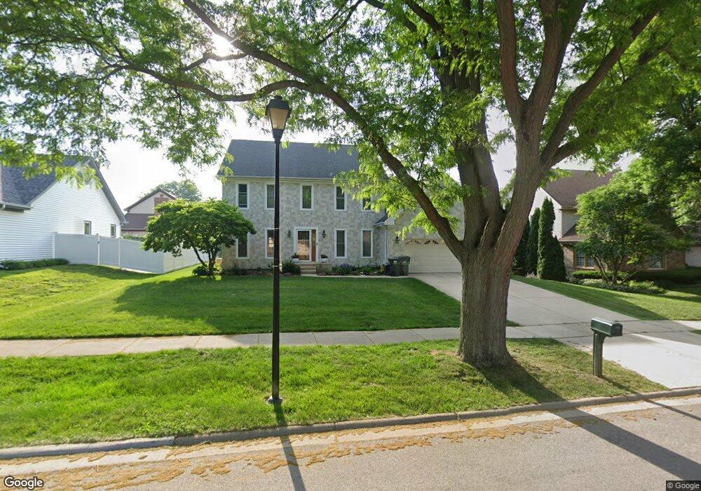
217 N Middleton Ave Palatine, IL 60067
Estimated Value: $690,000 - $756,000
4
Beds
3
Baths
2,728
Sq Ft
$266/Sq Ft
Est. Value
About This Home
This home is located at 217 N Middleton Ave, Palatine, IL 60067 and is currently estimated at $724,962, approximately $265 per square foot. 217 N Middleton Ave is a home located in Cook County with nearby schools including Stuart R Paddock School, Walter R. Sundling Junior High School, and William Fremd High School.
Ownership History
Date
Name
Owned For
Owner Type
Purchase Details
Closed on
Dec 23, 1993
Sold by
Brescia Anthony and Brescia Joelle M
Bought by
Mavi Harbans S and Gill Pardeep K
Current Estimated Value
Home Financials for this Owner
Home Financials are based on the most recent Mortgage that was taken out on this home.
Original Mortgage
$232,000
Interest Rate
7.26%
Create a Home Valuation Report for This Property
The Home Valuation Report is an in-depth analysis detailing your home's value as well as a comparison with similar homes in the area
Home Values in the Area
Average Home Value in this Area
Purchase History
| Date | Buyer | Sale Price | Title Company |
|---|---|---|---|
| Mavi Harbans S | $193,333 | -- |
Source: Public Records
Mortgage History
| Date | Status | Borrower | Loan Amount |
|---|---|---|---|
| Closed | Mavi Harbans S | $232,000 |
Source: Public Records
Tax History Compared to Growth
Tax History
| Year | Tax Paid | Tax Assessment Tax Assessment Total Assessment is a certain percentage of the fair market value that is determined by local assessors to be the total taxable value of land and additions on the property. | Land | Improvement |
|---|---|---|---|---|
| 2024 | $14,506 | $49,000 | $11,611 | $37,389 |
| 2023 | $14,034 | $49,000 | $11,611 | $37,389 |
| 2022 | $14,034 | $49,000 | $11,611 | $37,389 |
| 2021 | $13,799 | $42,487 | $6,047 | $36,440 |
| 2020 | $13,593 | $42,487 | $6,047 | $36,440 |
| 2019 | $13,419 | $46,792 | $6,047 | $40,745 |
| 2018 | $13,318 | $42,854 | $5,563 | $37,291 |
| 2017 | $13,923 | $45,664 | $5,563 | $40,101 |
| 2016 | $14,158 | $49,933 | $5,563 | $44,370 |
| 2015 | $13,194 | $42,943 | $5,079 | $37,864 |
| 2014 | $13,034 | $42,943 | $5,079 | $37,864 |
| 2013 | $13,911 | $47,035 | $5,079 | $41,956 |
Source: Public Records
Map
Nearby Homes
- 951 W Willow St
- 260 N Clyde Ave
- 1120 W Wilson St
- 886 W Palatine Rd
- 77 N Quentin Rd Unit 414
- 77 N Quentin Rd Unit 202
- 155 Burleigh Ln Unit 66
- 185 Barra Ln Unit 158
- 445 N Cambridge Dr
- 105 Craigie Ln Unit 22
- 550 N Quentin Rd
- 43 Ravenscraig Ln Unit 34
- 566 W Bridge View Ct
- 580 N Quentin Rd
- 192 Glamis Ln Unit 131
- Lot 1 W Wilson St
- 480 W Wood St Unit 3
- 836 W Dorchester Rd
- 834 W Dorchester Rd
- 1124 W Colfax St
- 205 N Middleton Ave
- 229 N Middleton Ave
- 970 W Wood St
- 216 N Middleton Ave
- 959 W Hidden Hills Ln
- 1000 N Auburn Woods Dr
- 958 W Wood St
- 204 N Middleton Ave
- 228 N Middleton Ave
- 195 N Middleton Ave
- 947 W Hidden Hills Ln
- 946 W Wood St
- 988 W Hidden Hills Ln
- 976 W Hidden Hills Ln
- 1010 W Wood St
- 260 N Middleton Ave
- 1001 W Wood St
- 187 N Middleton Ave
- 934 W Wood St
- 935 W Hidden Hills Ln