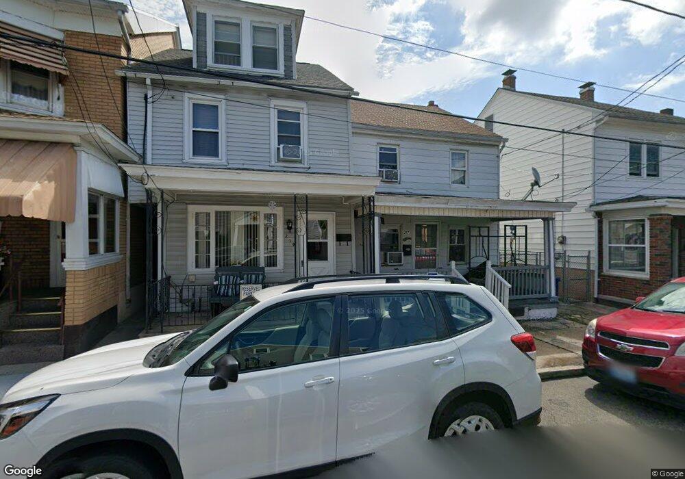
217 N Mill St Saint Clair, PA 17970
Estimated Value: $73,193 - $438,000
3
Beds
3
Baths
1,241
Sq Ft
$139/Sq Ft
Est. Value
About This Home
This home is located at 217 N Mill St, Saint Clair, PA 17970 and is currently estimated at $172,048, approximately $138 per square foot. 217 N Mill St is a home located in Schuylkill County with nearby schools including Saint Clair Area Elementary/Middle School, Gillingham Charter School, and ASSUMPTION BVM SCHOOL.
Ownership History
Date
Name
Owned For
Owner Type
Purchase Details
Closed on
Jul 22, 2024
Sold by
Skad Solutions Llc
Bought by
Conyak Realty Llc
Current Estimated Value
Purchase Details
Closed on
Aug 31, 2023
Sold by
Myro Patricia
Bought by
Wise Lisa A
Purchase Details
Closed on
Aug 30, 2023
Sold by
Myro Patricia
Bought by
Wise Lisa A
Create a Home Valuation Report for This Property
The Home Valuation Report is an in-depth analysis detailing your home's value as well as a comparison with similar homes in the area
Home Values in the Area
Average Home Value in this Area
Purchase History
| Date | Buyer | Sale Price | Title Company |
|---|---|---|---|
| Conyak Realty Llc | $430,000 | Abe Settlement Services | |
| Wise Lisa A | -- | None Listed On Document | |
| Myro Patricia | -- | None Listed On Document | |
| Allbrook William E | -- | None Listed On Document | |
| Wise Lisa A | -- | None Listed On Document | |
| Myro Patricia | -- | None Listed On Document | |
| Allbrook William E | -- | None Listed On Document |
Source: Public Records
Tax History
| Year | Tax Paid | Tax Assessment Tax Assessment Total Assessment is a certain percentage of the fair market value that is determined by local assessors to be the total taxable value of land and additions on the property. | Land | Improvement |
|---|---|---|---|---|
| 2025 | $812 | $12,350 | $3,000 | $9,350 |
| 2024 | $760 | $12,350 | $3,000 | $9,350 |
| 2023 | $723 | $12,350 | $3,000 | $9,350 |
| 2022 | $723 | $12,350 | $3,000 | $9,350 |
| 2021 | $730 | $12,350 | $3,000 | $9,350 |
| 2020 | $730 | $12,350 | $3,000 | $9,350 |
| 2018 | $715 | $12,350 | $3,000 | $9,350 |
| 2017 | $687 | $12,350 | $3,000 | $9,350 |
| 2015 | -- | $12,350 | $3,000 | $9,350 |
| 2011 | -- | $12,350 | $0 | $0 |
Source: Public Records
Map
Nearby Homes
- 144 N Mill St
- 32 S Front St
- Lot 30 Elmwood Ct
- 0 - Lot 10 Elmwood Ct Unit 10
- 141 S Nicholas St
- 219 S 3rd St
- 320 S Mill St
- 108 Cherry St
- 309 Chestnut St
- 1 S Front St Thwing St
- 117 Chestnut St
- 0 Caroline Ave Unit PASK2022658
- 714 Port Carbon Saint Clair Hwy
- 702 & 698 Port Carbon St Clair Hwy
- 145 Chamberlaine Ave
- 15 Marcello Dr
- 441 Nichols St
- 0 Schuylkill Manor Rd Unit PASK2018142
- 935 N Centre St
- 542 3rd St
- 215 N Mill St
- 219 N Mill St
- 213 N Mill St
- 221 N Mill St
- 209 N Mill St
- 207 N Mill St
- 218 N Nicholas St
- 212 N Nicholas St
- 210 N Nicholas St
- 207 E Franklin St
- 220 N Nicholas St
- 208 N Nicholas St
- 201 N Mill St
- 224 N Nicholas St
- 209 E Franklin St
- 231 N Mill St
- 226 N Nicholas St
- 206 N Nicholas St
- 226 N Mill St
- 254 N Mill St