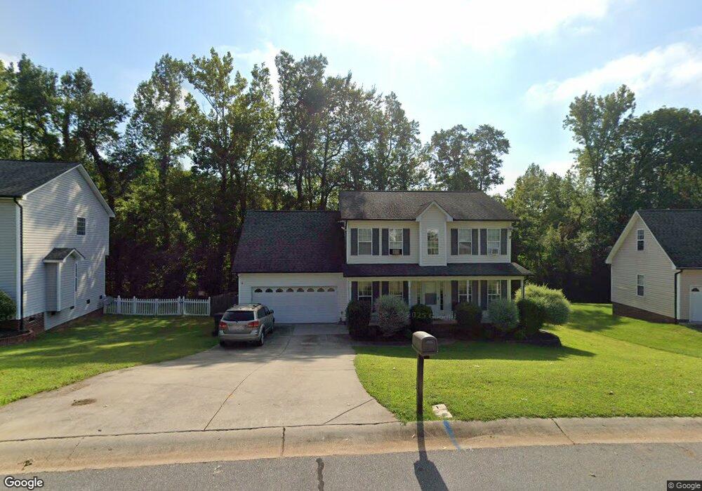
217 Patrick Ave SW Concord, NC 28025
Estimated Value: $358,000 - $377,000
4
Beds
3
Baths
1,975
Sq Ft
$186/Sq Ft
Est. Value
About This Home
This home is located at 217 Patrick Ave SW, Concord, NC 28025 and is currently estimated at $367,679, approximately $186 per square foot. 217 Patrick Ave SW is a home located in Cabarrus County with nearby schools including Rocky River Elementary School, J.N. Fries Middle School, and Branch Christian Academy.
Ownership History
Date
Name
Owned For
Owner Type
Purchase Details
Closed on
Mar 8, 2007
Sold by
Gary W Laton Llc
Bought by
Andrews Michael P and Andrews Joyce A
Current Estimated Value
Home Financials for this Owner
Home Financials are based on the most recent Mortgage that was taken out on this home.
Original Mortgage
$179,000
Outstanding Balance
$107,930
Interest Rate
6.19%
Mortgage Type
Purchase Money Mortgage
Estimated Equity
$259,749
Purchase Details
Closed on
Dec 30, 2004
Sold by
Danny G Bost Llc
Bought by
Gary W Laton Llc
Home Financials for this Owner
Home Financials are based on the most recent Mortgage that was taken out on this home.
Original Mortgage
$227,500
Interest Rate
5.66%
Mortgage Type
Seller Take Back
Purchase Details
Closed on
Feb 3, 2004
Sold by
Bw Homes Inc
Bought by
Danny G Bost Llc
Create a Home Valuation Report for This Property
The Home Valuation Report is an in-depth analysis detailing your home's value as well as a comparison with similar homes in the area
Home Values in the Area
Average Home Value in this Area
Purchase History
| Date | Buyer | Sale Price | Title Company |
|---|---|---|---|
| Andrews Michael P | $179,000 | None Available | |
| Gary W Laton Llc | $455,000 | -- | |
| Danny G Bost Llc | -- | -- |
Source: Public Records
Mortgage History
| Date | Status | Borrower | Loan Amount |
|---|---|---|---|
| Open | Andrews Michael P | $179,000 | |
| Previous Owner | Gary W Laton Llc | $227,500 |
Source: Public Records
Tax History Compared to Growth
Tax History
| Year | Tax Paid | Tax Assessment Tax Assessment Total Assessment is a certain percentage of the fair market value that is determined by local assessors to be the total taxable value of land and additions on the property. | Land | Improvement |
|---|---|---|---|---|
| 2025 | $3,554 | $356,840 | $80,000 | $276,840 |
| 2024 | $3,554 | $356,840 | $80,000 | $276,840 |
| 2023 | $2,595 | $212,680 | $41,000 | $171,680 |
| 2022 | $2,547 | $208,760 | $41,000 | $167,760 |
| 2021 | $2,547 | $208,760 | $41,000 | $167,760 |
| 2020 | $2,547 | $208,760 | $41,000 | $167,760 |
| 2019 | $2,120 | $173,740 | $25,000 | $148,740 |
| 2018 | $2,085 | $173,740 | $25,000 | $148,740 |
| 2017 | $2,050 | $173,740 | $25,000 | $148,740 |
| 2016 | $1,216 | $166,110 | $22,500 | $143,610 |
| 2015 | $1,960 | $166,110 | $22,500 | $143,610 |
| 2014 | $1,960 | $166,110 | $22,500 | $143,610 |
Source: Public Records
Map
Nearby Homes
- 4227 Kiser Woods Dr SW
- 4294 Kiser Woods Dr SW
- 1150 Hearth Ln SW
- 5356 Zion Church Rd
- 123 Softwind Ln
- 4531 Falls Lake Dr SW
- 1130 Brigadoon Ct
- 137 Softwind Ln
- 4194 Clifftonville Ave SW
- 1001 Loch Lomond Cir
- 910/820 Archibald Rd
- 4183 Broadstairs Dr
- 4175 Broadstairs Dr
- 1051 Manston Place SW
- 4285 Long Arrow Dr
- 3931 Kellybrook Dr
- 4425 Norfleet St
- 668 Shellbark Dr
- 1009 Braxton Dr
- 518 Viking Place SW
- 221 Patrick Ave SW
- 213 Patrick Ave SW
- 225 Patrick Ave SW
- 209 Patrick Ave SW
- 220 Patrick Ave SW
- 212 Patrick Ave SW
- 224 Patrick Ave SW
- 229 Patrick Ave SW
- 205 Patrick Ave SW
- 228 Patrick Ave SW
- 202 Patrick Ave SW
- 4239 Kiser Woods Dr SW
- 233 Patrick Ave SW
- 4243 Kiser Woods Dr SW
- 232 Patrick Ave SW
- 4247 Kiser Woods Dr SW
- 237 Patrick Ave SW
- 4251 Kiser Woods Dr SW
- 236 Patrick Ave SW