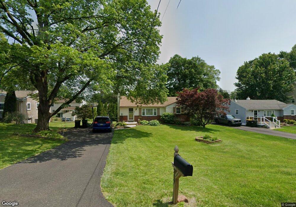
217 Pershing Ave Horsham, PA 19044
Estimated Value: $413,000 - $433,000
3
Beds
1
Bath
1,250
Sq Ft
$338/Sq Ft
Est. Value
About This Home
This home is located at 217 Pershing Ave, Horsham, PA 19044 and is currently estimated at $422,850, approximately $338 per square foot. 217 Pershing Ave is a home located in Montgomery County with nearby schools including Hallowell Elementary School, Keith Valley Middle School, and Hatboro-Horsham Senior High School.
Ownership History
Date
Name
Owned For
Owner Type
Purchase Details
Closed on
Jun 21, 2021
Sold by
Bowman Christine A and Moore Patricia M
Bought by
Kermick Jeffrie S and Kermick Margaret
Current Estimated Value
Home Financials for this Owner
Home Financials are based on the most recent Mortgage that was taken out on this home.
Original Mortgage
$272,000
Interest Rate
3%
Mortgage Type
New Conventional
Purchase Details
Closed on
Mar 22, 2016
Sold by
Bowman Michael J
Bought by
Bowman Christine A
Purchase Details
Closed on
Dec 6, 2000
Sold by
Bowman Christian T
Bought by
Bowman Christian T and Christian T Bowman Trust
Create a Home Valuation Report for This Property
The Home Valuation Report is an in-depth analysis detailing your home's value as well as a comparison with similar homes in the area
Home Values in the Area
Average Home Value in this Area
Purchase History
| Date | Buyer | Sale Price | Title Company |
|---|---|---|---|
| Kermick Jeffrie S | $340,000 | None Available | |
| Bowman Christine A | -- | Attorney | |
| Bowman Christian T | -- | -- |
Source: Public Records
Mortgage History
| Date | Status | Borrower | Loan Amount |
|---|---|---|---|
| Previous Owner | Kermick Jeffrie S | $272,000 |
Source: Public Records
Tax History Compared to Growth
Tax History
| Year | Tax Paid | Tax Assessment Tax Assessment Total Assessment is a certain percentage of the fair market value that is determined by local assessors to be the total taxable value of land and additions on the property. | Land | Improvement |
|---|---|---|---|---|
| 2025 | $4,958 | $126,140 | -- | -- |
| 2024 | $4,958 | $126,140 | -- | -- |
| 2023 | $4,719 | $126,140 | $0 | $0 |
| 2022 | $4,567 | $126,140 | $0 | $0 |
| 2021 | $4,459 | $126,140 | $0 | $0 |
| 2020 | $4,353 | $126,140 | $0 | $0 |
| 2019 | $4,270 | $126,140 | $0 | $0 |
| 2018 | $3,327 | $126,140 | $0 | $0 |
| 2017 | $3,913 | $121,010 | $42,690 | $78,320 |
| 2016 | $3,866 | $121,010 | $42,690 | $78,320 |
| 2015 | $3,789 | $121,010 | $42,690 | $78,320 |
| 2014 | $3,692 | $121,010 | $42,690 | $78,320 |
Source: Public Records
Map
Nearby Homes
- 414 Watson Ave
- 204 Wilson Ave
- 890 Easton Rd
- 125 Meetinghouse Rd
- 474 Easton Rd
- 236 Oak Hill Dr
- 336 Laurel Ave
- 243 Summer Ave
- 29 Patriot Ln
- 4 Beaver Hill Rd
- 454 1/2 Avenue A Unit A
- 18 Patriot Ln
- 604 Liberty Ridge Rd
- 616 Liberty Ridge Rd
- 603 Liberty Ridge Rd
- 605 Liberty Ridge Rd
- 607 Liberty Ridge Rd
- 611 Liberty Ridge Rd
- Faraday Plan at Liberty Ridge
- Westmont Plan at Liberty Ridge
- 219 Pershing Ave
- 215 Pershing Ave
- 218 Jefferson Ave
- 220 Jefferson Ave
- 216 Jefferson Ave
- 213 Pershing Ave
- 221 Pershing Ave
- 222 Jefferson Ave
- 220 Pershing Ave
- 218 Pershing Ave
- 214 Jefferson Ave
- 222 Pershing Ave
- 223 Pershing Ave
- 224 Jefferson Ave
- 409 Watson Ave
- 211 Pershing Ave
- 408 Watson Ave
- 219 Jefferson Ave
- 221 Jefferson Ave
- 215 Grant Ave