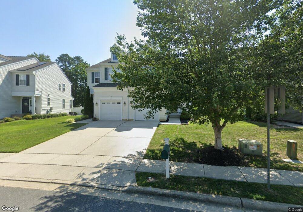
217 Pheasant Run Rd Mays Landing, NJ 08330
Estimated Value: $380,000 - $402,000
--
Bed
--
Bath
1,694
Sq Ft
$231/Sq Ft
Est. Value
About This Home
This home is located at 217 Pheasant Run Rd, Mays Landing, NJ 08330 and is currently estimated at $390,858, approximately $230 per square foot. 217 Pheasant Run Rd is a home with nearby schools including George L. Hess Educational Complex, Joseph Shaner School, and William Davies Middle School.
Ownership History
Date
Name
Owned For
Owner Type
Purchase Details
Closed on
May 25, 2012
Sold by
Baker Residential Of Pennsylvnia Llc
Bought by
Sabulao Maria A and Escriba Justo
Current Estimated Value
Home Financials for this Owner
Home Financials are based on the most recent Mortgage that was taken out on this home.
Original Mortgage
$211,561
Outstanding Balance
$138,439
Interest Rate
2.75%
Mortgage Type
FHA
Estimated Equity
$252,419
Create a Home Valuation Report for This Property
The Home Valuation Report is an in-depth analysis detailing your home's value as well as a comparison with similar homes in the area
Home Values in the Area
Average Home Value in this Area
Purchase History
| Date | Buyer | Sale Price | Title Company |
|---|---|---|---|
| Sabulao Maria A | $217,065 | Commonwealth Land Title Co |
Source: Public Records
Mortgage History
| Date | Status | Borrower | Loan Amount |
|---|---|---|---|
| Open | Sabulao Maria A | $211,561 |
Source: Public Records
Tax History Compared to Growth
Tax History
| Year | Tax Paid | Tax Assessment Tax Assessment Total Assessment is a certain percentage of the fair market value that is determined by local assessors to be the total taxable value of land and additions on the property. | Land | Improvement |
|---|---|---|---|---|
| 2025 | $6,821 | $198,800 | $42,200 | $156,600 |
| 2024 | $6,821 | $198,800 | $42,200 | $156,600 |
| 2023 | $6,413 | $198,800 | $42,200 | $156,600 |
| 2022 | $6,413 | $198,800 | $42,200 | $156,600 |
| 2021 | $6,399 | $198,800 | $42,200 | $156,600 |
| 2020 | $6,399 | $198,800 | $42,200 | $156,600 |
| 2019 | $6,415 | $198,800 | $42,200 | $156,600 |
| 2018 | $6,191 | $198,800 | $42,200 | $156,600 |
| 2017 | $6,093 | $198,800 | $42,200 | $156,600 |
| 2016 | $5,922 | $198,800 | $42,200 | $156,600 |
| 2015 | $5,721 | $198,800 | $42,200 | $156,600 |
| 2014 | $5,627 | $214,200 | $47,200 | $167,000 |
Source: Public Records
Map
Nearby Homes
- 20 Knollwood Dr Unit 20
- 72 Knollwood Dr
- 103 Galleria Dr
- 35 Knollwood Dr
- 3 Pin Oak Dr
- 3 Knollwood Dr
- 218 Burning Tree Ct
- 277 Greenbriar Ct
- 131 Aberdeen Ct Unit 131
- 209 Burning Tree Ct
- 197 Pebble Beach Dr Unit 197
- 154 Muirfield Ct
- 68 Northridge Dr
- 156 Muirfield Ct
- 165 Turnberry Ct
- 172 Turnberry Ct
- 182 Pebble Beach Dr
- 66 Monet Dr
- 20 Monet Dr
- 8 Rembrandt Way
- 215 Pheasant Run Rd
- 219 Pheasant Run Rd
- 213 Pheasant Run Rd
- 221 Pheasant Run Rd
- 218 Pheasant Run Rd
- 216 Pheasant Run Rd
- 223 Pheasant Run Rd
- 220 Pheasant Run Rd
- 214 Pheasant Run Rd
- 222 Pheasant Run Rd
- 164 Meadow Cir
- 166 Meadow Cir
- 162 Meadow Cir
- 209 Pheasant Run Rd
- 168 Meadow Cir
- 212 Pheasant Run Rd
- 160 Meadow Cir
- 224 Pheasant Run Rd
- 170 Meadow Cir
- 210 Pheasant Run Rd