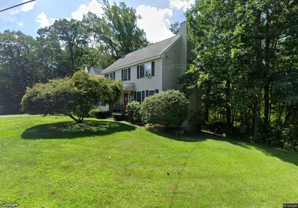
217 Raymond Rd Marlborough, MA 01752
Estimated Value: $782,000 - $859,000
4
Beds
3
Baths
2,307
Sq Ft
$356/Sq Ft
Est. Value
About This Home
This home is located at 217 Raymond Rd, Marlborough, MA 01752 and is currently estimated at $822,305, approximately $356 per square foot. 217 Raymond Rd is a home located in Middlesex County with nearby schools including Marlborough High School, New Covenant Christian School, and Glenhaven Academy - JRI School.
Ownership History
Date
Name
Owned For
Owner Type
Purchase Details
Closed on
Aug 30, 2012
Sold by
Flores Linda G
Bought by
Mcdowell Kimberly L
Current Estimated Value
Purchase Details
Closed on
Aug 14, 2006
Sold by
Szwarc Alexandria
Bought by
Mcdowell Kimberly L and Flores Linda G
Home Financials for this Owner
Home Financials are based on the most recent Mortgage that was taken out on this home.
Original Mortgage
$355,200
Interest Rate
6.8%
Mortgage Type
Purchase Money Mortgage
Purchase Details
Closed on
Mar 26, 2004
Sold by
Cagan Andrew M and Cagan Germaine L
Bought by
Szwarc Alexandria and Szwarc Grace M
Create a Home Valuation Report for This Property
The Home Valuation Report is an in-depth analysis detailing your home's value as well as a comparison with similar homes in the area
Home Values in the Area
Average Home Value in this Area
Purchase History
| Date | Buyer | Sale Price | Title Company |
|---|---|---|---|
| Mcdowell Kimberly L | $30,000 | -- | |
| Mcdowell Kimberly L | $444,000 | -- | |
| Szwarc Alexandria | $453,000 | -- |
Source: Public Records
Mortgage History
| Date | Status | Borrower | Loan Amount |
|---|---|---|---|
| Previous Owner | Mcdowell Kimberly L | $355,200 |
Source: Public Records
Tax History Compared to Growth
Tax History
| Year | Tax Paid | Tax Assessment Tax Assessment Total Assessment is a certain percentage of the fair market value that is determined by local assessors to be the total taxable value of land and additions on the property. | Land | Improvement |
|---|---|---|---|---|
| 2025 | $7,092 | $719,300 | $230,000 | $489,300 |
| 2024 | $6,959 | $679,600 | $209,200 | $470,400 |
| 2023 | $7,408 | $641,900 | $180,500 | $461,400 |
| 2022 | $7,161 | $545,800 | $171,900 | $373,900 |
| 2021 | $6,995 | $506,900 | $143,300 | $363,600 |
| 2020 | $6,872 | $484,600 | $136,500 | $348,100 |
| 2019 | $6,635 | $471,600 | $133,800 | $337,800 |
| 2018 | $8,687 | $451,500 | $116,600 | $334,900 |
| 2017 | $6,419 | $419,000 | $115,300 | $303,700 |
| 2016 | $6,210 | $404,800 | $115,300 | $289,500 |
| 2015 | $6,310 | $400,400 | $117,900 | $282,500 |
Source: Public Records
Map
Nearby Homes
- 17 Mcneil Cir
- 38 Collins Dr
- 168 Blanchette Dr
- 492 Stow Rd
- 114 Linda Cir
- 618 Sudbury St
- 551 Sudbury St
- 274 Naugler Ave
- 3 Stonehill Rd
- 28 Stetson Dr
- 256 Robert Rd
- 688 Boston Post Rd E Unit 202
- 688 Boston Post Rd E Unit 304
- 688 Boston Post Rd E Unit 100
- 688 Boston Post Rd E Unit 324
- 688 Boston Post Rd E Unit 228
- 624 Boston Post Rd E Unit 7
- 323 Robert Rd
- 137 Naugler Ave
- 33A Russo Dr