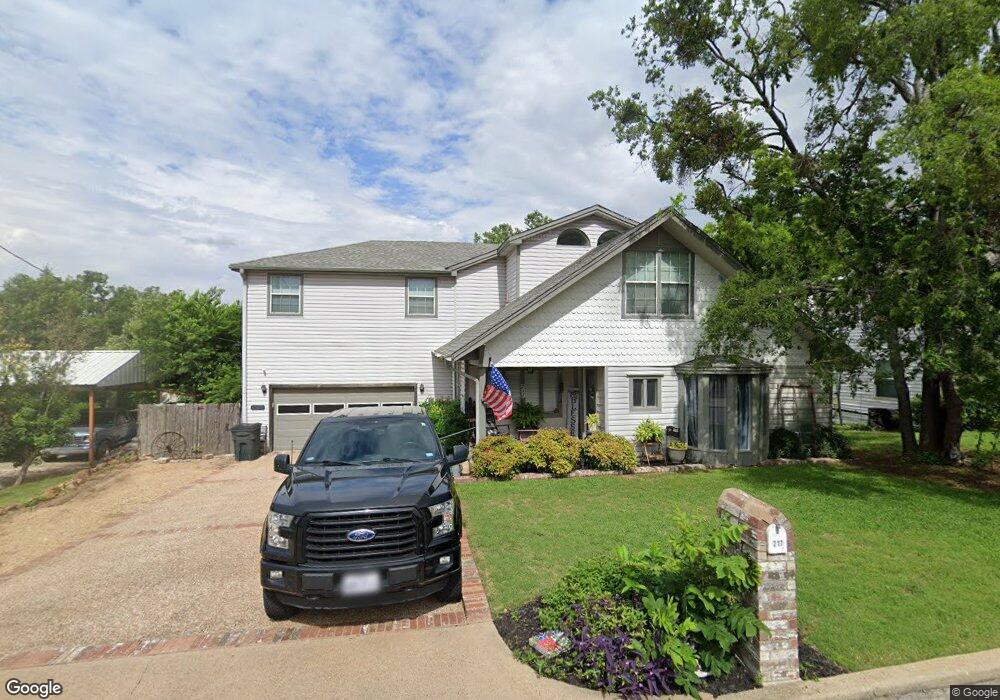
217 S 2nd St Midlothian, TX 76065
Estimated Value: $381,000 - $425,236
3
Beds
3
Baths
2,878
Sq Ft
$140/Sq Ft
Est. Value
About This Home
This home is located at 217 S 2nd St, Midlothian, TX 76065 and is currently estimated at $403,118, approximately $140 per square foot. 217 S 2nd St is a home located in Ellis County with nearby schools including Irvin Elementary School and Frank Seale Middle School.
Ownership History
Date
Name
Owned For
Owner Type
Purchase Details
Closed on
Aug 29, 2014
Sold by
Lacroix Corby and Lacroix Cari
Bought by
Fleeman Jimmy Dale and Fleeman Blaire
Current Estimated Value
Home Financials for this Owner
Home Financials are based on the most recent Mortgage that was taken out on this home.
Original Mortgage
$176,739
Outstanding Balance
$135,853
Interest Rate
4.25%
Mortgage Type
FHA
Estimated Equity
$267,265
Purchase Details
Closed on
Aug 24, 2007
Sold by
Blethen Stephen R and Blethen Marilyn
Bought by
Lacroix Corby and Lacroix Cari
Home Financials for this Owner
Home Financials are based on the most recent Mortgage that was taken out on this home.
Original Mortgage
$15,980
Interest Rate
6.72%
Mortgage Type
Unknown
Create a Home Valuation Report for This Property
The Home Valuation Report is an in-depth analysis detailing your home's value as well as a comparison with similar homes in the area
Home Values in the Area
Average Home Value in this Area
Purchase History
| Date | Buyer | Sale Price | Title Company |
|---|---|---|---|
| Fleeman Jimmy Dale | -- | None Available | |
| Lacroix Corby | -- | None Available |
Source: Public Records
Mortgage History
| Date | Status | Borrower | Loan Amount |
|---|---|---|---|
| Open | Fleeman Jimmy Dale | $176,739 | |
| Previous Owner | Lacroix Corby | $15,980 | |
| Previous Owner | Lacroix Corby | $143,900 |
Source: Public Records
Tax History Compared to Growth
Tax History
| Year | Tax Paid | Tax Assessment Tax Assessment Total Assessment is a certain percentage of the fair market value that is determined by local assessors to be the total taxable value of land and additions on the property. | Land | Improvement |
|---|---|---|---|---|
| 2025 | $4,858 | $372,292 | -- | -- |
| 2024 | $4,858 | $338,447 | -- | -- |
| 2023 | $4,858 | $307,679 | $0 | $0 |
| 2022 | $6,267 | $279,708 | $0 | $0 |
| 2021 | $6,017 | $254,280 | $26,250 | $228,030 |
| 2020 | $6,035 | $239,910 | $26,250 | $213,660 |
| 2019 | $6,275 | $239,610 | $0 | $0 |
| 2018 | $5,102 | $232,330 | $20,000 | $212,330 |
| 2017 | $5,419 | $203,570 | $20,000 | $183,570 |
| 2016 | $5,174 | $194,390 | $15,000 | $179,390 |
| 2015 | $3,849 | $183,580 | $15,000 | $168,580 |
| 2014 | $3,849 | $163,540 | $0 | $0 |
Source: Public Records
Map
Nearby Homes
- 1834 Rough Ridge Trail
- 120 N 5th St
- 114 S 6th St
- 312 Overlook Dr
- 507 S 6th St
- 209 W Avenue K
- 3429 Herd Way
- 705 S 4th St
- 000 N 6th St
- 414 N 5th St
- 412 N 5th St
- TBD FM 663
- 1003 Sierra Vista Ct Unit 2
- 714 Green Acres Ln
- 501 N 9th St
- 0 W Avenue A
- 807 Crockett St
- 0 U S Highway 67
- 796 N 7th St
- 620 N 6th St