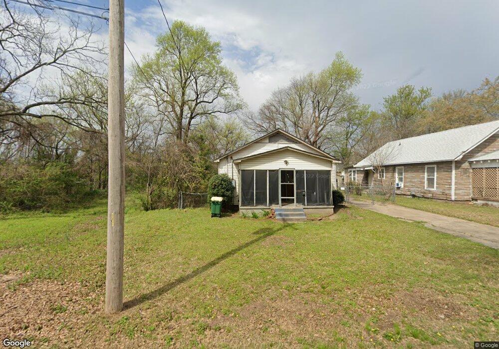
217 S Laurel St North Little Rock, AR 72114
Rose City NeighborhoodEstimated Value: $46,000 - $103,000
--
Bed
1
Bath
1,056
Sq Ft
$69/Sq Ft
Est. Value
About This Home
This home is located at 217 S Laurel St, North Little Rock, AR 72114 and is currently estimated at $73,111, approximately $69 per square foot. 217 S Laurel St is a home located in Pulaski County with nearby schools including Glenview Elementary School, North Little Rock Middle School 6th Grade Campus, and North Little Rock High School.
Ownership History
Date
Name
Owned For
Owner Type
Purchase Details
Closed on
Jun 4, 2025
Sold by
Commissioner Of State Lands
Bought by
Greene Mark
Current Estimated Value
Purchase Details
Closed on
Sep 3, 2021
Sold by
Grm Properties Llc
Bought by
Green Mark
Purchase Details
Closed on
Jan 14, 2009
Sold by
Hsbc Mortgage Services Inc
Bought by
Grm Properties Llc
Purchase Details
Closed on
Feb 28, 2007
Sold by
Raye Sandra F
Bought by
Hsbc Mortgage Services Inc
Purchase Details
Closed on
Oct 3, 2006
Sold by
Raye Sandra F
Bought by
Hsbc Mortgage Services Inc
Create a Home Valuation Report for This Property
The Home Valuation Report is an in-depth analysis detailing your home's value as well as a comparison with similar homes in the area
Home Values in the Area
Average Home Value in this Area
Purchase History
| Date | Buyer | Sale Price | Title Company |
|---|---|---|---|
| Greene Mark | $1,125 | None Listed On Document | |
| Green Mark | $2,000 | None Listed On Document | |
| Grm Properties Llc | $6,000 | None Available | |
| Hsbc Mortgage Services Inc | $26,737 | None Available | |
| Hsbc Mortgage Services Inc | -- | None Available |
Source: Public Records
Tax History Compared to Growth
Tax History
| Year | Tax Paid | Tax Assessment Tax Assessment Total Assessment is a certain percentage of the fair market value that is determined by local assessors to be the total taxable value of land and additions on the property. | Land | Improvement |
|---|---|---|---|---|
| 2025 | $315 | $4,722 | $200 | $4,522 |
| 2024 | $315 | $4,722 | $200 | $4,522 |
| 2023 | $315 | $4,722 | $200 | $4,522 |
| 2022 | $315 | $4,722 | $200 | $4,522 |
| 2021 | $224 | $3,360 | $200 | $3,160 |
| 2020 | $224 | $3,360 | $200 | $3,160 |
| 2019 | $224 | $3,360 | $200 | $3,160 |
| 2018 | $224 | $3,360 | $200 | $3,160 |
| 2017 | $224 | $3,360 | $200 | $3,160 |
| 2016 | $236 | $3,530 | $500 | $3,030 |
| 2015 | $236 | $3,530 | $500 | $3,030 |
| 2014 | $236 | $3,530 | $500 | $3,030 |
Source: Public Records
Map
Nearby Homes
- 2614 Lincoln Ave
- 2307 E 2nd St
- 2402 E Broadway St Unit 2410 E Broadway Stre
- 120 N Buckeye St
- 2704 Gribble St
- 1812 E 4th St
- 315 Bender St
- 1106 Ferry St
- 114 N Walnut St
- 915 N E St
- 1004 E 11th St
- 000 Highway 65 Unit Tract 6
- 000 Highway 65 Unit Tract 5
- 000 Highway 65 Unit Tract 4
- 000 Highway 65 Unit Tract 3
- 000 Highway 65 Unit Tract 2
- 000 Highway 65 Unit Tract 1
- 1104 N F St
- 913 Welch St
- 521 President Clinton #1206 Ave
- 219 S Laurel St Unit A
- 215 S Laurel St
- S Laurel St
- 221 S Laurel St
- 211 S Laurel St
- 210 S Linden St
- 218 S Laurel St
- 2301 Lincoln Ave
- 220 S Laurel St
- 2310 Arkansas Ave
- 2308 Arkansas Ave
- 209 S Laurel St
- 222 S Laurel St
- 206 S Laurel St
- 2302 Arkansas Ave Unit 12
- 206 S Linden St
- 200 S Laurel St
- 120 S Laurel St
- 2419 Lincoln Ave
- 117 S Laurel St