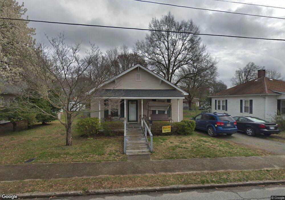
217 Sharpe Ave Kannapolis, NC 28083
Estimated Value: $178,000 - $290,000
2
Beds
1
Bath
1,090
Sq Ft
$204/Sq Ft
Est. Value
About This Home
This home is located at 217 Sharpe Ave, Kannapolis, NC 28083 and is currently estimated at $222,461, approximately $204 per square foot. 217 Sharpe Ave is a home located in Cabarrus County with nearby schools including North Kannapolis Elementary School, Kannapolis Middle, and A.L. Brown High School.
Ownership History
Date
Name
Owned For
Owner Type
Purchase Details
Closed on
Apr 15, 2023
Sold by
Griggs Cynthia S and Griggs Farrar O
Bought by
Griggs Farrar O and Griggs Cynthia S
Current Estimated Value
Purchase Details
Closed on
Jun 7, 2012
Sold by
Griggs Farrar
Bought by
Griggs Cynthia S
Purchase Details
Closed on
Sep 19, 2007
Sold by
Weaver Billy R and Estate Of Bobby Adam Weaver Sr
Bought by
Griggs Farrar O and Griggs Cynthia S
Purchase Details
Closed on
Apr 1, 1989
Bought by
Weaver Rebecca Ann
Purchase Details
Closed on
Mar 1, 1989
Create a Home Valuation Report for This Property
The Home Valuation Report is an in-depth analysis detailing your home's value as well as a comparison with similar homes in the area
Home Values in the Area
Average Home Value in this Area
Purchase History
| Date | Buyer | Sale Price | Title Company |
|---|---|---|---|
| Griggs Farrar O | -- | None Listed On Document | |
| Griggs Cynthia S | -- | None Available | |
| Griggs Farrar O | $75,000 | None Available | |
| Weaver Rebecca Ann | $21,000 | -- | |
| -- | $16,500 | -- |
Source: Public Records
Tax History Compared to Growth
Tax History
| Year | Tax Paid | Tax Assessment Tax Assessment Total Assessment is a certain percentage of the fair market value that is determined by local assessors to be the total taxable value of land and additions on the property. | Land | Improvement |
|---|---|---|---|---|
| 2025 | -- | $190,910 | $48,000 | $142,910 |
| 2024 | $2,168 | $190,910 | $48,000 | $142,910 |
| 2023 | $1,486 | $108,470 | $30,000 | $78,470 |
| 2022 | $0 | $106,660 | $30,000 | $76,660 |
| 2021 | $1,461 | $106,660 | $30,000 | $76,660 |
| 2020 | $1,461 | $106,660 | $30,000 | $76,660 |
| 2019 | $984 | $71,820 | $12,750 | $59,070 |
| 2018 | $970 | $71,820 | $12,750 | $59,070 |
| 2017 | $955 | $71,820 | $12,750 | $59,070 |
| 2016 | $955 | $78,510 | $21,000 | $57,510 |
| 2015 | $846 | $78,510 | $21,000 | $57,510 |
| 2014 | $846 | $78,510 | $21,000 | $57,510 |
Source: Public Records
Map
Nearby Homes
- 226 York Ave
- 202 Milton L Taylor St
- 417 York Ave
- 100 N Ridge Ave
- 209 James St
- 5941 Mantle Way
- 5880 Mantle Way
- 00 Centergrove Rd
- 704 Gem St Unit 17
- 704 S Harding Ave
- 3131 Baines Ct
- 803 Desoto Ave
- 613 Hillside St
- 506 Ford St
- 3161 Baines Ct
- 617 Fairview St
- 615 Fairview St
- 500 Plymouth St
- 608 Fairview St
- 402 Ford St