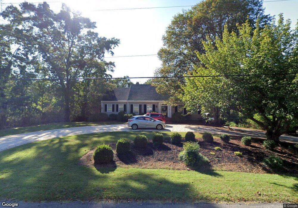
217 St Andrews Cir Lynchburg, VA 24503
Estimated Value: $466,307 - $561,000
4
Beds
4
Baths
4,136
Sq Ft
$121/Sq Ft
Est. Value
About This Home
This home is located at 217 St Andrews Cir, Lynchburg, VA 24503 and is currently estimated at $501,827, approximately $121 per square foot. 217 St Andrews Cir is a home located in Bedford County with nearby schools including Boonsboro Elementary School, Forest Middle School, and Jefferson Forest High School.
Ownership History
Date
Name
Owned For
Owner Type
Purchase Details
Closed on
Aug 28, 2023
Sold by
Henninger Barry Lee and Henninger Heidi Jo
Bought by
Barry L Henninger Revocable Trust and Heidi J Henninger Revocable Trust
Current Estimated Value
Purchase Details
Closed on
Oct 20, 2021
Sold by
Johnson Barbara F
Bought by
Henninger Barry Lee and Henninger Heidi Jo
Home Financials for this Owner
Home Financials are based on the most recent Mortgage that was taken out on this home.
Original Mortgage
$346,750
Interest Rate
2.88%
Mortgage Type
New Conventional
Create a Home Valuation Report for This Property
The Home Valuation Report is an in-depth analysis detailing your home's value as well as a comparison with similar homes in the area
Home Values in the Area
Average Home Value in this Area
Purchase History
| Date | Buyer | Sale Price | Title Company |
|---|---|---|---|
| Barry L Henninger Revocable Trust | $412,700 | None Listed On Document | |
| Henninger Barry Lee | $365,000 | Attorney |
Source: Public Records
Mortgage History
| Date | Status | Borrower | Loan Amount |
|---|---|---|---|
| Previous Owner | Henninger Barry Lee | $346,750 |
Source: Public Records
Tax History Compared to Growth
Tax History
| Year | Tax Paid | Tax Assessment Tax Assessment Total Assessment is a certain percentage of the fair market value that is determined by local assessors to be the total taxable value of land and additions on the property. | Land | Improvement |
|---|---|---|---|---|
| 2025 | $1,692 | $412,700 | $65,000 | $347,700 |
| 2024 | $1,692 | $412,700 | $65,000 | $347,700 |
| 2023 | $1,692 | $206,350 | $0 | $0 |
| 2022 | $1,686 | $168,600 | $0 | $0 |
| 2021 | $1,686 | $337,200 | $60,000 | $277,200 |
| 2020 | $1,686 | $337,200 | $60,000 | $277,200 |
| 2019 | $1,686 | $337,200 | $60,000 | $277,200 |
| 2018 | $1,600 | $307,700 | $40,000 | $267,700 |
| 2017 | $1,600 | $307,700 | $40,000 | $267,700 |
| 2016 | $1,600 | $307,700 | $40,000 | $267,700 |
| 2015 | $1,600 | $307,700 | $40,000 | $267,700 |
| 2014 | $1,445 | $277,800 | $38,000 | $239,800 |
Source: Public Records
Map
Nearby Homes
- 5902 Boonsboro Rd
- 5910 Boonsboro Rd
- 103 Millwoods Rd N
- 117 Marvin Place
- 1139 Macon Loop
- 1146 Macon Loop
- 5167 Boonsboro Rd
- 5165 Boonsboro Rd
- 300 Hayfield Dr
- 4 Snowfield
- 0 Stables Rd Unit 360853
- 172 Mill Lane Rd
- 201 Huntingwood Blvd
- 101 Oakmont Ct
- 103 Waterton Dr
- 106 Two Creek Dr
- 1229 Boone Hill Dr
- 105 Raven Stone Ct
- 109 Two Creek Dr
- 433 Coffee Rd
- 213 St Andrews Cir
- 221 St Andrews Cir
- 216 St Andrews Cir
- 220 St Andrews Cir
- 212 St Andrews Cir
- 211 St Andrews Cir
- 224 St Andrews Cir
- 1 Fairwood Ct
- 205 St Andrews Cir
- 205 Mountain Laurel Dr
- 203 Mountain Laurel Dr
- 207 Mountain Laurel Dr
- 201 Mountain Laurel Dr
- 204 St Andrews Cir
- 209 Mountain Laurel Dr
- 201 St Andrews Cir
- 300 St Andrews Cir
- 200 St Andrews Cir
- 104 St Johns Dr
- 211 Mountain Laurel Dr