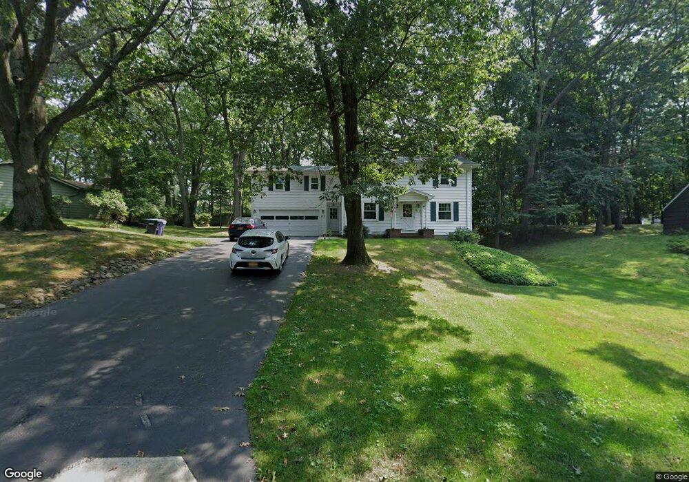
217 Stony Point Trail Webster, NY 14580
Estimated Value: $297,000 - $393,000
4
Beds
2
Baths
1,766
Sq Ft
$190/Sq Ft
Est. Value
About This Home
This home is located at 217 Stony Point Trail, Webster, NY 14580 and is currently estimated at $335,332, approximately $189 per square foot. 217 Stony Point Trail is a home located in Monroe County with nearby schools including DeWitt Road Elementary School, Willink Middle School, and Thomas High School.
Ownership History
Date
Name
Owned For
Owner Type
Purchase Details
Closed on
Aug 4, 2023
Sold by
Mahnken-Weatherspoon Theresa and Mahnken-Weatherspoon Ralph L
Bought by
Weatherspoon Michael and Knapp Maria
Current Estimated Value
Home Financials for this Owner
Home Financials are based on the most recent Mortgage that was taken out on this home.
Original Mortgage
$249,287
Outstanding Balance
$243,457
Interest Rate
6.67%
Mortgage Type
FHA
Estimated Equity
$91,875
Create a Home Valuation Report for This Property
The Home Valuation Report is an in-depth analysis detailing your home's value as well as a comparison with similar homes in the area
Home Values in the Area
Average Home Value in this Area
Purchase History
| Date | Buyer | Sale Price | Title Company |
|---|---|---|---|
| Weatherspoon Michael | $265,000 | Webtitle |
Source: Public Records
Mortgage History
| Date | Status | Borrower | Loan Amount |
|---|---|---|---|
| Open | Weatherspoon Michael | $249,287 |
Source: Public Records
Tax History
| Year | Tax Paid | Tax Assessment Tax Assessment Total Assessment is a certain percentage of the fair market value that is determined by local assessors to be the total taxable value of land and additions on the property. | Land | Improvement |
|---|---|---|---|---|
| 2024 | $6,567 | $140,500 | $28,500 | $112,000 |
| 2023 | $5,847 | $140,500 | $28,500 | $112,000 |
| 2022 | $6,358 | $140,500 | $28,500 | $112,000 |
| 2021 | $7,391 | $140,500 | $28,500 | $112,000 |
| 2020 | $5,584 | $140,500 | $28,500 | $112,000 |
| 2019 | $6,882 | $140,500 | $28,500 | $112,000 |
| 2018 | $5,199 | $138,500 | $28,500 | $110,000 |
| 2017 | $7,769 | $138,500 | $28,500 | $110,000 |
| 2016 | $6,882 | $138,500 | $28,500 | $110,000 |
| 2015 | -- | $138,500 | $28,500 | $110,000 |
| 2014 | -- | $138,500 | $28,500 | $110,000 |
Source: Public Records
Map
Nearby Homes
- 703 Mariner Cir
- 250 Norwood Cir
- 430 Sundance Trail
- 260 Point Pleasant Rd
- 286 Filon Ave
- 510 Klem Rd
- 203 Pinehill Dr
- 43 Oberlin St
- Lot #30 Maple Dr
- 763 Maple Dr
- 153 Mallard Dr
- 409 Newport Rd
- 407 Newport Rd
- 408 Newport Rd
- 524 Old Mill Ln
- 621 Brookstone Bend
- 1063 Hillsboro Cove Cir
- 207 Coolidge Rd
- 302 Marina View Ln
- 91 Birch Hills Dr
- 221 Stony Point Trail
- 213 Stony Point Trail
- 207 Raphael Dr
- 214 Colonial Dr
- 212 Colonial Dr
- 214 Stony Point Trail
- 210 Stony Point Trail
- 209 Raphael Dr
- 206 Stony Point Trail
- 210 Colonial Dr
- 223 Stony Point Trail
- 216 Colonial Dr
- 208 Colonial Dr
- 210 Raphael Dr
- 204 Stony Point Trail
- 206 Colonial Dr
- 218 Colonial Dr
- 211 Raphael Dr
- 217 Colonial Dr
Your Personal Tour Guide
Ask me questions while you tour the home.