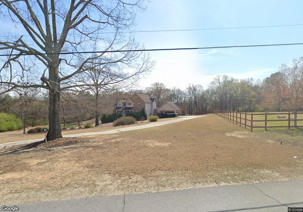
217 Stringer Rd Rockmart, GA 30153
Estimated Value: $491,573 - $523,000
3
Beds
3
Baths
2,714
Sq Ft
$188/Sq Ft
Est. Value
About This Home
This home is located at 217 Stringer Rd, Rockmart, GA 30153 and is currently estimated at $510,143, approximately $187 per square foot. 217 Stringer Rd is a home located in Polk County with nearby schools including Rockmart Middle School.
Ownership History
Date
Name
Owned For
Owner Type
Purchase Details
Closed on
Mar 29, 2019
Sold by
Smith James W
Bought by
Groom Jeffrey and Groom Tina Walton
Current Estimated Value
Home Financials for this Owner
Home Financials are based on the most recent Mortgage that was taken out on this home.
Original Mortgage
$284,200
Outstanding Balance
$248,324
Interest Rate
4.3%
Estimated Equity
$261,819
Purchase Details
Closed on
Nov 1, 2017
Sold by
Smith James W
Bought by
Tanner Don and Tanner Rita L
Purchase Details
Closed on
Dec 5, 2000
Sold by
Parks Timothy
Bought by
Smith James W and Smith Teresa R
Purchase Details
Closed on
Jun 30, 2000
Sold by
Jackson David James W Legrande
Bought by
Parks Timothy
Create a Home Valuation Report for This Property
The Home Valuation Report is an in-depth analysis detailing your home's value as well as a comparison with similar homes in the area
Home Values in the Area
Average Home Value in this Area
Purchase History
| Date | Buyer | Sale Price | Title Company |
|---|---|---|---|
| Groom Jeffrey | $310,000 | -- | |
| Tanner Don | -- | -- | |
| Smith James W | $207,700 | -- | |
| Parks Timothy | $22,000 | -- |
Source: Public Records
Mortgage History
| Date | Status | Borrower | Loan Amount |
|---|---|---|---|
| Open | Groom Jeffrey | $284,200 |
Source: Public Records
Tax History
| Year | Tax Paid | Tax Assessment Tax Assessment Total Assessment is a certain percentage of the fair market value that is determined by local assessors to be the total taxable value of land and additions on the property. | Land | Improvement |
|---|---|---|---|---|
| 2025 | $4,644 | $212,732 | $17,388 | $195,344 |
| 2024 | $4,314 | $208,386 | $13,042 | $195,344 |
| 2023 | $3,540 | $151,170 | $13,042 | $138,128 |
| 2022 | $3,097 | $132,486 | $8,694 | $123,792 |
| 2021 | $3,137 | $132,486 | $8,694 | $123,792 |
| 2020 | $2,939 | $132,486 | $8,694 | $123,792 |
| 2019 | $2,365 | $101,394 | $8,694 | $92,700 |
| 2018 | $2,215 | $93,717 | $7,245 | $86,472 |
| 2017 | $2,181 | $93,635 | $7,163 | $86,472 |
| 2016 | $2,107 | $90,938 | $5,294 | $85,644 |
| 2015 | $2,161 | $92,810 | $5,294 | $87,516 |
| 2014 | $2,172 | $92,810 | $5,294 | $87,516 |
Source: Public Records
Map
Nearby Homes
- 184 Morgan Ln
- 397 Stringer Rd
- 461 Lakeview Rd
- 18 Hillside Dr
- 865 Morgan Valley Rd
- 93 Clay Rd
- 907 Stringer Rd
- 60 Lee St
- 65 Wheeler Rd
- 11 Lee St
- 479 Morgan Valley Rd
- 1714 Cedartown Hwy
- 92 Autumn Path
- 831 Government Farm Rd
- 816 Government Farm Rd
- 2512 Tolbert Town Rd
- 0 Tolbert Town Rd Unit 10640593
- 0 Tolbert Town Rd Unit 7678739
- 0 Pine Mountain St Unit 10620510
- 0 Pine Mountain St Unit 10620492
- 217 Stringer Rd
- 157 Stringer Rd
- 824 Baldwin Rd
- 224 Stringer Rd
- 238 Stringer Rd
- 242 Stringer Rd
- 810 Baldwin Rd
- 143 Stringer Rd
- 365 Stringer Rd
- 140 Stringer Rd
- 800 Baldwin Rd
- 119 Ohara Dr
- 250 Stringer Rd
- 130 Stringer Rd
- 790 Baldwin Rd
- 116 Ohara Dr
- 1368 Morgan Valley Rd
- 113 Ohara Dr
- 120 Stringer Rd
- 290 Stringer Rd
Your Personal Tour Guide
Ask me questions while you tour the home.