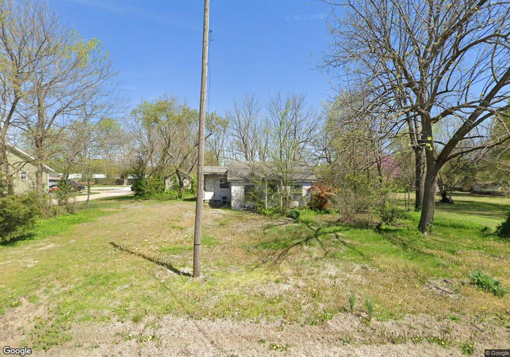
217 W Broad St Republic, MO 65738
Estimated Value: $94,920 - $151,000
1
Bed
1
Bath
800
Sq Ft
$163/Sq Ft
Est. Value
About This Home
This home is located at 217 W Broad St, Republic, MO 65738 and is currently estimated at $130,480, approximately $163 per square foot. 217 W Broad St is a home located in Greene County with nearby schools including Lyon Elementary School, Republic Middle School, and Republic High School.
Ownership History
Date
Name
Owned For
Owner Type
Purchase Details
Closed on
Mar 16, 2007
Sold by
H & H Llc and Huttenlocher Wagner
Bought by
Merced Christopher J and Bright Lisa L
Current Estimated Value
Purchase Details
Closed on
Jan 6, 2007
Sold by
Logan Doug and Logan Kayla
Bought by
Logan Doug and Logan Kayla
Purchase Details
Closed on
Dec 8, 2006
Sold by
Logan Doug and Logan Kayla
Bought by
Logan Doug and Logan Kayla
Create a Home Valuation Report for This Property
The Home Valuation Report is an in-depth analysis detailing your home's value as well as a comparison with similar homes in the area
Home Values in the Area
Average Home Value in this Area
Purchase History
| Date | Buyer | Sale Price | Title Company |
|---|---|---|---|
| Merced Christopher J | -- | None Available | |
| Logan Doug | -- | None Available | |
| Logan Doug | -- | None Available |
Source: Public Records
Tax History Compared to Growth
Tax History
| Year | Tax Paid | Tax Assessment Tax Assessment Total Assessment is a certain percentage of the fair market value that is determined by local assessors to be the total taxable value of land and additions on the property. | Land | Improvement |
|---|---|---|---|---|
| 2025 | -- | $8,110 | $5,700 | $2,410 |
| 2024 | $377 | $6,880 | $4,750 | $2,130 |
| 2023 | $377 | $6,880 | $4,750 | $2,130 |
| 2022 | $498 | $9,040 | $4,750 | $4,290 |
| 2021 | $495 | $9,040 | $4,750 | $4,290 |
| 2020 | $503 | $9,040 | $4,750 | $4,290 |
| 2019 | $456 | $9,040 | $4,750 | $4,290 |
| 2018 | $456 | $7,960 | $3,800 | $4,160 |
| 2017 | $0 | $7,640 | $3,800 | $3,840 |
| 2016 | $439 | $7,640 | $3,800 | $3,840 |
| 2015 | $438 | $7,640 | $3,800 | $3,840 |
| 2014 | $440 | $7,620 | $3,800 | $3,820 |
Source: Public Records
Map
Nearby Homes
- 207 W Broad St
- 0 Highway 60 Unit 60308100
- 0 Highway 60 Unit 60308095
- 217 E Ritter St
- 347 W Elm St
- 401 Ethan Ave
- 530 Ashley St
- 113 W Jewell Dr
- .94+/- Ac Highway 60
- 135 N Bonnie Ave
- 2450 Highway 60
- 975 S Montpelier Ct
- 410 E Wildwood Flower Dr
- 526 E Miller Rd
- 327 E Hadley St
- 520 N College Ave
- 1151 S Bordeaux Ave
- 508 E Mitchell Ct
- 533 N Main St
- 1213 N London Place
- 223 W Broad St
- 308 S Walnut Ave
- 305 W Broad St
- 214 W Broad St
- 201 W Broad St
- 119 W Broad St
- 304 W Broad St
- 221 Us Highway 60 W
- 221 Us Highway 60 W
- 221 Us Highway 60 W
- 221 Us Hwy 60 W
- 310 W Broad St
- ? S Main St
- 325 W Broad St
- 323 S Main Ave
- 320 W Broad St
- 331 S Main Ave
- 153 U S Highway 60 W
- 317 S Main Ave
- 317 S Main Ave Unit G