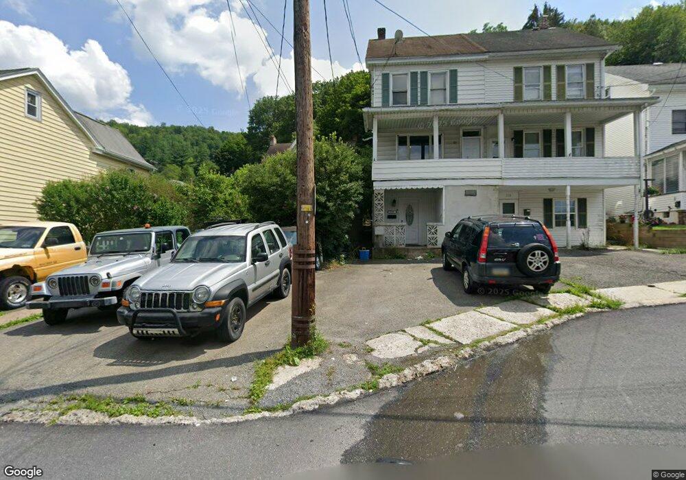
217 W High St Nesquehoning, PA 18240
Estimated Value: $97,000 - $130,000
3
Beds
2
Baths
1,120
Sq Ft
$101/Sq Ft
Est. Value
About This Home
This home is located at 217 W High St, Nesquehoning, PA 18240 and is currently estimated at $113,116, approximately $100 per square foot. 217 W High St is a home located in Carbon County with nearby schools including Panther Valley Elementary School, Panther Valley Intermediate School, and Panther Valley Junior/Senior High School.
Ownership History
Date
Name
Owned For
Owner Type
Purchase Details
Closed on
Feb 13, 2012
Sold by
Koehler Todd A and Bybel Charleen
Bought by
Koehler Todd A and Bybel Charleen
Current Estimated Value
Purchase Details
Closed on
May 27, 2010
Sold by
Cherevko Leonard A
Bought by
Koehler Todd A and Bybel Charleen
Home Financials for this Owner
Home Financials are based on the most recent Mortgage that was taken out on this home.
Original Mortgage
$89,296
Outstanding Balance
$60,314
Interest Rate
5.13%
Mortgage Type
FHA
Estimated Equity
$52,802
Purchase Details
Closed on
Dec 14, 2009
Sold by
Cherevko Leonard A
Bought by
Cherevko Leonard A
Create a Home Valuation Report for This Property
The Home Valuation Report is an in-depth analysis detailing your home's value as well as a comparison with similar homes in the area
Home Values in the Area
Average Home Value in this Area
Purchase History
| Date | Buyer | Sale Price | Title Company |
|---|---|---|---|
| Koehler Todd A | -- | None Available | |
| Koehler Todd A | $90,500 | None Available | |
| Cherevko Leonard A | -- | None Available |
Source: Public Records
Mortgage History
| Date | Status | Borrower | Loan Amount |
|---|---|---|---|
| Open | Koehler Todd A | $89,296 |
Source: Public Records
Tax History Compared to Growth
Tax History
| Year | Tax Paid | Tax Assessment Tax Assessment Total Assessment is a certain percentage of the fair market value that is determined by local assessors to be the total taxable value of land and additions on the property. | Land | Improvement |
|---|---|---|---|---|
| 2025 | $1,748 | $18,500 | $4,100 | $14,400 |
| 2024 | $1,819 | $18,500 | $4,100 | $14,400 |
| 2023 | $1,783 | $18,500 | $4,100 | $14,400 |
| 2022 | $1,794 | $18,500 | $4,100 | $14,400 |
| 2021 | $1,794 | $18,500 | $4,100 | $14,400 |
| 2020 | $1,767 | $18,500 | $4,100 | $14,400 |
| 2019 | $1,665 | $18,500 | $4,100 | $14,400 |
| 2018 | $1,646 | $18,500 | $4,100 | $14,400 |
| 2017 | $1,646 | $18,500 | $4,100 | $14,400 |
| 2016 | -- | $18,500 | $4,100 | $14,400 |
| 2015 | -- | $18,500 | $4,100 | $14,400 |
| 2014 | -- | $18,500 | $4,100 | $14,400 |
Source: Public Records
Map
Nearby Homes
- 229 W High St
- 153 W High St
- 134 W Railroad St Unit 136
- 158162 Coal St
- 1 W High St
- 61 Rhume St
- 2 W Catawissa St
- 34 Coal St
- 41 E Catawissa St
- 58 W Columbus Ave
- 142 E Center St
- 142 E Catawissa St
- 24 W Garibaldi Ave
- 20 W Garibaldi Ave
- 105 E Columbus Ave
- 117 E Garibaldi Ave
- 116 Spruce St
- 129 Lentz Trail
- 0 11th Ave Unit PM-131093
- 0 Birch Dr Unit 759990