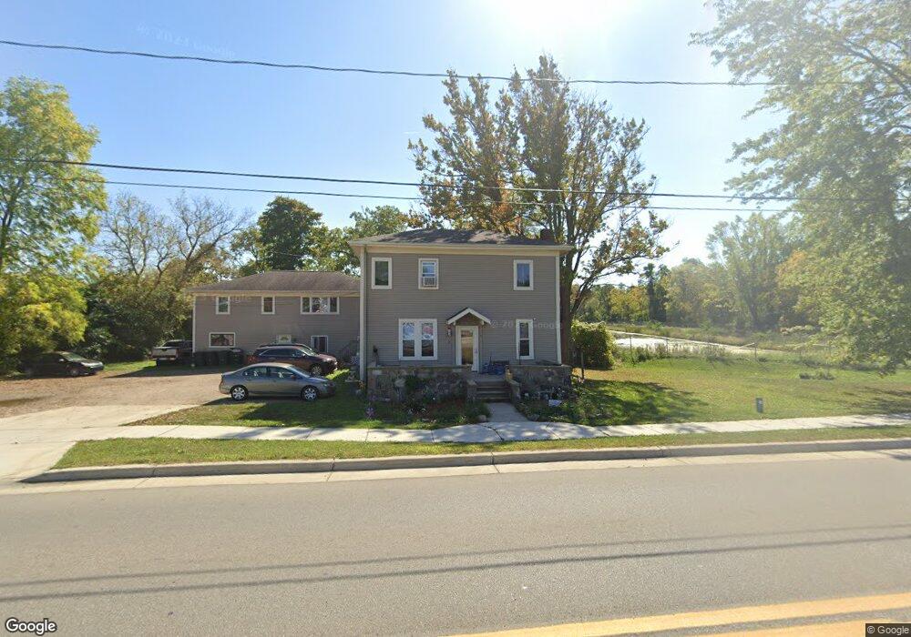
217 W Main St Spring Arbor, MI 49283
Estimated Value: $322,000 - $528,266
9
Beds
3
Baths
3,160
Sq Ft
$144/Sq Ft
Est. Value
About This Home
This home is located at 217 W Main St, Spring Arbor, MI 49283 and is currently estimated at $454,422, approximately $143 per square foot. 217 W Main St is a home located in Jackson County with nearby schools including Western High School and Trinity Lutheran School.
Ownership History
Date
Name
Owned For
Owner Type
Purchase Details
Closed on
Jun 10, 2011
Sold by
Labida Enterprises 1 Llc
Bought by
Becker William J and Becker Peggy
Current Estimated Value
Purchase Details
Closed on
Aug 12, 1998
Sold by
Boomershine Roger E
Bought by
Boomershine Roger E and Boomershine Yuvon L
Purchase Details
Closed on
Jul 29, 1992
Sold by
Young David P and Young Nancy
Bought by
Boomershine Roger E
Purchase Details
Closed on
Jul 1, 1992
Bought by
Boomshine
Create a Home Valuation Report for This Property
The Home Valuation Report is an in-depth analysis detailing your home's value as well as a comparison with similar homes in the area
Home Values in the Area
Average Home Value in this Area
Purchase History
| Date | Buyer | Sale Price | Title Company |
|---|---|---|---|
| Becker William J | $57,000 | At | |
| Boomershine Roger E | -- | -- | |
| Boomershine Roger E | $53,900 | -- | |
| Boomshine | $53,900 | -- |
Source: Public Records
Tax History Compared to Growth
Tax History
| Year | Tax Paid | Tax Assessment Tax Assessment Total Assessment is a certain percentage of the fair market value that is determined by local assessors to be the total taxable value of land and additions on the property. | Land | Improvement |
|---|---|---|---|---|
| 2025 | $5,205 | $297,900 | $0 | $0 |
| 2024 | $3,312 | $267,100 | $0 | $0 |
| 2023 | $3,242 | $258,200 | $0 | $0 |
| 2022 | $4,677 | $238,800 | $0 | $0 |
| 2021 | $4,550 | $219,830 | $0 | $0 |
| 2020 | $4,622 | $217,480 | $0 | $0 |
| 2019 | $4,298 | $198,760 | $0 | $0 |
| 2018 | $4,239 | $160,740 | $6,930 | $153,810 |
| 2017 | $3,129 | $153,620 | $0 | $0 |
| 2016 | $1,857 | $152,880 | $152,880 | $0 |
| 2015 | $64,128 | $132,950 | $132,950 | $0 |
| 2014 | $64,128 | $120,490 | $0 | $0 |
| 2013 | -- | $120,490 | $120,490 | $0 |
Source: Public Records
Map
Nearby Homes
- 125 Burr Oak Dr
- 392 Richard St
- V/L S Dearing Rd Unit 40 Acres Vacant Land
- 132 Remington Dr
- 2503 Milford Rd
- 0 King Rd Unit 25060444
- 8563 Mccain Rd
- 1864 Chapel Rd
- 2926 S Sandstone Rd
- 1570 Chapel Rd
- 5427 Vrooman Rd
- 6051 Riverside Dr
- 6820 Bowerman Rd
- 5162 Vrooman Rd
- 6930 Bowerman Rd
- 3352 Reynolds Rd
- 1126 Chapel Rd
- VL Sears Rd
- 1001 N Dearing Rd
- V/L Ikram Oaks Ln Unit 23
- 221 W Main St
- 226 W Main St
- 105 Burr Oak Dr
- 109 Burr Oak Dr
- 230 W Main St
- 194 W Main St
- 303 W Main St
- 0 Burr Oak Dr
- 108 Burr Oak Dr
- 123 Baker St
- 117 W Arbor Heights
- 114 Baker St
- 120 Ogle Ave
- 121 Burr Oak Dr
- 112 Burr Oak Dr
- 122 Baker St
- 106 W Arbor Heights
- 112 Baker St
- 113 W Arbor Heights
- 120 Burr Oak Dr