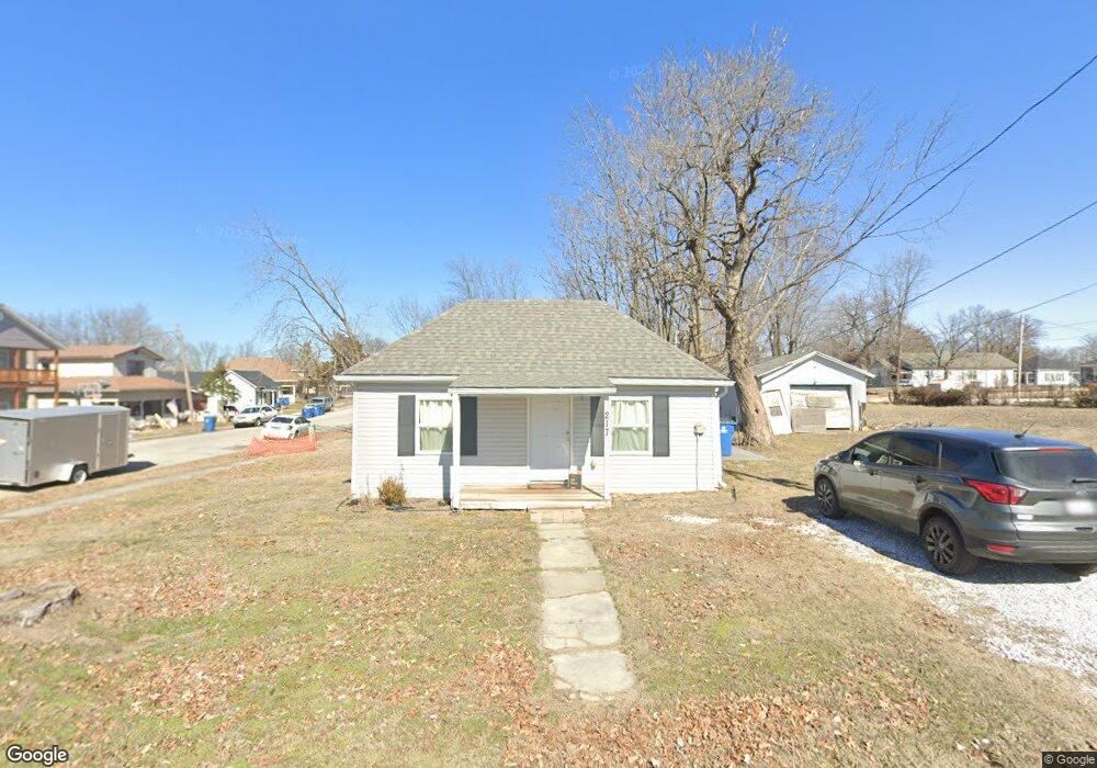
217 W Walton Ave Carl Junction, MO 64834
Estimated Value: $112,000 - $136,000
2
Beds
2
Baths
898
Sq Ft
$134/Sq Ft
Est. Value
About This Home
This home is located at 217 W Walton Ave, Carl Junction, MO 64834 and is currently estimated at $120,684, approximately $134 per square foot. 217 W Walton Ave is a home located in Jasper County with nearby schools including Carl Junction Primary School (K-1), Carl Junction Intermediate School, and Carl Junction Primary School (2-3).
Ownership History
Date
Name
Owned For
Owner Type
Purchase Details
Closed on
Jun 28, 2019
Sold by
Jones Nathan D and Jones Shannon
Bought by
Walker Stephen D and Walker Joann
Current Estimated Value
Create a Home Valuation Report for This Property
The Home Valuation Report is an in-depth analysis detailing your home's value as well as a comparison with similar homes in the area
Home Values in the Area
Average Home Value in this Area
Purchase History
| Date | Buyer | Sale Price | Title Company |
|---|---|---|---|
| Walker Stephen D | -- | -- |
Source: Public Records
Tax History Compared to Growth
Tax History
| Year | Tax Paid | Tax Assessment Tax Assessment Total Assessment is a certain percentage of the fair market value that is determined by local assessors to be the total taxable value of land and additions on the property. | Land | Improvement |
|---|---|---|---|---|
| 2025 | $376 | $7,270 | $750 | $6,520 |
| 2024 | $379 | $6,430 | $750 | $5,680 |
| 2023 | $379 | $6,430 | $750 | $5,680 |
| 2022 | $372 | $6,300 | $750 | $5,550 |
| 2021 | $319 | $6,300 | $750 | $5,550 |
| 2020 | $145 | $2,810 | $750 | $2,060 |
| 2019 | $137 | $2,810 | $750 | $2,060 |
| 2018 | $137 | $2,810 | $0 | $0 |
| 2017 | $137 | $2,810 | $0 | $0 |
| 2016 | $136 | $2,810 | $0 | $0 |
| 2015 | $133 | $2,810 | $0 | $0 |
| 2014 | $133 | $2,810 | $0 | $0 |
Source: Public Records
Map
Nearby Homes
- 114 W Walton Ave
- TBD S Roney St
- 408 W Walton Ave
- 409 W Gault St
- 409 Gault St
- 311 S Roney St
- 505 W Walton Ave
- 802 Aberdeen Ave
- 106 S Roney St
- 205 Allen St
- 503 Valley View
- 819 Delaney Dr
- 815 Delaney Dr
- 105 Summit St
- 720 Sheridan Ave
- Tract 3 Prairie Ln
- Tract 2 Prairie Ln
- Tract 1 Prairie Ln
- Tract 4 Prairie Ln
- 711 Prairie Ln
- 217 Walton St
- 213 Walton St
- 214 Walton St
- 212 W Walton Ave
- 616 S Roney St
- 614 S Roney St
- 212 Walton St
- 707 S Roney St
- 612 S Roney St
- 614 S Cowgill St
- 702 S Roney St
- 612 S Cowgill St
- 608 S Roney St
- 608 S Roney St Unit 1
- 608 S Cowgill St
- 601 S Roney St
- 708 S Roney St
- 610 S Cowgill St
- 606 S Roney St
- 713XX S Roney St