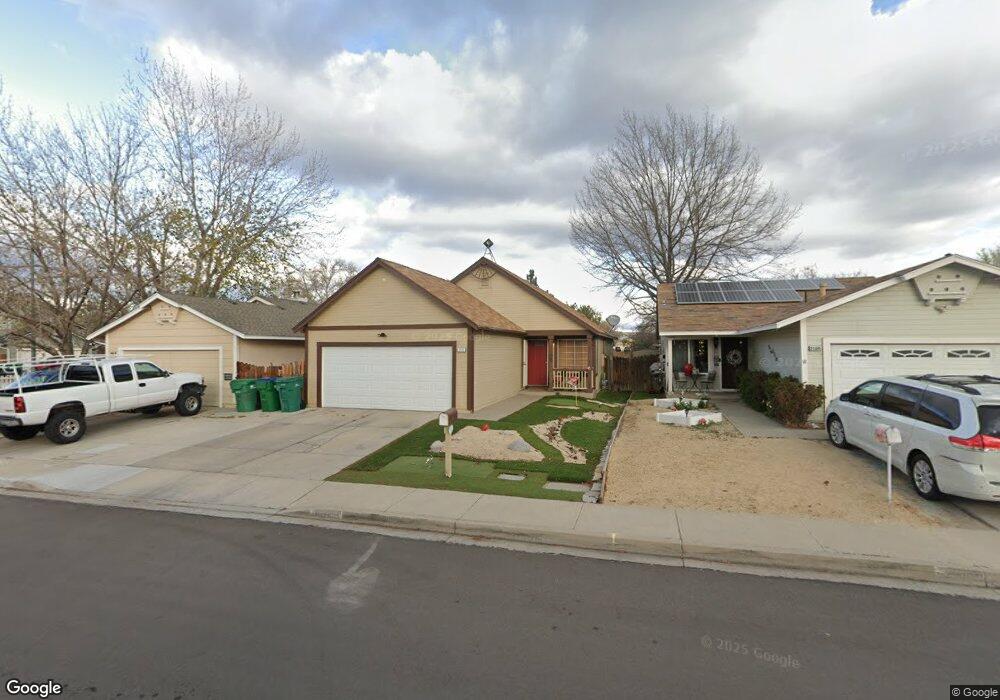
2170 Burnside Dr Sparks, NV 89434
O'Callaghan NeighborhoodEstimated Value: $421,000 - $440,000
3
Beds
2
Baths
1,250
Sq Ft
$344/Sq Ft
Est. Value
About This Home
This home is located at 2170 Burnside Dr, Sparks, NV 89434 and is currently estimated at $430,466, approximately $344 per square foot. 2170 Burnside Dr is a home located in Washoe County with nearby schools including Katherine Dunn Elementary School, George L Dilworth Middle School, and Edward C Reed High School.
Ownership History
Date
Name
Owned For
Owner Type
Purchase Details
Closed on
Feb 17, 2025
Sold by
Emerson Kimberly D and Emerson Thomas A
Bought by
Emerson Family Trust and Emerson
Current Estimated Value
Home Financials for this Owner
Home Financials are based on the most recent Mortgage that was taken out on this home.
Original Mortgage
$130,000
Outstanding Balance
$127,187
Interest Rate
7.04%
Mortgage Type
New Conventional
Estimated Equity
$303,279
Purchase Details
Closed on
Apr 7, 2023
Sold by
Emerson Thomas A and Emerson Kimberly D
Bought by
Emerson Family Trust
Home Financials for this Owner
Home Financials are based on the most recent Mortgage that was taken out on this home.
Original Mortgage
$50,000
Interest Rate
6.65%
Mortgage Type
New Conventional
Purchase Details
Closed on
Apr 20, 2022
Sold by
Emerson Thomas A and Emerson Kimberly D
Bought by
Emerson Family Trust
Purchase Details
Closed on
Jun 25, 1997
Sold by
Dominianni Lori J
Bought by
Emerson Thomas A and Emerson Kimberly D
Home Financials for this Owner
Home Financials are based on the most recent Mortgage that was taken out on this home.
Original Mortgage
$92,600
Interest Rate
3.95%
Create a Home Valuation Report for This Property
The Home Valuation Report is an in-depth analysis detailing your home's value as well as a comparison with similar homes in the area
Home Values in the Area
Average Home Value in this Area
Purchase History
| Date | Buyer | Sale Price | Title Company |
|---|---|---|---|
| Emerson Family Trust | -- | Amrock | |
| Emerson Kimberly D | -- | Amrock | |
| Emerson Family Trust | -- | Amrock | |
| Emerson Thomas A | -- | Amrock | |
| Emerson Family Trust | -- | None Listed On Document | |
| Emerson Thomas A | $123,500 | United Title |
Source: Public Records
Mortgage History
| Date | Status | Borrower | Loan Amount |
|---|---|---|---|
| Open | Emerson Kimberly D | $130,000 | |
| Previous Owner | Emerson Thomas A | $50,000 | |
| Previous Owner | Emerson Thomas A | $92,600 |
Source: Public Records
Tax History
| Year | Tax Paid | Tax Assessment Tax Assessment Total Assessment is a certain percentage of the fair market value that is determined by local assessors to be the total taxable value of land and additions on the property. | Land | Improvement |
|---|---|---|---|---|
| 2026 | $1,153 | $65,021 | $34,650 | $30,371 |
| 2025 | $1,497 | $66,006 | $34,580 | $31,426 |
| 2024 | $1,497 | $64,814 | $32,725 | $32,089 |
| 2023 | $1,455 | $63,089 | $32,305 | $30,784 |
| 2022 | $1,413 | $51,981 | $26,005 | $25,976 |
| 2021 | $1,372 | $45,975 | $19,845 | $26,130 |
| 2020 | $1,331 | $46,289 | $19,775 | $26,514 |
| 2019 | $1,292 | $44,841 | $18,935 | $25,906 |
| 2018 | $1,255 | $39,502 | $13,965 | $25,537 |
| 2017 | $1,219 | $38,485 | $12,670 | $25,815 |
| 2016 | $1,189 | $38,027 | $11,410 | $26,617 |
| 2015 | $1,187 | $36,505 | $9,625 | $26,880 |
| 2014 | $1,127 | $33,612 | $8,225 | $25,387 |
| 2013 | -- | $30,094 | $6,090 | $24,004 |
Source: Public Records
Map
Nearby Homes
- 2140 Burnside Dr
- 1674 Sabatino Dr
- 1655 Sabatino Dr
- 1236 Flora Glen Dr
- 2227 Valencia Way
- 2407 Sunny Slope Dr Unit 1
- 2507 Sycamore Glen Dr Unit 5
- 1544 Woodhaven Ln
- 2679 Sycamore Glen Dr Unit 4
- 2659 Sycamore Glen Dr Unit 5
- 2627 Sunny Slope Dr Unit 5
- 2625 Sunny Slope Dr
- 2625 Sunny Slope Dr Unit 2
- 2624 Sunny Slope Dr Unit 10
- 1308 Coachman Dr
- 1218 Junction Dr
- 2264 Fernwood Ct
- 2363 William Morby Dr
- 2575 Howard Dr
- 1074 Glen Martin Dr
- 2160 Burnside Dr
- 2180 Burnside Dr
- 2150 Burnside Dr
- 2301 Burnside Dr
- 2052 Union St
- 2005 Haywood Dr
- 2091 Burnside Dr
- 2130 Burnside Dr
- 2006 Haywood Dr
- 2073 Union St
- 2083 Union St
- 2042 Union St
- 2063 Union St
- 2015 Haywood Dr
- 2053 Union St
- 2081 Burnside Dr
- 2016 Haywood Dr
- 2120 Burnside Dr
- 2022 Union St
- 2043 Union St
Your Personal Tour Guide
Ask me questions while you tour the home.