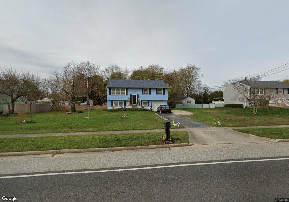
2170 S Union Rd Vineland, NJ 08361
Estimated Value: $232,000 - $318,505
--
Bed
--
Bath
1,830
Sq Ft
$157/Sq Ft
Est. Value
About This Home
This home is located at 2170 S Union Rd, Vineland, NJ 08361 and is currently estimated at $288,126, approximately $157 per square foot. 2170 S Union Rd is a home located in Cumberland County with nearby schools including Anthony Rossi Elementary School, Pauline J. Petway Elementary School, and Vineland Senior High School.
Ownership History
Date
Name
Owned For
Owner Type
Purchase Details
Closed on
Sep 30, 2005
Sold by
Rodriguez Annette
Bought by
Lewis Dana L
Current Estimated Value
Home Financials for this Owner
Home Financials are based on the most recent Mortgage that was taken out on this home.
Original Mortgage
$135,000
Outstanding Balance
$72,486
Interest Rate
5.81%
Estimated Equity
$215,640
Purchase Details
Closed on
Jun 30, 2003
Sold by
Santini Donald K
Bought by
Rodriguez Annette
Home Financials for this Owner
Home Financials are based on the most recent Mortgage that was taken out on this home.
Original Mortgage
$106,600
Interest Rate
5.46%
Purchase Details
Closed on
Oct 2, 1998
Sold by
Salazar Miguel
Bought by
Santini Donald K and Santini Robin
Home Financials for this Owner
Home Financials are based on the most recent Mortgage that was taken out on this home.
Original Mortgage
$85,456
Interest Rate
6.89%
Mortgage Type
FHA
Create a Home Valuation Report for This Property
The Home Valuation Report is an in-depth analysis detailing your home's value as well as a comparison with similar homes in the area
Home Values in the Area
Average Home Value in this Area
Purchase History
| Date | Buyer | Sale Price | Title Company |
|---|---|---|---|
| Lewis Dana L | $185,000 | -- | |
| Rodriguez Annette | $107,500 | -- | |
| Santini Donald K | $1,008,550 | -- |
Source: Public Records
Mortgage History
| Date | Status | Borrower | Loan Amount |
|---|---|---|---|
| Open | Lewis Dana L | $135,000 | |
| Previous Owner | Rodriguez Annette | $106,600 | |
| Previous Owner | Santini Donald K | $85,456 |
Source: Public Records
Tax History Compared to Growth
Tax History
| Year | Tax Paid | Tax Assessment Tax Assessment Total Assessment is a certain percentage of the fair market value that is determined by local assessors to be the total taxable value of land and additions on the property. | Land | Improvement |
|---|---|---|---|---|
| 2025 | $3,958 | $124,300 | $25,200 | $99,100 |
| 2024 | $3,958 | $124,300 | $25,200 | $99,100 |
| 2023 | $3,932 | $124,300 | $25,200 | $99,100 |
| 2022 | $3,815 | $124,300 | $25,200 | $99,100 |
| 2021 | $3,745 | $124,300 | $25,200 | $99,100 |
| 2020 | $3,638 | $124,300 | $25,200 | $99,100 |
| 2019 | $3,589 | $124,300 | $25,200 | $99,100 |
| 2018 | $3,494 | $124,300 | $25,200 | $99,100 |
| 2017 | $3,319 | $124,300 | $25,200 | $99,100 |
| 2016 | $3,202 | $124,300 | $25,200 | $99,100 |
| 2015 | $3,084 | $124,300 | $25,200 | $99,100 |
| 2014 | $2,916 | $124,300 | $25,200 | $99,100 |
Source: Public Records
Map
Nearby Homes
- 2189 Berkeley Dr
- 2020 S Union Rd
- 3259 S Union Rd
- 0 Genoa Ave Unit NJCB2013534
- 2810 Panther Rd
- 4517 Ascher Rd
- 3773 Brookhaven Dr
- 4491 E Chestnut Ave
- 1781 Cobblestone Ln
- 3538 Ravenna Ln
- 4926 Landis Ave
- 0 Ascher Rd
- 3391 Venturi Ln
- 3327 Dove Ct
- 116 Lejan Terrace
- 3966 Mays Landing Rd
- 6704 Lot 1 Buckingham Terrace
- 1670 Tori Ln
- 3938 Mays Landing Rd
- 4225 Mays Landing Rd
- 2190 S Union Rd
- 2150 S Union Rd
- 2169 Berkeley Dr
- 2130 S Union Rd
- 2200 S Union Rd
- 2129 Berkeley Dr
- 2201 Berkeley Dr
- 2110 S Union Rd
- 2109 Berkeley Dr
- 2230 S Union Rd
- 2170 Berkeley Dr
- 2090 S Union Rd
- 5591 Carteret St
- 2190 Berkeley Dr
- 2140 Berkeley Dr
- 2089 Berkeley Dr
- 2229 Berkeley Dr
- 2200 Berkeley Dr
- 2120 Berkeley Dr
- 2070 S Union Rd