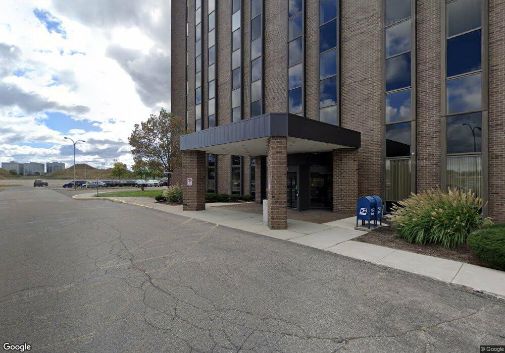
21700 Northwestern Hwy Unit 130 Southfield, MI 48075
Estimated Value: $189,000
--
Bed
--
Bath
2,500
Sq Ft
$76/Sq Ft
Est. Value
About This Home
This home is located at 21700 Northwestern Hwy Unit 130, Southfield, MI 48075 and is currently priced at $189,000, approximately $75 per square foot. 21700 Northwestern Hwy Unit 130 is a home located in Oakland County with nearby schools including Einstein Elementary School, Agbu Alex-Marie Manoogian School, and Pembroke Academy.
Ownership History
Date
Name
Owned For
Owner Type
Purchase Details
Closed on
Dec 30, 2014
Sold by
U S Bank National Association
Bought by
Sharnosa Llc
Current Estimated Value
Home Financials for this Owner
Home Financials are based on the most recent Mortgage that was taken out on this home.
Original Mortgage
$2,500,000
Interest Rate
3.85%
Mortgage Type
Commercial
Purchase Details
Closed on
Feb 18, 2014
Sold by
Tower 14 Llc
Bought by
U S Bank National Association
Purchase Details
Closed on
Jun 1, 2005
Sold by
Founders 14 Llc
Bought by
Tower 14 Llc
Purchase Details
Closed on
May 17, 2005
Sold by
Lasalle Bank Na
Bought by
Founders 14 Llc
Purchase Details
Closed on
Aug 6, 1998
Sold by
Hartford Creek Assoc Ltd
Bought by
Founders 14
Purchase Details
Closed on
Aug 29, 1995
Sold by
Sara Creek Real Est Thre
Bought by
Hartford Creek Assoc Ltd Ptr
Create a Home Valuation Report for This Property
The Home Valuation Report is an in-depth analysis detailing your home's value as well as a comparison with similar homes in the area
Home Values in the Area
Average Home Value in this Area
Purchase History
| Date | Buyer | Sale Price | Title Company |
|---|---|---|---|
| Sharnosa Llc | -- | Zodiac Title Services Llc | |
| U S Bank National Association | $4,420,000 | None Available | |
| Tower 14 Llc | -- | None Available | |
| Founders 14 Llc | -- | -- | |
| Founders 14 Llc | -- | -- | |
| Founders 14 | -- | -- | |
| Hartford Creek Assoc Ltd Ptr | -- | -- |
Source: Public Records
Mortgage History
| Date | Status | Borrower | Loan Amount |
|---|---|---|---|
| Closed | Sharnosa Llc | $2,500,000 |
Source: Public Records
Tax History Compared to Growth
Tax History
| Year | Tax Paid | Tax Assessment Tax Assessment Total Assessment is a certain percentage of the fair market value that is determined by local assessors to be the total taxable value of land and additions on the property. | Land | Improvement |
|---|---|---|---|---|
| 2022 | $20,312 | $354,520 | $354,520 | $0 |
| 2021 | $18,789 | $354,520 | $354,520 | $0 |
| 2020 | $8,975 | $125,000 | $125,000 | $0 |
| 2018 | $306,056 | $4,956,720 | $250,250 | $4,706,470 |
| 2015 | -- | $4,047,090 | $0 | $0 |
| 2014 | -- | $4,123,000 | $0 | $0 |
| 2011 | -- | $5,467,020 | $0 | $0 |
Source: Public Records
Map
Nearby Homes
- 16400 N Park Dr Unit 414
- 16400 N Park Dr Unit 1218
- 16400 N Park Dr Unit 810
- 16260 Mayfair Dr Unit 102
- 16245 Roanoke St
- 16275 W 9 Mile Rd
- 17581 Roxbury Ave
- 20569 Biltmore St
- 20575 Rutherford St
- 20536 Ferguson St
- 20558 Oakfield St
- 20542 Oakfield St
- 18252 Westland Ave
- 20300 Gilchrist St
- 20285 Prevost St
- 18249 Westover Ave
- 22150 Beverly St
- 20236 Ferguson St
- 20235 Ferguson St
- 17305 Gateway Cir Unit 6
- 21700 Northwestern Hwy
- 21700 Northwestern Hwy
- 21470 Brixton Place
- 0000 Roxbury Ave
- 0 Roxbury Ave
- 17014 Magnolia Pkwy
- 21500 Brixton Place
- BLUE SKY MANAGEMENT Magnolia Pkwy
- 21462 Brixton Place
- 17039 Dorset Ave
- 17022 Magnolia Pkwy
- 21434 Brixton Place Unit Bldg-Unit
- 21434 Brixton Place
- 21414 Pierce Ave
- 17055 Dorset Ave
- 17040 Magnolia Pkwy
- 17047 Magnolia Pkwy
- 0001 Cornell
- 0002 Cornell
- 17077 Dorset Ave