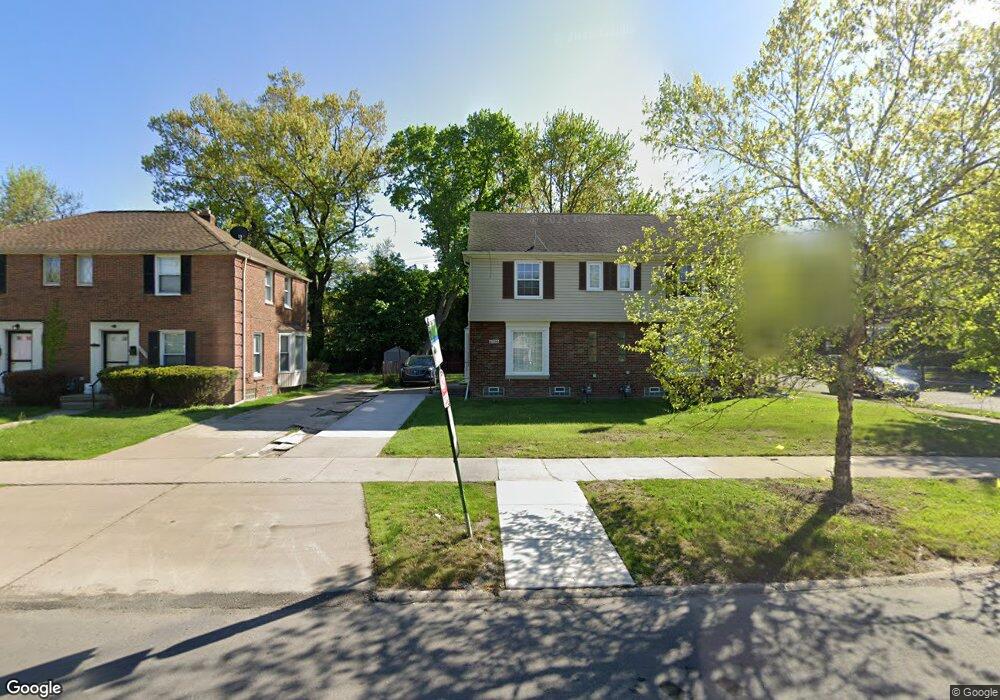
21706 Moross Rd Grosse Pointe, MI 48236
Cornerstone Village NeighborhoodEstimated Value: $84,000 - $140,000
Studio
1
Bath
902
Sq Ft
$123/Sq Ft
Est. Value
About This Home
This home is located at 21706 Moross Rd, Grosse Pointe, MI 48236 and is currently estimated at $111,000, approximately $123 per square foot. 21706 Moross Rd is a home located in Wayne County with nearby schools including Marquette Elementary-Middle School, Edward 'Duke' Ellington Conservatory of Music and Art, and Charles L. Spain Elementary-Middle School.
Ownership History
Date
Name
Owned For
Owner Type
Purchase Details
Closed on
Jun 28, 2024
Sold by
Stromco Investments Llc
Bought by
Walker Emanuellta
Current Estimated Value
Purchase Details
Closed on
Oct 15, 2012
Sold by
Wayne County Treasurer
Bought by
Stromco Investments Llc
Create a Home Valuation Report for This Property
The Home Valuation Report is an in-depth analysis detailing your home's value as well as a comparison with similar homes in the area
Home Values in the Area
Average Home Value in this Area
Purchase History
| Date | Buyer | Sale Price | Title Company |
|---|---|---|---|
| Walker Emanuellta | $198,000 | Ata National Title | |
| Walker Emanuellta | $198,000 | Ata National Title | |
| Stromco Investments Llc | $9,700 | None Available |
Source: Public Records
Tax History
| Year | Tax Paid | Tax Assessment Tax Assessment Total Assessment is a certain percentage of the fair market value that is determined by local assessors to be the total taxable value of land and additions on the property. | Land | Improvement |
|---|---|---|---|---|
| 2025 | $1,193 | $32,600 | $0 | $0 |
| 2024 | $926 | $28,000 | $0 | $0 |
| 2023 | $1,144 | $20,900 | $0 | $0 |
| 2022 | $1,209 | $16,700 | $0 | $0 |
| 2021 | $1,180 | $13,100 | $0 | $0 |
| 2020 | $1,180 | $11,800 | $0 | $0 |
| 2019 | $1,065 | $9,900 | $0 | $0 |
| 2018 | $941 | $9,100 | $0 | $0 |
| 2017 | $176 | $9,300 | $0 | $0 |
| 2016 | $1,221 | $11,700 | $0 | $0 |
| 2015 | $1,170 | $11,700 | $0 | $0 |
| 2013 | $1,666 | $16,660 | $0 | $0 |
| 2010 | -- | $24,426 | $835 | $23,591 |
Source: Public Records
Map
Nearby Homes
- 21756 Moross Rd
- 21820 Moross Rd
- 19196 Berden St
- 19134 Mallina St
- 21970 Moross Rd
- 19217 Linville St
- 6144 Radnor St
- 18721 Chandler Park Dr
- 6300 Radnor St
- 6137 Radnor St
- 5951 Radnor St
- 21741 Bournemouth St
- 6166 Farmbrook St
- 19299 Raymond St
- 6306 Farmbrook St
- 21602 Newcastle Rd
- 5273 Hillcrest St
- 5924 Lodewyck St
- 5754 Farmbrook St
- 5228 Hillcrest St
- 21700 Moross Rd
- 21718 Moross Rd
- 21720 Moross Rd
- 21730 Moross Rd
- 6016 Hillcrest St
- 21650 Moross Rd
- 6024 Hillcrest St
- 21734 Moross Rd
- 6008 Hillcrest St
- 6000 Hillcrest St
- 21646 Moross Rd
- 21646 Moross Rd
- 5992 Hillcrest St
- 19019 Rolandale St
- 21636 Moross Rd
- 21748 Moross Rd
- 5984 Hillcrest St
- 19009 Rolandale St
- 21632 Moross Rd
- 19001 Rolandale St
Your Personal Tour Guide
Ask me questions while you tour the home.