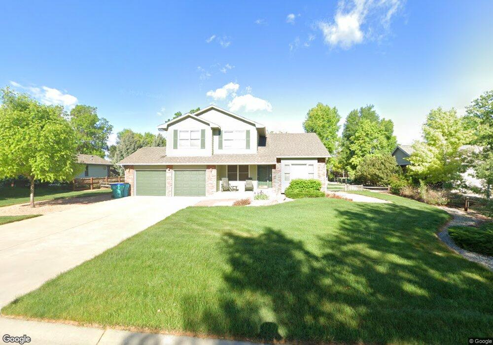
2171 Burbank St Berthoud, CO 80513
Estimated Value: $753,683 - $895,000
About This Home
This home is located at 2171 Burbank St, Berthoud, CO 80513 and is currently estimated at $817,921, approximately $319 per square foot. 2171 Burbank St is a home located in Larimer County with nearby schools including Berthoud Elementary School, Turner Middle School, and Berthoud High School.
Ownership History
We collect this data history from publicly available records. To have your information removed, we recommend requesting removal directly through your county’s website.
Purchase Details
Home Financials for this Owner
Home Financials are based on the most recent Mortgage that was taken out on this home.Purchase Details
Home Financials for this Owner
Home Financials are based on the most recent Mortgage that was taken out on this home.Purchase Details
Home Financials for this Owner
Home Financials are based on the most recent Mortgage that was taken out on this home.Home Values in the Area
Average Home Value in this Area
Purchase History
We collect this data history from publicly available records. To have your information removed, we recommend requesting removal directly through your county’s website.
| Date | Buyer | Sale Price | Title Company |
|---|---|---|---|
| -- | Land Title | ||
| $238,000 | -- | ||
| $50,400 | -- |
Mortgage History
We collect this data history from publicly available records. To have your information removed, we recommend requesting removal directly through your county’s website.
| Date | Status | Borrower | Loan Amount |
|---|---|---|---|
| Open | $227,150 | ||
| Closed | $226,100 | ||
| Previous Owner | $190,000 |
Tax History
We collect this data history from publicly available records. To have your information removed, we recommend requesting removal directly through your county’s website.
| Year | Tax Paid | Tax Assessment Tax Assessment Total Assessment is a certain percentage of the fair market value that is determined by local assessors to be the total taxable value of land and additions on the property. | Land | Improvement |
|---|---|---|---|---|
| 2025 | $3,486 | $46,400 | $13,250 | $33,150 |
| 2024 | $3,371 | $50,672 | $14,204 | $36,468 |
| 2022 | $3,339 | $38,712 | $3,684 | $35,028 |
| 2021 | $3,432 | $39,826 | $3,790 | $36,036 |
| 2020 | $3,276 | $38,003 | $3,790 | $34,213 |
| 2019 | $3,228 | $38,003 | $3,790 | $34,213 |
| 2018 | $3,050 | $34,294 | $3,816 | $30,478 |
| 2017 | $2,659 | $34,294 | $3,816 | $30,478 |
| 2016 | $2,432 | $30,415 | $4,219 | $26,196 |
| 2015 | $2,416 | $30,420 | $4,220 | $26,200 |
| 2014 | $2,248 | $26,990 | $4,780 | $22,210 |
Map
- 2177 Burbank St
- 2243 Breckenridge Dr
- 2238 Breckenridge Dr
- 2289 Elmwood St
- 2227 Breckenridge Dr
- 2032 Cuda Ct
- 2204 Breckenridge Dr
- 740 W County Road 10 E
- 1325 Tipton St
- 2321 Nicholson St
- 2158 Lamborn Ct
- 2480 Nicholson St
- 2403 Tabor St
- 1907 Mount Monroe Dr
- 1496 Biffle Ct
- 885 Great Plains Ave
- 2615 Great Plains Trail
- 2614 Great Plains Trail
- 2475 Likens Dr
- 793 Great Plains Ave
- 2285 Burbank St
- 2261 Breckenridge Dr
- 2249 Breckenridge Dr
- 2165 Burbank St
- 2156 Elmwood St
- 2288 Elmwood St
- 2150 Elmwood St
- 2290 Elmwood St
- 2170 Burbank St
- 2260 Breckenridge Dr
- 2164 Burbank St
- 2159 Burbank St
- 2144 Elmwood St
- 2248 Breckenridge Dr
- 2296 Elmwood St
- 2239 Breckenridge Dr
- 2138 Elmwood St
- 2242 Breckenridge Dr
- 2158 Burbank St
- 2151 Burbank St
Ask me questions while you tour the home.