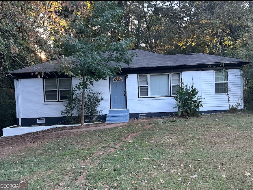
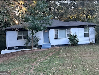
2171 Pryor Rd SW Atlanta, GA 30315
Polar Rock NeighborhoodHighlights
- City View
- Furnished
- No HOA
- Wood Flooring
- Solid Surface Countertops
- Keeping Room
About This Home
Newly renovated modern home, open concept floor plan updated kitchen, Fresh interior/Exterior paint this home blends functionality and Charm. Wont Last!
Listing Agent
Lisa Wu
Hartwell & Associates Realtors Brokerage Phone: 6782708536 License #202661 Listed on: 10/20/2025
Home Details
Home Type
- Single Family
Est. Annual Taxes
- $1,841
Year Built
- Built in 1965 | Remodeled
Lot Details
- 0.26 Acre Lot
- Level Lot
Parking
- Assigned Parking
Home Design
- Slab Foundation
- Concrete Roof
- Brick Front
Interior Spaces
- 1-Story Property
- Furnished
- Ceiling Fan
- Combination Dining and Living Room
- Keeping Room
- Wood Flooring
- City Views
Kitchen
- Cooktop
- Microwave
- Dishwasher
- Solid Surface Countertops
Bedrooms and Bathrooms
- 3 Main Level Bedrooms
- 2 Full Bathrooms
Home Security
- Carbon Monoxide Detectors
- Fire and Smoke Detector
Schools
- Slater Elementary School
- Price Middle School
- Carver High School
Utilities
- Central Heating and Cooling System
- 440 Volts
- Cable TV Available
Additional Features
- Accessible Entrance
- Property is near schools
Listing and Financial Details
- Security Deposit $2,500
- 12-Month Min and 24-Month Max Lease Term
- $100 Application Fee
- Tax Lot 91
Community Details
Pet Policy
- No Pets Allowed
Additional Features
- No Home Owners Association
- No Laundry Facilities
Map
Source: Georgia MLS
MLS Number: 10628468
APN: 14-0091-0003-024-8
Disclaimer: Certain information contained herein is derived from information provided by parties other than Homes.com. All information provided is deemed reliable, but is not guaranteed to be accurate and should be independently verified.
![]() The data relating to real estate for sale on this web site comes in part from the Broker Reciprocity Program of Georgia MLS. Real estate listings held by brokerage firms other than Redfin are marked with the Broker Reciprocity logo and detailed information about them includes the name of the listing brokers. Information deemed reliable but not guaranteed. Copyright 2025 Georgia MLS. All rights reserved.
The data relating to real estate for sale on this web site comes in part from the Broker Reciprocity Program of Georgia MLS. Real estate listings held by brokerage firms other than Redfin are marked with the Broker Reciprocity logo and detailed information about them includes the name of the listing brokers. Information deemed reliable but not guaranteed. Copyright 2025 Georgia MLS. All rights reserved.
- 0 Nelms Dr SW Unit 10530666
- 0 Nelms Dr SW Unit 7586743
- 2235 Pryor Rd SW
- 2231 Nelms Dr SW
- 2239 Nelms Dr SW
- 2218 Bagwell Dr SW
- 2259 Nelms Dr SW
- 2535 Lakewood Ave SW
- 2245 Polar Rock Ave SW
- 2210 Polar Rock Ave SW
- 2025 Moody Dr SW
- 193 Polar Rock Rd SW
- 2240 Polar Rock Ave SW
- 272 Hilltop Dr SW
- 2308 Lakewood Ave SW
- 1993 Reynolds Dr SW
- 0 Hilltop Dr SW Unit 10606623
- 2336 Polar Rock Ave SW
- 2242 Polar Rock Place SW
- 195 Polar Rock Rd SW
- 2019 Pryor Rd SW
- 2246 Polar Rock Terrace SW
- 2312 Polar Rock Ave SW
- 2162 Polar Rock Place SW
- 133 Hilltop Dr SW
- 157 Polar Rock Dr SW
- 565 Saint Johns Ave SW
- 650 Banks Ave SW
- 2285 Metropolitan Pkwy SW
- 2466 Old Hapeville Rd SW
- 1778 Maple Walk Cir SW
- 2585 Beeler Dr SW
- 16 Bromack Dr SE
- 1960 Brewer Blvd SW
- 2601 Beeler Dr SW
- 245 Amal Dr SW Unit 2007
- 2500 Swallow Cir SE
- 718 Pegg Rd SW
- 2637 Old Hapeville Rd SW