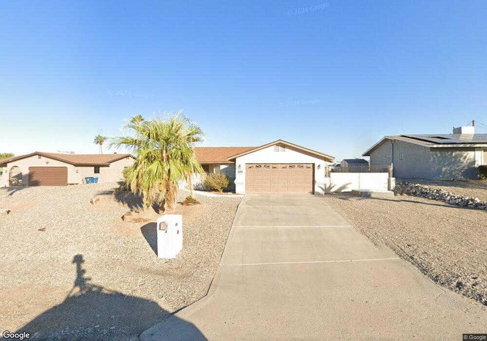
2171 Wallapai Dr Lake Havasu City, AZ 86403
Estimated Value: $404,234 - $521,000
--
Bed
1
Bath
1,683
Sq Ft
$276/Sq Ft
Est. Value
About This Home
This home is located at 2171 Wallapai Dr, Lake Havasu City, AZ 86403 and is currently estimated at $464,559, approximately $276 per square foot. 2171 Wallapai Dr is a home located in Mohave County with nearby schools including Smoketree Elementary School, Thunderbolt Middle School, and Lake Havasu High School.
Ownership History
Date
Name
Owned For
Owner Type
Purchase Details
Closed on
Feb 11, 2022
Sold by
Lecours Paul E
Bought by
Paul E Lecours And Lyndia L Lecours Living Tr and Le Lyndia
Current Estimated Value
Purchase Details
Closed on
Apr 7, 2011
Sold by
Lecours Paul E and Lecours Lyndia L
Bought by
Lecours Paul E and Lecours Lynda L
Purchase Details
Closed on
May 12, 2006
Sold by
Mcwhorter C R and Mcwhorter Lavonne
Bought by
Mcwhorter Claude R and Mcwhorter Lavonne
Purchase Details
Closed on
Jan 17, 2003
Sold by
Crawford Donald R and Crawford Fujie
Bought by
Lecours Paul E and Lecours Lyndia L
Home Financials for this Owner
Home Financials are based on the most recent Mortgage that was taken out on this home.
Original Mortgage
$100,000
Interest Rate
5.83%
Mortgage Type
New Conventional
Create a Home Valuation Report for This Property
The Home Valuation Report is an in-depth analysis detailing your home's value as well as a comparison with similar homes in the area
Home Values in the Area
Average Home Value in this Area
Purchase History
| Date | Buyer | Sale Price | Title Company |
|---|---|---|---|
| Paul E Lecours And Lyndia L Lecours Living Tr | -- | -- | |
| Lecours Paul E | -- | None Available | |
| Mcwhorter Claude R | -- | None Available | |
| Lecours Paul E | $170,000 | First American Title Ins Co |
Source: Public Records
Mortgage History
| Date | Status | Borrower | Loan Amount |
|---|---|---|---|
| Previous Owner | Lecours Paul E | $100,000 |
Source: Public Records
Tax History Compared to Growth
Tax History
| Year | Tax Paid | Tax Assessment Tax Assessment Total Assessment is a certain percentage of the fair market value that is determined by local assessors to be the total taxable value of land and additions on the property. | Land | Improvement |
|---|---|---|---|---|
| 2026 | $907 | -- | -- | -- |
| 2025 | $971 | $38,221 | $0 | $0 |
| 2024 | $971 | $42,417 | $0 | $0 |
| 2023 | $971 | $36,361 | $0 | $0 |
| 2022 | $995 | $28,631 | $0 | $0 |
| 2021 | $1,475 | $24,491 | $0 | $0 |
| 2019 | $1,403 | $22,801 | $0 | $0 |
| 2018 | $1,357 | $20,436 | $0 | $0 |
| 2017 | $1,334 | $19,950 | $0 | $0 |
| 2016 | $1,184 | $16,851 | $0 | $0 |
| 2015 | $1,153 | $14,478 | $0 | $0 |
Source: Public Records
Map
Nearby Homes
- 1790 Rainbow Ave S
- 2270 Constellation Dr
- 2295 Cosnina Dr
- 2305 Cosnina Dr
- 532 Acoma Blvd N
- 2075 Palo Verde Blvd S
- 2067 Palo Verde Blvd S
- 2294 Pheasant Ln
- 583 Robin Ln
- 273 Acoma Blvd N
- 320 Senita Ln
- 2010 Rapier Ln
- 2030 Mimosa Dr
- 640 Acoma Blvd N
- 2311 Rainbow Ave N
- 320 Chipeta Ln
- 2200 Clarke Dr
- 675 Knobhill Ln
- 2004 Pima Dr N
- 1970 Pima Dr N
- 2175 Wallapai Dr
- 2165 Wallapai Dr
- 2155 Wallapai Dr
- 2170 Constellation Ln
- 2166 Constellation Ln
- 2160 Constellation Ln
- 2174 Constellation Ln
- 2145 Wallapai Dr
- 2174 Wallapai Dr
- 2185 Wallapai Dr
- 2170 Wallapai Dr
- 2178 Wallapai Dr
- 2160 Wallapai Dr
- 2180 Wallapai Dr
- 2180 Constellation Ln
- 2150 Constellation Ln
- 2156 Wallapai Dr
- 2184 Wallapai Dr
- 2140 Wallapai Dr