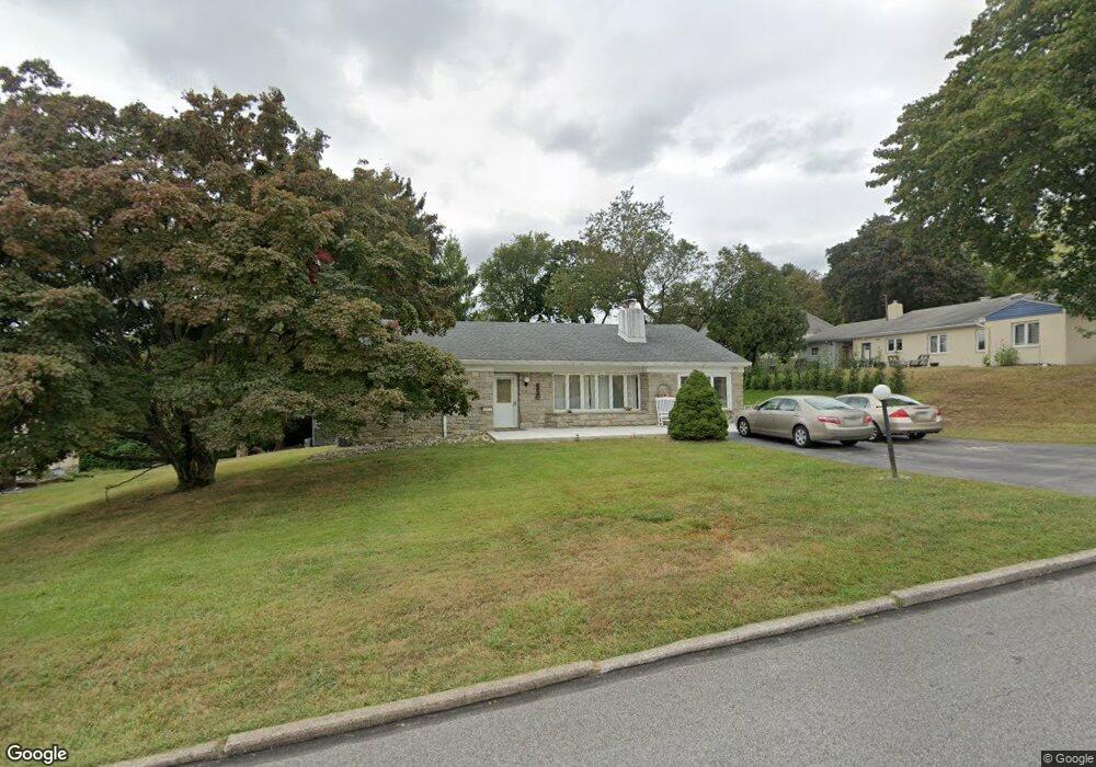
2172 Brookthorpe Cir Broomall, PA 19008
Marple Township Delaware NeighborhoodEstimated Value: $562,068 - $650,000
3
Beds
2
Baths
1,598
Sq Ft
$370/Sq Ft
Est. Value
About This Home
This home is located at 2172 Brookthorpe Cir, Broomall, PA 19008 and is currently estimated at $590,517, approximately $369 per square foot. 2172 Brookthorpe Cir is a home located in Delaware County with nearby schools including Loomis Elementary School, Paxon Hollow Middle School, and Marple Newtown Senior High School.
Ownership History
Date
Name
Owned For
Owner Type
Purchase Details
Closed on
Mar 30, 1998
Sold by
Minuti Lena C and Mcgroarty Mary
Bought by
Purifico Dante E and Purifico Mary Ann
Current Estimated Value
Home Financials for this Owner
Home Financials are based on the most recent Mortgage that was taken out on this home.
Original Mortgage
$117,000
Outstanding Balance
$21,977
Interest Rate
6.98%
Mortgage Type
Purchase Money Mortgage
Estimated Equity
$568,540
Create a Home Valuation Report for This Property
The Home Valuation Report is an in-depth analysis detailing your home's value as well as a comparison with similar homes in the area
Home Values in the Area
Average Home Value in this Area
Purchase History
| Date | Buyer | Sale Price | Title Company |
|---|---|---|---|
| Purifico Dante E | $130,000 | -- |
Source: Public Records
Mortgage History
| Date | Status | Borrower | Loan Amount |
|---|---|---|---|
| Open | Purifico Dante E | $117,000 |
Source: Public Records
Tax History Compared to Growth
Tax History
| Year | Tax Paid | Tax Assessment Tax Assessment Total Assessment is a certain percentage of the fair market value that is determined by local assessors to be the total taxable value of land and additions on the property. | Land | Improvement |
|---|---|---|---|---|
| 2025 | $6,134 | $354,940 | $129,950 | $224,990 |
| 2024 | $6,134 | $354,940 | $129,950 | $224,990 |
| 2023 | $5,939 | $354,940 | $129,950 | $224,990 |
| 2022 | $5,827 | $354,940 | $129,950 | $224,990 |
| 2021 | $8,793 | $354,940 | $129,950 | $224,990 |
| 2020 | $4,237 | $147,230 | $61,240 | $85,990 |
| 2019 | $4,186 | $147,230 | $61,240 | $85,990 |
| 2018 | $4,142 | $147,230 | $0 | $0 |
| 2017 | $4,144 | $147,230 | $0 | $0 |
| 2016 | $808 | $147,230 | $0 | $0 |
| 2015 | $824 | $147,230 | $0 | $0 |
| 2014 | $824 | $147,230 | $0 | $0 |
Source: Public Records
Map
Nearby Homes
- 300 Rock Run Cir
- 54 Sterner Ave
- 200 Marple Rd
- 1 Lawrence Rd Unit A3A
- 127 Deerfield Rd
- 1741 Lawrence Rd
- 345 Ellis Rd
- 1 Brighton Village Dr
- 7 Brighton Village Dr
- 306 Rock Run Cir
- 6205 Parkview Dr
- 210 218 David Dr
- 15 Oakland Rd
- 63 S Greenhill Rd
- 1702 Melrose Ave
- 88 4th Ave
- 201 Golf Hills Rd
- 301 S New Ardmore Ave
- 124 Carli Dr
- 106 2nd Ave
- 2170 Brookthorpe Cir
- 111 Thomas Ave
- 109 Thomas Ave
- 2173 Brookthorpe Cir
- 107 Thomas Ave
- 2168 Brookthorpe Cir
- 2175 Brookthorpe Cir
- 2171 Brookthorpe Cir
- 9 Darlene Cir
- 7 Darlene Cir
- 110 Thomas Ave
- 105 Thomas Ave
- 2169 Brookthorpe Cir
- 2166 Brookthorpe Cir
- 108 Thomas Ave
- 203 Brookthorpe Cir
- 200 Brookthorpe Cir
- 11 Darlene Cir
- 103 Thomas Ave
- 106 Thomas Ave