--
Bed
--
Bath
--
Sq Ft
--
Built
About This Home
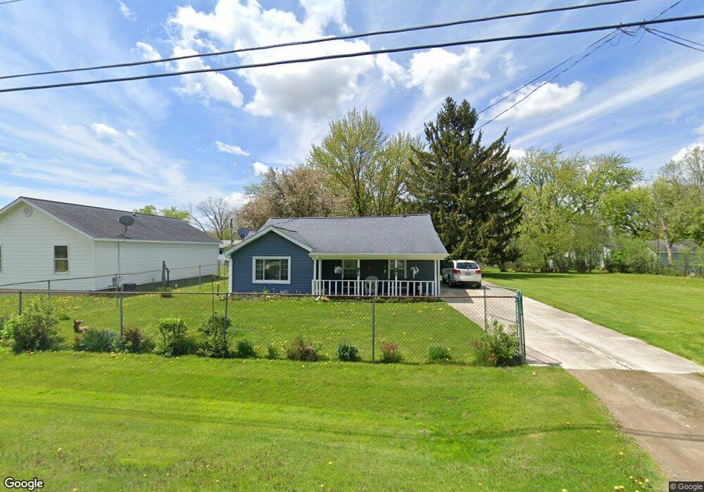
This home is located at 2172 Diamond Ave, Flint, MI 48532. 2172 Diamond Ave is a home located in Genesee County with nearby schools including Carman-Ainsworth High School, Genesee STEM Academy, and St. Paul Lutheran School.
Create a Home Valuation Report for This Property
The Home Valuation Report is an in-depth analysis detailing your home's value as well as a comparison with similar homes in the area
Home Values in the Area
Average Home Value in this Area
Tax History
| Year | Tax Paid | Tax Assessment Tax Assessment Total Assessment is a certain percentage of the fair market value that is determined by local assessors to be the total taxable value of land and additions on the property. | Land | Improvement |
|---|---|---|---|---|
| 2024 | $496 | $38,400 | $0 | $0 |
| 2023 | $775 | $31,300 | $0 | $0 |
| 2022 | $514 | $28,400 | $0 | $0 |
| 2021 | $951 | $26,300 | $0 | $0 |
| 2020 | $425 | $22,100 | $0 | $0 |
| 2019 | $419 | $18,800 | $0 | $0 |
| 2018 | $911 | $20,900 | $0 | $0 |
| 2016 | $890 | $19,300 | $0 | $0 |
| 2015 | $724 | $18,700 | $0 | $0 |
| 2014 | $429 | $18,000 | $0 | $0 |
| 2012 | -- | $21,200 | $21,200 | $0 |
Source: Public Records
Map
Nearby Homes
- 18.41 Taft Rd
- 2033 Eberly Rd
- 10 Acres T A Mansour Blvd
- 1512 Crescent Lane Dr Lot#46
- 1455 S Linden Rd
- 4474 Corunna Rd
- 4480 Corunna Rd
- 2521 White Oak Place
- 4335 Lennon Rd
- 4199 Sheraton Dr
- 0 Charter Dr Unit 50153638
- 4490 W Lennon Rd
- 5151 Brobeck St
- 3.9 Acres W Court St
- 3088 Curtis Dr
- 3277 Whitney Ave
- 5200 Elko St
- 3139 Red Barn Rd
- VL Clairmont St
- 5227 Dania St
- 2164 Diamond Ave
- 2176 Diamond Ave
- 2156 Diamond Ave
- 2150 Diamond Ave
- 2165 Dutcher St
- 2179 Dutcher St
- 2169 Diamond Ave
- 2186 Diamond Ave
- 2185 Dutcher St
- 2179 Diamond Ave
- 2157 Diamond Ave
- 2151 Dutcher St
- 2181 Diamond Ave
- 2146 Diamond Ave
- 2202 Diamond Ave
- 2201 Dutcher St
- 2166 Monaco St
- 2141 Dutcher St
- 2164 Monaco St
- 2156 Monaco St
Your Personal Tour Guide
Ask me questions while you tour the home.