Estimated Value: $417,575 - $452,000
4
Beds
3
Baths
1,867
Sq Ft
$233/Sq Ft
Est. Value
About This Home
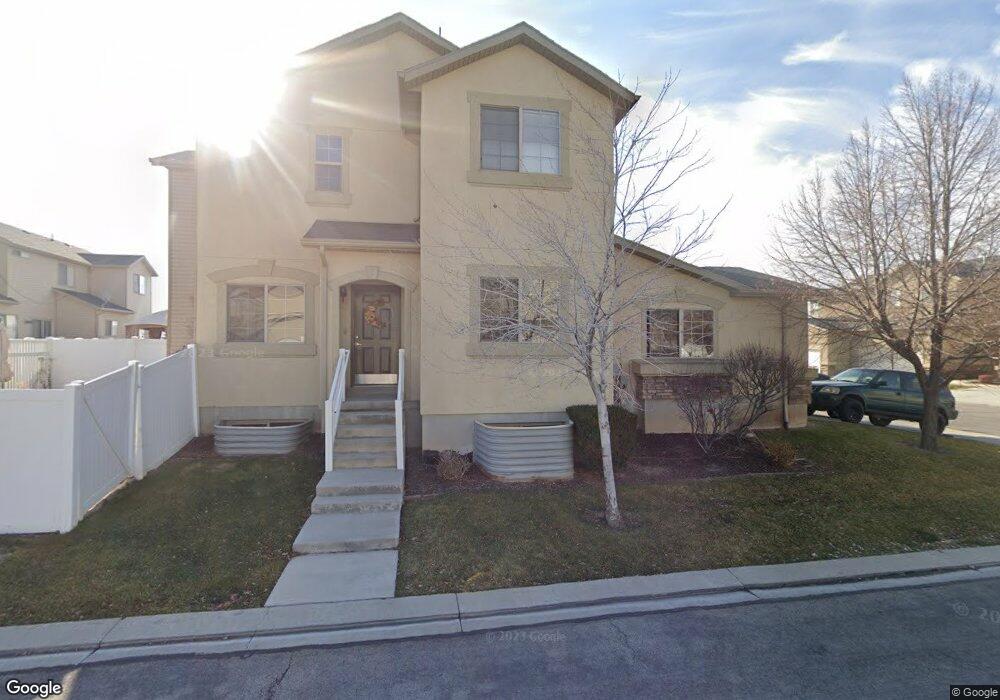
This home is located at 2172 N 2040 W, Lehi, UT 84043 and is currently estimated at $434,644, approximately $232 per square foot. 2172 N 2040 W is a home located in Utah County with nearby schools including Liberty Hills Elementary School, Skyridge High School, and Ascent Academies of Utah - Lehi Campus.
Ownership History
Date
Name
Owned For
Owner Type
Purchase Details
Closed on
May 31, 2018
Sold by
Atkin Mark and Atkin Roma
Bought by
Seasiders Llc
Current Estimated Value
Home Financials for this Owner
Home Financials are based on the most recent Mortgage that was taken out on this home.
Original Mortgage
$206,400
Outstanding Balance
$178,098
Interest Rate
4.4%
Mortgage Type
New Conventional
Estimated Equity
$256,546
Purchase Details
Closed on
Sep 1, 2017
Sold by
Miller James
Bought by
Miller James and Miller Kandi
Home Financials for this Owner
Home Financials are based on the most recent Mortgage that was taken out on this home.
Original Mortgage
$216,218
Interest Rate
4.4%
Mortgage Type
FHA
Purchase Details
Closed on
Jul 13, 2016
Sold by
Miller James D and Miller Kandi L
Bought by
Miller James
Home Financials for this Owner
Home Financials are based on the most recent Mortgage that was taken out on this home.
Original Mortgage
$193,626
Interest Rate
3.62%
Mortgage Type
FHA
Purchase Details
Closed on
Nov 4, 2014
Sold by
Clear Vision Homes Llc
Bought by
Miller James D and Miller Kandi L
Purchase Details
Closed on
May 30, 2014
Sold by
Secretary Of Hud
Bought by
Clear Vision Homes Llc
Purchase Details
Closed on
Aug 9, 2013
Sold by
Nationstar Mortgage Llc
Bought by
Secretary Of Hud
Purchase Details
Closed on
Jul 8, 2013
Sold by
Black Tammy A
Bought by
Nationstar Mortgage Llc
Purchase Details
Closed on
Jun 9, 2005
Sold by
Pointe Meadows Townhomes Llc
Bought by
Black Tammy A
Home Financials for this Owner
Home Financials are based on the most recent Mortgage that was taken out on this home.
Original Mortgage
$148,765
Interest Rate
5.72%
Mortgage Type
FHA
Create a Home Valuation Report for This Property
The Home Valuation Report is an in-depth analysis detailing your home's value as well as a comparison with similar homes in the area
Home Values in the Area
Average Home Value in this Area
Purchase History
| Date | Buyer | Sale Price | Title Company |
|---|---|---|---|
| Seasiders Llc | -- | Provo Land Title Co | |
| Atkins Mark | -- | Key Land Title | |
| Miller James | -- | Key Land Title | |
| Miller James | -- | Key Land Title | |
| Miller James D | -- | Provo Land Title Co | |
| Clear Vision Homes Llc | -- | Cornerstone Title Ins A | |
| Secretary Of Hud | -- | None Available | |
| Nationstar Mortgage Llc | $217,728 | Etitle Insurance Agency | |
| Black Tammy A | -- | Cottonwood Title |
Source: Public Records
Mortgage History
| Date | Status | Borrower | Loan Amount |
|---|---|---|---|
| Open | Atkins Mark | $206,400 | |
| Previous Owner | Miller James | $216,218 | |
| Previous Owner | Miller James | $193,626 | |
| Previous Owner | Black Tammy A | $148,765 |
Source: Public Records
Tax History Compared to Growth
Tax History
| Year | Tax Paid | Tax Assessment Tax Assessment Total Assessment is a certain percentage of the fair market value that is determined by local assessors to be the total taxable value of land and additions on the property. | Land | Improvement |
|---|---|---|---|---|
| 2025 | $1,899 | $223,410 | $59,700 | $346,500 |
| 2024 | $1,899 | $222,255 | $0 | $0 |
| 2023 | $1,649 | $209,495 | $0 | $0 |
| 2022 | $1,715 | $211,310 | $0 | $0 |
| 2021 | $1,551 | $288,900 | $43,300 | $245,600 |
| 2020 | $1,449 | $266,700 | $40,000 | $226,700 |
| 2019 | $1,302 | $249,100 | $37,400 | $211,700 |
| 2018 | $1,134 | $205,100 | $30,800 | $174,300 |
| 2017 | $1,104 | $106,205 | $0 | $0 |
| 2016 | $1,190 | $106,205 | $0 | $0 |
| 2015 | $1,149 | $97,350 | $0 | $0 |
| 2014 | $1,012 | $85,250 | $0 | $0 |
Source: Public Records
Map
Nearby Homes
- 1968 N 2040 W Unit 40
- 1969 N 2040 St W
- 2013 N 2040 W
- 1990 N 2040 W
- 1990 N 2040 W Unit 41
- 1898 W Pointe Meadow Loop
- 1912 W 2250 N
- 1970 N 2090 St W
- 1882 N 2230 St W Unit 24
- 2191 W Swift Fox Dr Unit 274
- 999 Empire St
- 424 N Artesian Way W Unit 1634
- 2184 W Cape Fox Way N Unit 220
- 1920 N 2230 St W Unit 27
- 1060 N Canvasback Dr Unit 405
- 1672 S 70 W
- 2209 W Swift Fox Way Unit 271
- 2179 W Swift Fox Way Unit 276
- 2178 W Cape Fox Way Unit 221
- 2196 N 2350 W
- 2178 N 2040 W
- 2168 N 2040 W
- 2162 N 2040 W
- 2023 W 2175 N
- 2021 W 2175 N
- 2025 W 2175 N
- 2013 N 2040 W Unit 43
- 1969 N 2040 St W Unit 45
- 1991 N 2040 St W Unit 44
- 2167 N 2040 W
- 2026 W 2180 N
- 2163 N 2040 W
- 2032 W 2180 N
- 2018 W 2180 N Unit 22D
- 2173 N 2040 W
- 2008 W 2180 N
- 2038 W 2180 N
- 2038 W 2180 N Unit 22A
- 2159 N 2040 W
- 2048 W 2180 N