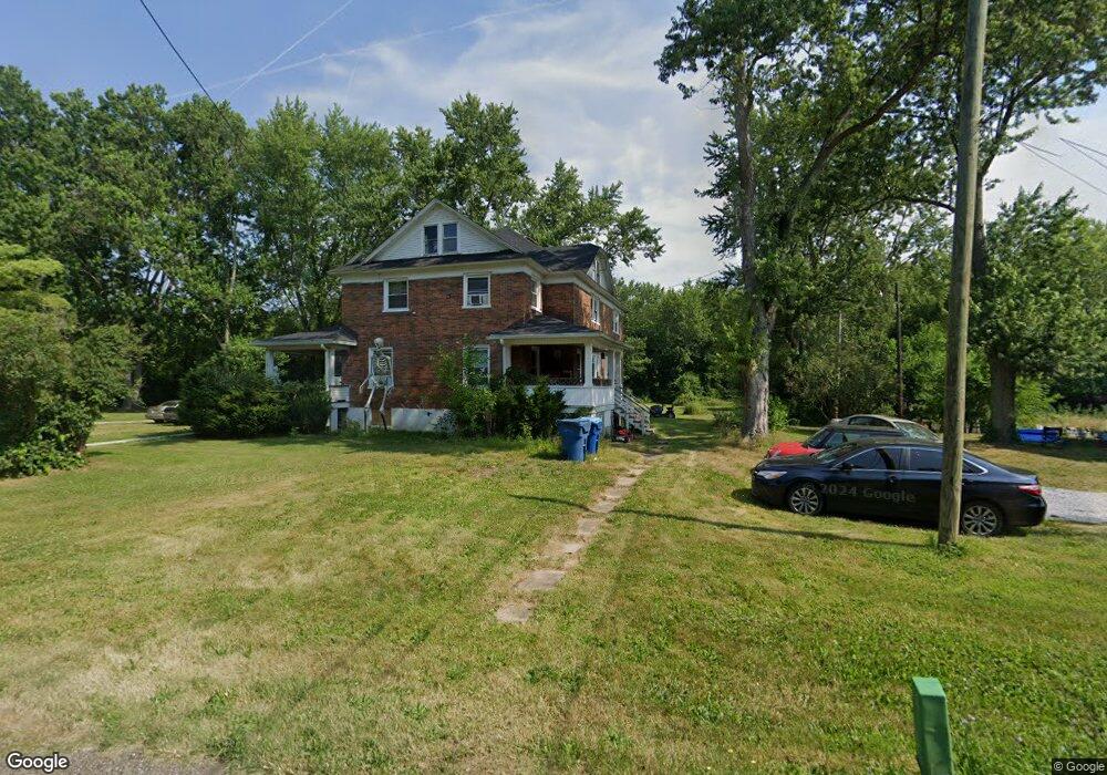
2173 Center Rd Unit 2175 New Franklin, OH 44216
Estimated Value: $340,000 - $489,776
12
Beds
4
Baths
5,684
Sq Ft
$74/Sq Ft
Est. Value
About This Home
This home is located at 2173 Center Rd Unit 2175, New Franklin, OH 44216 and is currently estimated at $419,444, approximately $73 per square foot. 2173 Center Rd Unit 2175 is a home located in Summit County with nearby schools including Northwest Primary School, W.S. Stinson Elementary School, and Northwest Middle School.
Ownership History
Date
Name
Owned For
Owner Type
Purchase Details
Closed on
Jan 30, 2008
Sold by
Koly Michael R
Bought by
Koly Michael R and Koly Nancy G
Current Estimated Value
Purchase Details
Closed on
May 23, 2001
Sold by
Akronareahomescom Ltd
Bought by
Koly Michael
Home Financials for this Owner
Home Financials are based on the most recent Mortgage that was taken out on this home.
Original Mortgage
$234,000
Outstanding Balance
$87,634
Interest Rate
7.07%
Mortgage Type
Purchase Money Mortgage
Estimated Equity
$331,810
Purchase Details
Closed on
Apr 4, 2000
Sold by
Myers Thomas G
Bought by
Akronareahomescom Ltd
Home Financials for this Owner
Home Financials are based on the most recent Mortgage that was taken out on this home.
Original Mortgage
$192,000
Interest Rate
8.31%
Mortgage Type
Purchase Money Mortgage
Purchase Details
Closed on
Feb 18, 2000
Sold by
Sage Francis E and Sage Ada M
Bought by
Myers Thomas G
Home Financials for this Owner
Home Financials are based on the most recent Mortgage that was taken out on this home.
Original Mortgage
$192,000
Interest Rate
8.31%
Mortgage Type
Purchase Money Mortgage
Create a Home Valuation Report for This Property
The Home Valuation Report is an in-depth analysis detailing your home's value as well as a comparison with similar homes in the area
Home Values in the Area
Average Home Value in this Area
Purchase History
| Date | Buyer | Sale Price | Title Company |
|---|---|---|---|
| Koly Michael R | -- | Attorney | |
| Koly Michael | $260,000 | Guardian Title | |
| Akronareahomescom Ltd | -- | Midland Commerce Group | |
| Myers Thomas G | $160,000 | Midland Commerce Group |
Source: Public Records
Mortgage History
| Date | Status | Borrower | Loan Amount |
|---|---|---|---|
| Open | Koly Michael | $234,000 | |
| Previous Owner | Akronareahomescom Ltd | $192,000 |
Source: Public Records
Tax History Compared to Growth
Tax History
| Year | Tax Paid | Tax Assessment Tax Assessment Total Assessment is a certain percentage of the fair market value that is determined by local assessors to be the total taxable value of land and additions on the property. | Land | Improvement |
|---|---|---|---|---|
| 2025 | $6,868 | $152,058 | $18,946 | $133,112 |
| 2024 | $6,418 | $119,879 | $46,536 | $73,343 |
| 2023 | $6,418 | $119,879 | $46,536 | $73,343 |
| 2022 | $5,599 | $112,637 | $14,035 | $98,602 |
| 2021 | $6,792 | $115,651 | $42,308 | $73,343 |
| 2020 | $6,811 | $112,640 | $14,040 | $98,600 |
| 2019 | $5,964 | $94,080 | $14,040 | $80,040 |
| 2018 | $5,961 | $94,080 | $14,040 | $80,040 |
| 2017 | $4,407 | $94,080 | $14,040 | $80,040 |
| 2016 | $6,277 | $78,770 | $14,040 | $64,730 |
| 2015 | $4,407 | $78,770 | $14,040 | $64,730 |
| 2014 | $4,601 | $78,770 | $14,040 | $64,730 |
| 2013 | $4,806 | $82,360 | $14,040 | $68,320 |
Source: Public Records
Map
Nearby Homes
- 7452 S Cleveland Massillon Rd
- 2536 Emmons Dr
- 6270 Pinto Dr
- 0 Grill Rd
- 2543 Shadow Ln
- 3241 Grill Rd
- 2200 W Comet Rd
- 6387 Hampsher Rd
- 8177 S Cleveland Massillon Rd Unit 16
- 8177 S Cleveland Massillon Rd Unit 42
- 6090 Manchester Rd Unit 6096
- 5239 Monroe Square E
- V/L Monroe Square
- 18592 Edwards Rd Unit 137
- 18592 Edwards Rd Unit 94
- 18592 Edwards Rd Unit 243
- 18592 Edwards Rd Unit 3
- 781 Leeman Dr
- 8941 Shoemaker Ave NW
- V/L Bishop Oval
- 2175 Center Rd
- 2175 Center Rd
- 2191 Center Rd
- 2178 Center Rd
- 2168 Center Rd
- 2188 Center Rd
- 6380 Van Buren Rd
- 6269 Van Buren Rd
- 2049 Center Rd
- 6425 Van Buren Rd
- 2025 Center Rd
- 2015 Center Rd
- 2011 Center Rd
- 2001 Center Rd
- 6508 Van Buren Rd
- 2381 Center Rd
- 6499 Van Buren Rd
- 1989 Center Rd
- 6102 Van Buren Rd
- 6577 Fairland Rd