Estimated Value: $418,502 - $444,000
3
Beds
3
Baths
2,004
Sq Ft
$215/Sq Ft
Est. Value
About This Home
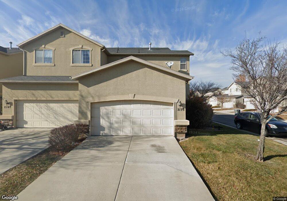
This home is located at 2173 N 2080 W Unit 14D, Lehi, UT 84043 and is currently estimated at $431,376, approximately $215 per square foot. 2173 N 2080 W Unit 14D is a home located in Utah County with nearby schools including Liberty Hills Elementary School, Skyridge High School, and Ascent Academies of Utah - Lehi Campus.
Ownership History
Date
Name
Owned For
Owner Type
Purchase Details
Closed on
Jul 15, 2021
Sold by
Delgado Roberto
Bought by
Delgado Roberto and Brevis Carmen G
Current Estimated Value
Home Financials for this Owner
Home Financials are based on the most recent Mortgage that was taken out on this home.
Original Mortgage
$387,845
Outstanding Balance
$351,909
Interest Rate
2.9%
Mortgage Type
FHA
Estimated Equity
$79,467
Purchase Details
Closed on
Sep 14, 2017
Sold by
Scott Heffron Brandon J and Heffron Korrine M
Bought by
Tonks Alan and Tonks Mary Ann
Home Financials for this Owner
Home Financials are based on the most recent Mortgage that was taken out on this home.
Original Mortgage
$237,616
Interest Rate
3.62%
Mortgage Type
FHA
Purchase Details
Closed on
Oct 21, 2015
Sold by
Hendrickson Corbin
Bought by
Scott Heffron Brandon J and Heffron Korrine M
Home Financials for this Owner
Home Financials are based on the most recent Mortgage that was taken out on this home.
Original Mortgage
$197,849
Interest Rate
3.5%
Mortgage Type
FHA
Purchase Details
Closed on
Dec 5, 2011
Sold by
Fannie Mae
Bought by
Hendrickson Corbin
Home Financials for this Owner
Home Financials are based on the most recent Mortgage that was taken out on this home.
Original Mortgage
$126,250
Interest Rate
3.75%
Mortgage Type
FHA
Purchase Details
Closed on
Jun 30, 2011
Sold by
Smith David Milton and Smith Adriana R
Bought by
Federal National Mortgage Association
Purchase Details
Closed on
Nov 3, 2006
Sold by
White Steven L and White Emily C
Bought by
Smith David Milton and Smith Adriana R
Home Financials for this Owner
Home Financials are based on the most recent Mortgage that was taken out on this home.
Original Mortgage
$19,970
Interest Rate
6.28%
Mortgage Type
Stand Alone Second
Purchase Details
Closed on
Feb 9, 2006
Sold by
Pointe Meadows Townhomes Llc
Bought by
White Steven L and White Emily C
Home Financials for this Owner
Home Financials are based on the most recent Mortgage that was taken out on this home.
Original Mortgage
$36,270
Interest Rate
6.15%
Mortgage Type
Credit Line Revolving
Create a Home Valuation Report for This Property
The Home Valuation Report is an in-depth analysis detailing your home's value as well as a comparison with similar homes in the area
Home Values in the Area
Average Home Value in this Area
Purchase History
| Date | Buyer | Sale Price | Title Company |
|---|---|---|---|
| Delgado Roberto | -- | Accommodation | |
| Delgado Roberto | -- | Vanguard Title Insurance Age | |
| Tonks Alan | -- | Title One | |
| Scott Heffron Brandon J | -- | Utah First Title Ins Ag | |
| Hendrickson Corbin | -- | Empire Land Title Inc | |
| Federal National Mortgage Association | $169,691 | Etitle Insurance Agency | |
| Smith David Milton | -- | Title West Title Company | |
| White Steven L | -- | Cottonwood Title Insurance |
Source: Public Records
Mortgage History
| Date | Status | Borrower | Loan Amount |
|---|---|---|---|
| Open | Delgado Roberto | $387,845 | |
| Previous Owner | Tonks Alan | $237,616 | |
| Previous Owner | Scott Heffron Brandon J | $197,849 | |
| Previous Owner | Hendrickson Corbin | $126,250 | |
| Previous Owner | Smith David Milton | $19,970 | |
| Previous Owner | White Steven L | $36,270 |
Source: Public Records
Tax History Compared to Growth
Tax History
| Year | Tax Paid | Tax Assessment Tax Assessment Total Assessment is a certain percentage of the fair market value that is determined by local assessors to be the total taxable value of land and additions on the property. | Land | Improvement |
|---|---|---|---|---|
| 2025 | $1,920 | $218,185 | $58,300 | $338,400 |
| 2024 | $1,920 | $224,675 | $0 | $0 |
| 2023 | $1,692 | $214,995 | $0 | $0 |
| 2022 | $1,751 | $215,655 | $0 | $0 |
| 2021 | $1,583 | $294,800 | $44,200 | $250,600 |
| 2020 | $1,508 | $277,600 | $41,600 | $236,000 |
| 2019 | $1,249 | $239,100 | $35,900 | $203,200 |
| 2018 | $1,161 | $210,000 | $31,500 | $178,500 |
| 2017 | $1,058 | $101,805 | $0 | $0 |
| 2016 | $1,141 | $101,805 | $0 | $0 |
| 2015 | $1,201 | $101,750 | $0 | $0 |
| 2014 | $1,012 | $85,250 | $0 | $0 |
Source: Public Records
Map
Nearby Homes
- 1968 N 2040 W Unit 40
- 1969 N 2040 St W
- 2013 N 2040 W
- 1990 N 2040 W
- 1990 N 2040 W Unit 41
- 1912 W 2250 N
- 1898 W Pointe Meadow Loop
- 1970 N 2090 St W
- 1882 N 2230 St W Unit 24
- 2191 W Swift Fox Dr Unit 274
- 999 Empire St
- 2184 W Cape Fox Way N Unit 220
- 1920 N 2230 St W Unit 27
- 1060 N Canvasback Dr Unit 405
- 500 S Center St E
- 1672 S 70 W
- 2209 W Swift Fox Way Unit 271
- 2179 W Swift Fox Way Unit 276
- 2178 W Cape Fox Way Unit 221
- 2196 N 2350 W
- 2167 N 2080 W
- 2163 N 2080 W
- 2101 W 2180 N
- 2159 N 2080 W
- 2107 W 2180 N
- 2088 W 2180 N
- 2088 W 2180 N Unit 20A
- 2094 W 2180 N
- 2111 W 2180 N
- 2084 W 2180 N
- 2084 W 2180 N Unit 20B
- 2178 N 2080 W
- 2098 W 2180 N
- 2172 N 2080 W
- 2076 W 2180 N Unit 20C
- 2117 W 2180 N
- 2168 N 2080 W
- 2068 W 2180 N
- 2068 W 2180 N Unit 20D
- 2104 W 2180 N