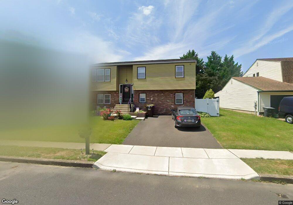
2173 Philip Dr Bensalem, PA 19020
Estimated Value: $391,788 - $452,000
5
Beds
2
Baths
1,077
Sq Ft
$398/Sq Ft
Est. Value
About This Home
This home is located at 2173 Philip Dr, Bensalem, PA 19020 and is currently estimated at $428,197, approximately $397 per square foot. 2173 Philip Dr is a home located in Bucks County with nearby schools including Benjamin Rush El School, St. Ephrem School, and Bensalem Baptist School.
Ownership History
Date
Name
Owned For
Owner Type
Purchase Details
Closed on
Oct 16, 1998
Sold by
Hadfield Donald J and Hadfield Laura
Bought by
Freeling Edward and Freeling Laura M
Current Estimated Value
Purchase Details
Closed on
May 22, 1998
Sold by
Freeling Edward and Freeling Laura M
Bought by
Hadfield Donald J and Hadfield Laura
Home Financials for this Owner
Home Financials are based on the most recent Mortgage that was taken out on this home.
Original Mortgage
$81,700
Interest Rate
6.75%
Create a Home Valuation Report for This Property
The Home Valuation Report is an in-depth analysis detailing your home's value as well as a comparison with similar homes in the area
Home Values in the Area
Average Home Value in this Area
Purchase History
| Date | Buyer | Sale Price | Title Company |
|---|---|---|---|
| Freeling Edward | -- | -- | |
| Hadfield Donald J | -- | Germantown Title Company |
Source: Public Records
Mortgage History
| Date | Status | Borrower | Loan Amount |
|---|---|---|---|
| Previous Owner | Hadfield Donald J | $81,700 |
Source: Public Records
Tax History Compared to Growth
Tax History
| Year | Tax Paid | Tax Assessment Tax Assessment Total Assessment is a certain percentage of the fair market value that is determined by local assessors to be the total taxable value of land and additions on the property. | Land | Improvement |
|---|---|---|---|---|
| 2025 | $5,230 | $23,960 | $4,640 | $19,320 |
| 2024 | $5,230 | $23,960 | $4,640 | $19,320 |
| 2023 | $1,101 | $23,960 | $4,640 | $19,320 |
| 2022 | $5,053 | $23,960 | $4,640 | $19,320 |
| 2021 | $5,053 | $23,960 | $4,640 | $19,320 |
| 2020 | $5,002 | $23,960 | $4,640 | $19,320 |
| 2019 | $4,891 | $23,960 | $4,640 | $19,320 |
| 2018 | $4,777 | $23,960 | $4,640 | $19,320 |
| 2017 | $4,747 | $23,960 | $4,640 | $19,320 |
| 2016 | $4,747 | $23,960 | $4,640 | $19,320 |
| 2015 | -- | $23,960 | $4,640 | $19,320 |
| 2014 | -- | $23,960 | $4,640 | $19,320 |
Source: Public Records
Map
Nearby Homes
- Lot 7 Galloway Rd
- Lot 6 Galloway Rd
- LOT 1 Edward Ct
- Lot 4 Edward Ct
- 3755 Mechanicsville Rd
- Lot 3 Edward Ct
- Lot 2 Edward Ct
- 3752 Mechanicsville Rd
- Lot 5 Edward Ct
- 4122 Mechanicsville Rd
- 5057 Sayer Ct
- 1839 Byberry Rd
- 1881 Byberry Rd
- 5111 Euston Ct
- 120 Liberty Dr Unit 120
- 66 Freedom Ln Unit 66
- 1440 Atterbury Way
- 1852 Gibson Rd Unit 58
- 1790 Gibson Rd Unit 69
- 1446 Gibson Rd Unit D50
- 2181 Philip Dr
- 2165 Philip Dr
- 2150 Lillian Dr
- 2158 Lillian Dr
- 2189 Philip Dr
- 2172 Philip Dr
- 2142 Lillian Dr
- 2164 Philip Dr
- 2180 Philip Dr
- 2166 Lillian Dr
- 2255 Andrea Dr
- 2156 Philip Dr
- 2149 Philip Dr
- 2134 Lillian Dr
- 2188 Philip Dr
- 2148 Philip Dr
- 2174 Lillian Dr
- 2163 Joshua Dr
- 4234 Telly Ln
- 2141 Philip Dr