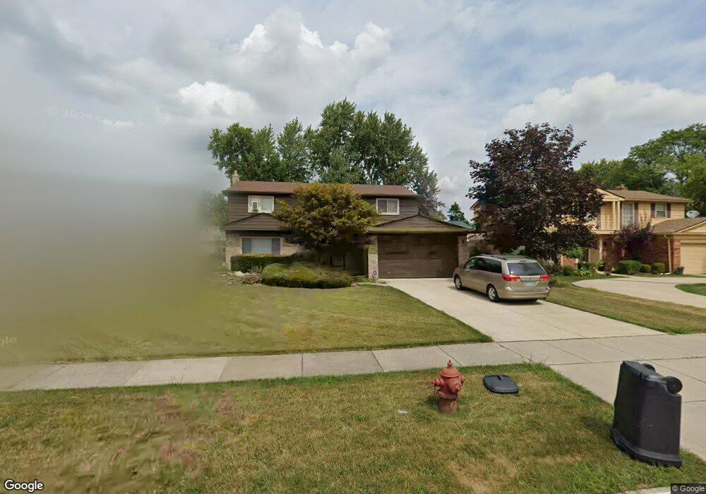
21730 Independence Dr Unit Bldg-Unit Southfield, MI 48076
Estimated Value: $342,292 - $387,000
--
Bed
3
Baths
2,410
Sq Ft
$150/Sq Ft
Est. Value
About This Home
This home is located at 21730 Independence Dr Unit Bldg-Unit, Southfield, MI 48076 and is currently estimated at $360,573, approximately $149 per square foot. 21730 Independence Dr Unit Bldg-Unit is a home located in Oakland County with nearby schools including Alice M. Birney K-8 School, Faxon Academy, and Southfield Christian School.
Ownership History
Date
Name
Owned For
Owner Type
Purchase Details
Closed on
Jun 29, 2018
Sold by
Foster Mark
Bought by
Stephens Twanique
Current Estimated Value
Home Financials for this Owner
Home Financials are based on the most recent Mortgage that was taken out on this home.
Original Mortgage
$204,250
Interest Rate
4.6%
Mortgage Type
New Conventional
Purchase Details
Closed on
Jun 14, 2017
Sold by
Erickson Karen and Forster Dave
Bought by
Foster Dave and Dave And Losi Forster Living Trust
Purchase Details
Closed on
Feb 15, 2017
Sold by
Foster Dave
Bought by
Foster Dave and Erickson Karen
Purchase Details
Closed on
Jun 1, 2007
Sold by
Foster Dave and Foster Lois
Bought by
Foster Dave and Foster Lois
Create a Home Valuation Report for This Property
The Home Valuation Report is an in-depth analysis detailing your home's value as well as a comparison with similar homes in the area
Home Values in the Area
Average Home Value in this Area
Purchase History
| Date | Buyer | Sale Price | Title Company |
|---|---|---|---|
| Stephens Twanique | $215,000 | First American Title Insuran | |
| Foster Dave | -- | None Available | |
| Foster Dave | -- | None Available | |
| Foster Dave | -- | None Available |
Source: Public Records
Mortgage History
| Date | Status | Borrower | Loan Amount |
|---|---|---|---|
| Open | Stephens Twanique L | $207,100 | |
| Previous Owner | Stephens Twanique | $204,250 | |
| Previous Owner | Foster Dave | $100,000 | |
| Previous Owner | Foster Dave | $51,000 | |
| Previous Owner | Foster Dave | $65,000 |
Source: Public Records
Tax History Compared to Growth
Tax History
| Year | Tax Paid | Tax Assessment Tax Assessment Total Assessment is a certain percentage of the fair market value that is determined by local assessors to be the total taxable value of land and additions on the property. | Land | Improvement |
|---|---|---|---|---|
| 2022 | $6,609 | $133,580 | $25,960 | $107,620 |
| 2021 | $6,905 | $122,550 | $21,130 | $101,420 |
| 2020 | $5,993 | $115,370 | $18,060 | $97,310 |
| 2018 | $4,123 | $94,240 | $18,060 | $76,180 |
| 2015 | -- | $72,090 | $0 | $0 |
| 2014 | -- | $60,820 | $0 | $0 |
| 2011 | -- | $61,000 | $0 | $0 |
Source: Public Records
Map
Nearby Homes
- 28330 Lahser Rd
- 21440 Constitution St
- 21330 Winchester St
- 21140 Winchester St
- 21901 Concord St
- 21731 Concord St
- 22300 Ivanhoe Ln
- 21361 Andover Rd
- 27249 Nantucket Dr
- 20780 Wayland St
- 000 Pontiac Trail
- 28355 Tavistock Trail
- 22465 Kenwyck Dr
- 29140 Briarbank Ct
- 27925 Arlington Dr
- 22679 Bell Brook St
- 28740 Tavistock Trail
- 20351 Lacrosse Ave
- 28450 Tapert Dr
- 28401 River Crest Dr
- 21730 Independence Dr
- 21700 Independence Dr
- 21760 Independence Dr
- 21670 Independence Dr
- 21729 Glenmorra St
- 21790 Independence Dr
- 21759 Glenmorra St
- 21699 Glenmorra St
- 21669 Glenmorra St
- 21729 Independence Dr
- 21699 Independence Dr
- 21759 Independence Dr
- 21820 Independence Dr
- 21789 Glenmorra St
- 21669 Independence Dr
- 21789 Independence Dr
- 21819 Glenmorra St
- 21850 Independence Dr
- 21819 Independence Dr
- 28150 Valley Forge St