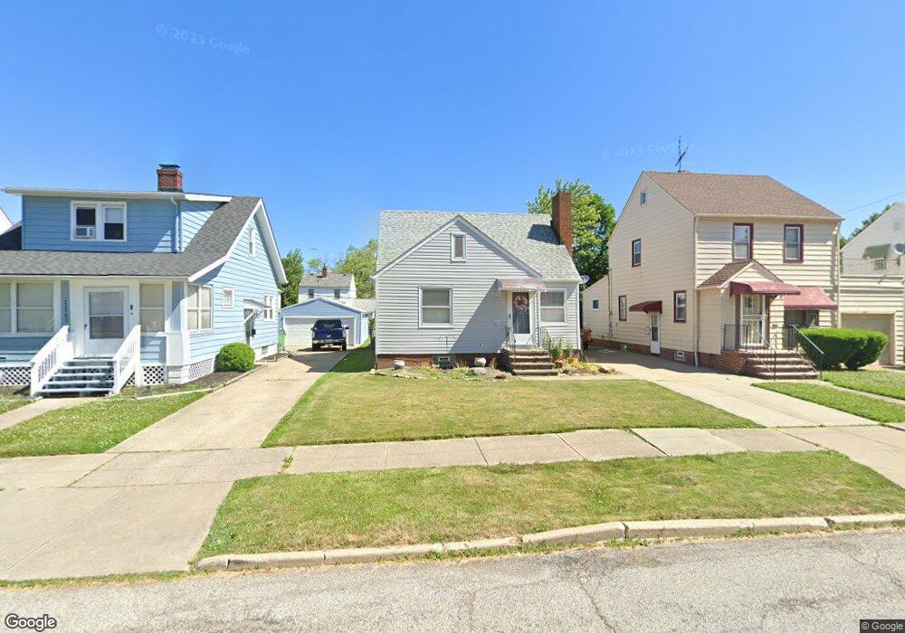
21731 Westport Ave Euclid, OH 44123
Estimated Value: $111,000 - $125,000
3
Beds
1
Bath
879
Sq Ft
$134/Sq Ft
Est. Value
About This Home
This home is located at 21731 Westport Ave, Euclid, OH 44123 and is currently estimated at $118,188, approximately $134 per square foot. 21731 Westport Ave is a home located in Cuyahoga County with nearby schools including Arbor Elementary School, Euclid Middle School, and Euclid High School.
Ownership History
Date
Name
Owned For
Owner Type
Purchase Details
Closed on
Feb 27, 2020
Sold by
Hinojosa Guadalupe
Bought by
Hinojosa Guadalupe and Hinojosa Theresa
Current Estimated Value
Purchase Details
Closed on
Aug 16, 1996
Sold by
Maxwell Randall C
Bought by
Hinojosa Guadalupe
Home Financials for this Owner
Home Financials are based on the most recent Mortgage that was taken out on this home.
Original Mortgage
$62,969
Outstanding Balance
$2,754
Interest Rate
8.18%
Mortgage Type
New Conventional
Estimated Equity
$115,434
Purchase Details
Closed on
Dec 11, 1987
Sold by
Major Kathleen E
Bought by
Maxwell Randall C
Purchase Details
Closed on
Sep 13, 1985
Sold by
Serra Ruth A
Bought by
Major Kathleen E
Purchase Details
Closed on
Jan 1, 1975
Bought by
Serra Ruth A
Create a Home Valuation Report for This Property
The Home Valuation Report is an in-depth analysis detailing your home's value as well as a comparison with similar homes in the area
Home Values in the Area
Average Home Value in this Area
Purchase History
| Date | Buyer | Sale Price | Title Company |
|---|---|---|---|
| Hinojosa Guadalupe | -- | Accommodation | |
| Hinojosa Guadalupe | $74,000 | -- | |
| Maxwell Randall C | $50,000 | -- | |
| Major Kathleen E | $35,000 | -- | |
| Serra Ruth A | -- | -- |
Source: Public Records
Mortgage History
| Date | Status | Borrower | Loan Amount |
|---|---|---|---|
| Open | Hinojosa Guadalupe | $62,969 |
Source: Public Records
Tax History
| Year | Tax Paid | Tax Assessment Tax Assessment Total Assessment is a certain percentage of the fair market value that is determined by local assessors to be the total taxable value of land and additions on the property. | Land | Improvement |
|---|---|---|---|---|
| 2025 | $1,831 | $36,505 | $7,420 | $29,085 |
| 2024 | $2,539 | $36,505 | $7,420 | $29,085 |
| 2023 | $2,101 | $23,840 | $5,810 | $18,030 |
| 2022 | $2,054 | $23,840 | $5,810 | $18,030 |
| 2021 | $2,279 | $23,840 | $5,810 | $18,030 |
| 2020 | $1,921 | $18,060 | $4,410 | $13,650 |
| 2019 | $1,723 | $51,600 | $12,600 | $39,000 |
| 2018 | $1,695 | $18,060 | $4,410 | $13,650 |
| 2017 | $1,788 | $15,510 | $2,940 | $12,570 |
| 2016 | $1,792 | $15,510 | $2,940 | $12,570 |
| 2015 | $1,635 | $15,510 | $2,940 | $12,570 |
| 2014 | $1,635 | $15,510 | $2,940 | $12,570 |
Source: Public Records
Map
Nearby Homes
- 21481 Ball Ave
- 21250 Wilmore Ave
- 21250 Ball Ave
- 21170 Wilmore Ave
- 21670 Crystal Ave
- 21181 Ball Ave
- 21051 Westport Ave
- 21000 Crystal Ave
- 20900 Priday Ave
- 20931 Priday Ave
- 20890 Morris Ave
- 20801 Morris Ave
- 21100 Nicholas Ave
- 20751 Wilmore Ave
- 21051 S Lake Shore Blvd
- 20830 Tracy Ave
- 20591 Ball Ave
- 20700 Crystal Ave
- 21130 Arbor Ave
- 442 Clearview Dr Unit U9
- 21751 Westport Ave
- 21701 Westport Ave
- 21771 Westport Ave
- 21671 Westport Ave
- 21730 Ball Ave
- 21750 Ball Ave
- 21700 Ball Ave
- 21801 Westport Ave
- 21651 Westport Ave
- 21770 Ball Ave
- 21670 Ball Ave
- 21841 Westport Ave
- 21851 Westport Ave
- 21601 Westport Ave
- 21800 Ball Ave
- 21650 Ball Ave
- 21730 Westport Ave
- 21670 Westport Ave
- 21770 Westport Ave
- 21600 Ball Ave
Your Personal Tour Guide
Ask me questions while you tour the home.