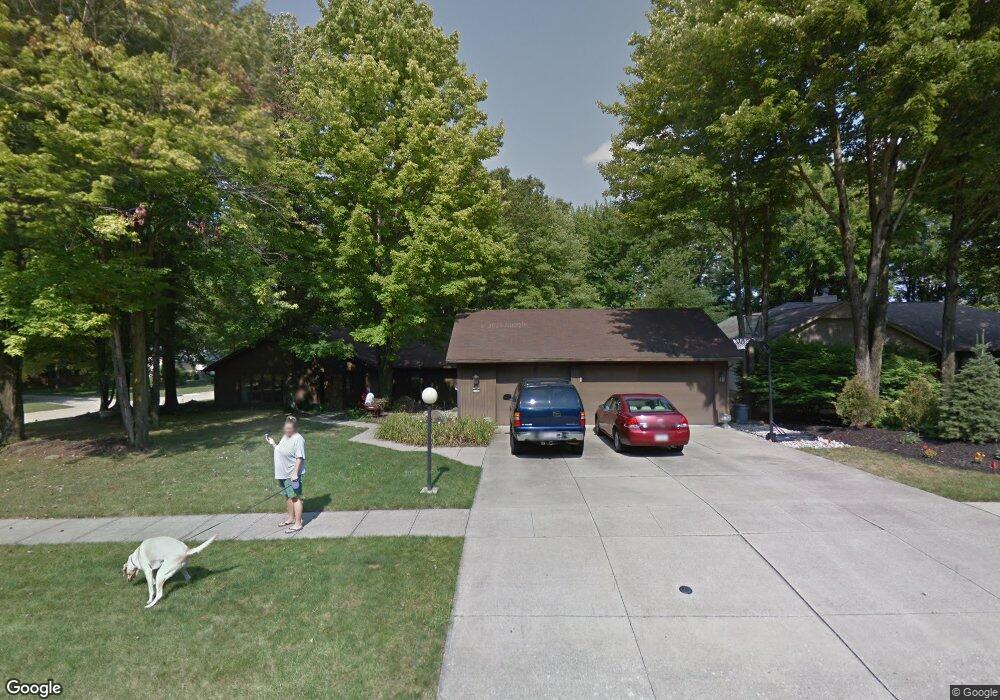
21732 Meadows Edge Ln Strongsville, OH 44149
Estimated Value: $419,836 - $492,000
5
Beds
4
Baths
1,088
Sq Ft
$411/Sq Ft
Est. Value
About This Home
This home is located at 21732 Meadows Edge Ln, Strongsville, OH 44149 and is currently estimated at $446,709, approximately $410 per square foot. 21732 Meadows Edge Ln is a home located in Cuyahoga County with nearby schools including Strongsville High School and Sts Joseph & John Interparochial School.
Ownership History
Date
Name
Owned For
Owner Type
Purchase Details
Closed on
Oct 23, 2006
Sold by
Anderson Sandra L
Bought by
Boyle Timothy and Boyle Rhonda
Current Estimated Value
Home Financials for this Owner
Home Financials are based on the most recent Mortgage that was taken out on this home.
Original Mortgage
$50,000
Interest Rate
6.11%
Mortgage Type
Stand Alone Second
Purchase Details
Closed on
Sep 12, 2000
Sold by
Anderson Edward L and Anderson M G
Bought by
Anderson Edward L and Anderson Mary G
Purchase Details
Closed on
Jan 1, 1987
Bought by
Anderson Edward L and M G
Create a Home Valuation Report for This Property
The Home Valuation Report is an in-depth analysis detailing your home's value as well as a comparison with similar homes in the area
Home Values in the Area
Average Home Value in this Area
Purchase History
| Date | Buyer | Sale Price | Title Company |
|---|---|---|---|
| Boyle Timothy | $250,000 | First American Title Ins Co | |
| Anderson Edward L | -- | -- | |
| Anderson Edward L | -- | -- |
Source: Public Records
Mortgage History
| Date | Status | Borrower | Loan Amount |
|---|---|---|---|
| Closed | Boyle Timothy | $50,000 | |
| Open | Boyle Timothy | $200,000 |
Source: Public Records
Tax History Compared to Growth
Tax History
| Year | Tax Paid | Tax Assessment Tax Assessment Total Assessment is a certain percentage of the fair market value that is determined by local assessors to be the total taxable value of land and additions on the property. | Land | Improvement |
|---|---|---|---|---|
| 2024 | $6,327 | $134,750 | $23,625 | $111,125 |
| 2023 | $6,176 | $98,640 | $26,080 | $72,560 |
| 2022 | $6,131 | $98,630 | $26,080 | $72,560 |
| 2021 | $6,083 | $98,630 | $26,080 | $72,560 |
| 2020 | $5,637 | $80,850 | $21,390 | $59,470 |
| 2019 | $5,471 | $231,000 | $61,100 | $169,900 |
| 2018 | $4,966 | $80,850 | $21,390 | $59,470 |
| 2017 | $5,570 | $83,970 | $16,940 | $67,030 |
| 2016 | $5,525 | $83,970 | $16,940 | $67,030 |
| 2015 | $5,440 | $83,970 | $16,940 | $67,030 |
| 2014 | $5,440 | $81,520 | $16,450 | $65,070 |
Source: Public Records
Map
Nearby Homes
- 21359 Briar Bush Ln
- 11030 Southwind Ct
- 21469 Woodview Cir
- 10842 Fence Row Dr
- 10353 Oak Branch Trail
- 21176 Hickory Branch Trail
- 0 Priem Rd
- 10839 Prospect Rd
- 10824 Watercress Rd
- 12515 Countryside Dr
- 12579 Woodberry Ln
- 22300 Rock Creek Cir
- 21292 Creekside Dr
- 20684 Albion Rd
- 9829 Plum Brook Ln
- 10800 Meadow Trail
- 22235 North Trail
- 10001 N Marks Rd
- 9598 Pebble Brook Ln
- 22125 Olde Creek Trail
- 21700 Meadows Edge Ln
- 21727 Briar Bush Ln
- 21668 Meadows Edge Ln
- 21675 Briar Bush Ln
- 21707 Meadows Edge Ln
- 21735 Meadows Edge Ln
- 21800 Briar Bush Ln
- 21860 Meadows Edge Ln
- 21763 Meadows Edge Ln
- 21616 Meadows Edge Ln
- 21744 Briar Bush Ln
- 21623 Briar Bush Ln
- 21651 Meadows Edge Ln
- 21791 Meadows Edge Ln
- 21688 Briar Bush Ln
- 21564 Meadows Edge Ln
- 21623 Meadows Edge Ln
- 21819 Meadows Edge Ln Unit L
- 21571 Briar Bush Ln
- 21996 Meadows Edge Ln