Estimated Value: $60,844
--
Bed
--
Bath
2,400
Sq Ft
$25/Sq Ft
Est. Value
About This Home
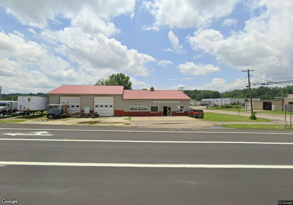
This home is located at 2174 State Route 516 NW, Dover, OH 44622 and is currently priced at $60,844, approximately $25 per square foot. 2174 State Route 516 NW is a home located in Tuscarawas County with nearby schools including Dover High School, Tuscarawas Central Catholic Elementary School, and Tuscarawas Central Catholic Junior/Senior High School.
Ownership History
Date
Name
Owned For
Owner Type
Purchase Details
Closed on
Jan 8, 2009
Sold by
Grove Donald S and Grove Ann P
Bought by
Grove Adam
Current Estimated Value
Home Financials for this Owner
Home Financials are based on the most recent Mortgage that was taken out on this home.
Original Mortgage
$71,450
Outstanding Balance
$49,901
Interest Rate
7.25%
Mortgage Type
Future Advance Clause Open End Mortgage
Purchase Details
Closed on
Aug 27, 2008
Sold by
Grove Donald S and Grove Ann P
Bought by
Troyer Corp
Purchase Details
Closed on
Apr 9, 2002
Sold by
Bonifant Rodney C
Bought by
Grove Donald S and Grove Ann P
Purchase Details
Closed on
Feb 16, 1994
Sold by
Bonifant Rodney C and Bonifant Denise A
Bought by
Grove Adam
Purchase Details
Closed on
Jun 27, 1989
Sold by
Baker Orval
Bought by
Baker Orval and Bonifant Denise A
Create a Home Valuation Report for This Property
The Home Valuation Report is an in-depth analysis detailing your home's value as well as a comparison with similar homes in the area
Home Values in the Area
Average Home Value in this Area
Purchase History
| Date | Buyer | Sale Price | Title Company |
|---|---|---|---|
| Grove Adam | $70,000 | Alpha Land Title | |
| Troyer Corp | $35,000 | Attorney | |
| Grove Donald S | $100,000 | -- | |
| Grove Adam | -- | -- | |
| Baker Orval | -- | -- |
Source: Public Records
Mortgage History
| Date | Status | Borrower | Loan Amount |
|---|---|---|---|
| Open | Grove Adam | $71,450 |
Source: Public Records
Tax History Compared to Growth
Tax History
| Year | Tax Paid | Tax Assessment Tax Assessment Total Assessment is a certain percentage of the fair market value that is determined by local assessors to be the total taxable value of land and additions on the property. | Land | Improvement |
|---|---|---|---|---|
| 2024 | $3,568 | $68,440 | $5,000 | $63,440 |
| 2023 | $3,568 | $104,670 | $14,290 | $90,380 |
| 2022 | $1,948 | $36,635 | $5,002 | $31,633 |
| 2021 | $1,867 | $31,630 | $4,221 | $27,409 |
| 2020 | $1,964 | $31,630 | $4,221 | $27,409 |
| 2019 | $1,882 | $31,630 | $4,221 | $27,409 |
| 2018 | $1,927 | $31,630 | $4,220 | $27,410 |
| 2017 | $1,932 | $31,630 | $4,220 | $27,410 |
| 2016 | $1,934 | $31,630 | $4,220 | $27,410 |
| 2014 | $1,190 | $19,370 | $3,910 | $15,460 |
| 2013 | $1,196 | $19,370 | $3,910 | $15,460 |
Source: Public Records
Map
Nearby Homes
- 500 W 13th St
- 1411 Chestnut St
- 1319 N Walnut St
- 2180 Kimberley Dr NW
- 159 Charles Dr
- 3030 N Wooster Ave
- 306 E 15th St
- 227 E Slingluff Ave
- 0000 Red Hill Rd NW
- 0 Bair Rd NW Unit 5124469
- 0 Bair Rd NW Unit 5124477
- 0 Bair Rd NW Unit 5124464
- 0 Bair Rd NW Unit 5124485
- 0 Bair Rd NW Unit 5124339
- 0 Bair Rd NW Unit 5124397
- 0 Bair Rd NW Unit 5124402
- 0 Bair Rd NW Unit 5124415
- 0 Bair Rd NW Unit 5124421
- 450 E 5th St
- 442 E 4th St
- 3183 Reese Rd NW
- 0 Ohio 516 Unit 4473365
- 3 Ohio 516
- 4 Ohio 516
- 1 Ohio 516
- 5 Ohio 516
- 2 Ohio 516
- 0 Ohio 516
- 2243 State Route 516 NW
- 9999 State Route 516 NW
- 2208 Ohio 516
- 2024 State Route 39 NW
- 2120 Ohio 39
- 2150 Ohio 39
- 2161 State Route 39 NW
- 3470 Davis Rd NW
- 2170 State Route 39 NW
- 2158 Donald St
- 2226 Donald St
- 2198 Donald St