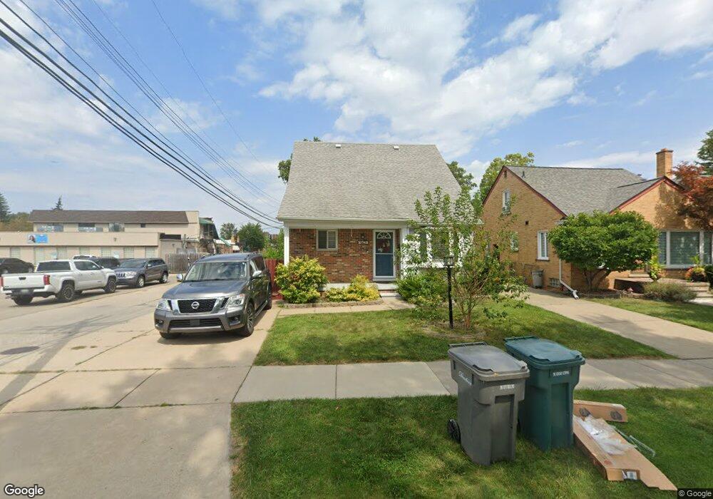
21742 Olmstead St Unit Bldg-Unit Dearborn, MI 48124
Ford Homes Historic District NeighborhoodEstimated Value: $364,700 - $427,000
4
Beds
2
Baths
1,542
Sq Ft
$252/Sq Ft
Est. Value
About This Home
This home is located at 21742 Olmstead St Unit Bldg-Unit, Dearborn, MI 48124 and is currently estimated at $388,175, approximately $251 per square foot. 21742 Olmstead St Unit Bldg-Unit is a home located in Wayne County with nearby schools including Duvall Elementary School, Smith Middle School, and Edsel Ford High School.
Ownership History
Date
Name
Owned For
Owner Type
Purchase Details
Closed on
Jun 13, 2022
Sold by
Diebolt Sue A and Diebolt Patrick G
Bought by
Mohsen Haleema and Saeed Rafat
Current Estimated Value
Purchase Details
Closed on
Jul 20, 2018
Sold by
F & L Management Inc
Bought by
Diebolt Patrick G and Diebolt Sue A
Purchase Details
Closed on
Oct 19, 2001
Sold by
Umlauf Joseph G
Bought by
F & L Management Inc
Purchase Details
Closed on
Mar 23, 2001
Sold by
Burton Shelly E
Bought by
Umlauf Joseph G
Purchase Details
Closed on
Apr 30, 1996
Sold by
Bu William G and Bu Shelley
Bought by
Lanzi James A and Lanzi Marie
Create a Home Valuation Report for This Property
The Home Valuation Report is an in-depth analysis detailing your home's value as well as a comparison with similar homes in the area
Home Values in the Area
Average Home Value in this Area
Purchase History
| Date | Buyer | Sale Price | Title Company |
|---|---|---|---|
| Mohsen Haleema | $300,000 | Title One | |
| Diebolt Patrick G | $215,000 | Devon Title Co | |
| F & L Management Inc | -- | -- | |
| Umlauf Joseph G | $200,000 | -- | |
| Lanzi James A | $122,000 | -- |
Source: Public Records
Mortgage History
| Date | Status | Borrower | Loan Amount |
|---|---|---|---|
| Closed | Umlauf Joseph G | -- |
Source: Public Records
Tax History Compared to Growth
Tax History
| Year | Tax Paid | Tax Assessment Tax Assessment Total Assessment is a certain percentage of the fair market value that is determined by local assessors to be the total taxable value of land and additions on the property. | Land | Improvement |
|---|---|---|---|---|
| 2025 | $6,745 | $133,400 | $0 | $0 |
| 2024 | $6,745 | $206,000 | $0 | $0 |
| 2023 | $6,555 | $146,700 | $0 | $0 |
| 2022 | $5,388 | $122,400 | $0 | $0 |
| 2021 | $6,261 | $112,900 | $0 | $0 |
| 2019 | $6,198 | $98,200 | $0 | $0 |
| 2018 | $4,435 | $97,700 | $0 | $0 |
| 2017 | $1,044 | $93,400 | $0 | $0 |
| 2016 | $4,197 | $91,800 | $0 | $0 |
| 2015 | $6,436 | $75,250 | $0 | $0 |
| 2013 | $6,235 | $62,350 | $0 | $0 |
| 2011 | -- | $68,500 | $0 | $0 |
Source: Public Records
Map
Nearby Homes
- 21725 Nowlin St
- 22151 Olmstead St
- 21353 Donaldson St
- 22200 Gregory St
- 22306 Nowlin St
- 22101 Francis St
- 21230 Audette St
- 21514 Francis St
- 20761 Outer Dr
- 22406 Nowlin St
- 22223 Military St
- 2721 Pardee Ave
- 22205 Columbia St
- 22350 Military St
- 3101 Roosevelt St
- 22740 Cleveland St
- 3245 Gertrude St
- 21514 Homer St
- 3260 Gertrude St
- 3321 Williams St
- 21742 Olmstead St
- 21734 Olmstead St
- 21726 Olmstead St
- 21720 Olmstead St
- 21719 Gregory St
- 21741 Gregory St
- 2323 Monroe St
- 21735 Gregory St
- 21710 Olmstead St
- 21711 Gregory St
- 21727 Gregory St
- 21741 Olmstead St
- 21735 Olmstead St
- 21700 Olmstead St Unit Bldg-Unit
- 21700 Olmstead St
- 21725 Olmstead St
- 21719 Olmstead St
- 21564 Olmstead St
- 2330 Monroe St
- 21703 Gregory St