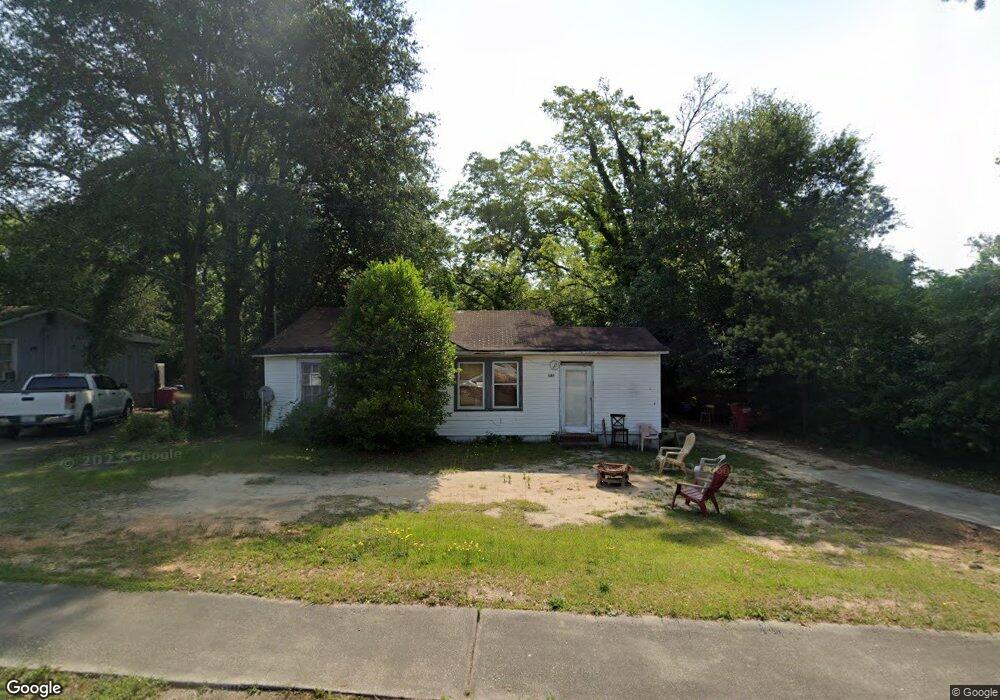
2175 New Clinton Rd Macon, GA 31217
Estimated Value: $79,000 - $139,000
4
Beds
1
Bath
1,576
Sq Ft
$66/Sq Ft
Est. Value
About This Home
This home is located at 2175 New Clinton Rd, Macon, GA 31217 and is currently estimated at $104,318, approximately $66 per square foot. 2175 New Clinton Rd is a home located in Bibb County with nearby schools including Martin Luther King Jr. Elementary School, Appling Middle School, and Northeast High School.
Ownership History
Date
Name
Owned For
Owner Type
Purchase Details
Closed on
Sep 29, 2014
Sold by
Gulf Coast Pcb Llc
Bought by
Adside Wallace
Current Estimated Value
Purchase Details
Closed on
Aug 15, 2014
Sold by
Humphrey Darrell
Bought by
Gulf Coast Pcb Llc
Purchase Details
Closed on
Aug 12, 2005
Sold by
Hicks Anthony P and Hicks Susan S
Bought by
Humphrey Darrell
Purchase Details
Closed on
Jun 8, 2005
Home Financials for this Owner
Home Financials are based on the most recent Mortgage that was taken out on this home.
Original Mortgage
$28,000
Interest Rate
5.69%
Mortgage Type
Future Advance Clause Open End Mortgage
Purchase Details
Closed on
Oct 5, 2004
Purchase Details
Closed on
Jan 3, 2003
Purchase Details
Closed on
Nov 19, 2001
Create a Home Valuation Report for This Property
The Home Valuation Report is an in-depth analysis detailing your home's value as well as a comparison with similar homes in the area
Home Values in the Area
Average Home Value in this Area
Purchase History
| Date | Buyer | Sale Price | Title Company |
|---|---|---|---|
| Adside Wallace | $2,500 | None Available | |
| Gulf Coast Pcb Llc | $33,083 | None Available | |
| Humphrey Darrell | $44,500 | None Available | |
| -- | -- | -- | |
| Hicks Anthony | $28,000 | None Avilebel | |
| -- | $48,000 | -- | |
| -- | $68,000 | -- | |
| -- | $60,000 | -- |
Source: Public Records
Mortgage History
| Date | Status | Borrower | Loan Amount |
|---|---|---|---|
| Previous Owner | Hicks Anthony | $28,000 |
Source: Public Records
Tax History Compared to Growth
Tax History
| Year | Tax Paid | Tax Assessment Tax Assessment Total Assessment is a certain percentage of the fair market value that is determined by local assessors to be the total taxable value of land and additions on the property. | Land | Improvement |
|---|---|---|---|---|
| 2025 | $877 | $35,687 | $2,640 | $33,047 |
| 2024 | $906 | $35,687 | $2,640 | $33,047 |
| 2023 | $840 | $33,088 | $2,640 | $30,448 |
| 2022 | $746 | $21,560 | $1,990 | $19,570 |
| 2021 | $573 | $15,068 | $1,326 | $13,742 |
| 2020 | $515 | $13,267 | $1,106 | $12,161 |
| 2019 | $519 | $13,267 | $1,106 | $12,161 |
| 2018 | $975 | $13,267 | $1,106 | $12,161 |
| 2017 | $497 | $13,267 | $1,106 | $12,161 |
| 2016 | $493 | $14,243 | $1,106 | $13,138 |
| 2015 | $49 | $14,612 | $1,474 | $13,138 |
| 2014 | $303 | $16,163 | $1,879 | $14,284 |
Source: Public Records
Map
Nearby Homes
- 2229 New Clinton Rd
- 2130 New Clinton Rd
- 2146 Melton Ave
- 2066 Melton Ave
- 1840 Kinder Kare Dr
- 1818 Kinder Kare Dr
- 875 Artic Cir
- 837 Artic Cir
- 875 Artic Place
- 4436 Jeffersonville Rd
- 2370 Recreation Rd
- 909 Johnson St
- 2675 Andy Dr
- 860 Morningside Dr
- 2371 Kensington Rd
- 2458 Tredway Dr
- 1008 Sunnydale Dr
- 2720 Jordan Ave
- 2630 Pauladale Dr
- 1030 Forsyth Ave
- 2165 New Clinton Rd
- 2179 New Clinton Rd
- 2179 New Clinton Rd Unit 1
- 2155 New Clinton Rd
- 2206 Millerfield Rd
- 2185 New Clinton Rd
- 2176 Millerfield Rd
- 2180 New Clinton Rd
- 2170 New Clinton Rd
- 2189 New Clinton Rd
- 2145 New Clinton Rd
- 2160 Millerfield Rd
- 2236 Millerfield Rd
- 2160 New Clinton Rd
- 2146 New Clinton Rd
- 2205 New Clinton Rd
- 2215 Millerfield Rd
- 2192 New Clinton Rd
- 2225 Millerfield Rd
- 2200 New Clinton Rd