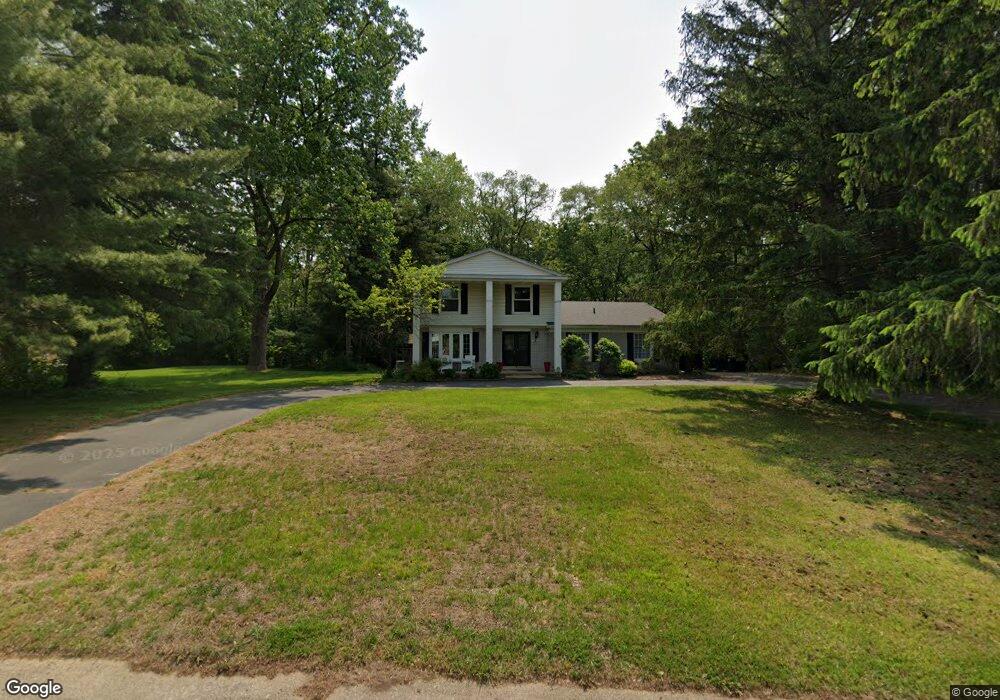
2175 Pear Tree Ln Unit Bldg-Unit Oakland, MI 48363
Estimated Value: $417,076 - $584,000
4
Beds
3
Baths
2,030
Sq Ft
$237/Sq Ft
Est. Value
About This Home
This home is located at 2175 Pear Tree Ln Unit Bldg-Unit, Oakland, MI 48363 and is currently estimated at $481,019, approximately $236 per square foot. 2175 Pear Tree Ln Unit Bldg-Unit is a home located in Oakland County with nearby schools including Baldwin Elementary School, Hart Middle School, and Stoney Creek High School.
Ownership History
Date
Name
Owned For
Owner Type
Purchase Details
Closed on
Sep 28, 2018
Sold by
Dayton Jeremy
Bought by
Muxiow Agnieszka
Current Estimated Value
Home Financials for this Owner
Home Financials are based on the most recent Mortgage that was taken out on this home.
Original Mortgage
$268,000
Outstanding Balance
$232,262
Interest Rate
4.5%
Mortgage Type
New Conventional
Estimated Equity
$248,757
Purchase Details
Closed on
Nov 27, 2013
Sold by
The Betty A Plumely Declaration Of Trust
Bought by
Dayton Jeremy
Home Financials for this Owner
Home Financials are based on the most recent Mortgage that was taken out on this home.
Original Mortgage
$211,498
Interest Rate
4.25%
Mortgage Type
FHA
Purchase Details
Closed on
Feb 19, 1998
Sold by
Plumley Betty A
Bought by
Betty A Plumley Tr
Create a Home Valuation Report for This Property
The Home Valuation Report is an in-depth analysis detailing your home's value as well as a comparison with similar homes in the area
Home Values in the Area
Average Home Value in this Area
Purchase History
| Date | Buyer | Sale Price | Title Company |
|---|---|---|---|
| Muxiow Agnieszka | $335,000 | Liberty Title | |
| Dayton Jeremy | $215,400 | Sterling Title Agency | |
| Betty A Plumley Tr | -- | -- |
Source: Public Records
Mortgage History
| Date | Status | Borrower | Loan Amount |
|---|---|---|---|
| Open | Muxiow Agnieszka | $268,000 | |
| Previous Owner | Dayton Jeremy | $211,498 |
Source: Public Records
Tax History
| Year | Tax Paid | Tax Assessment Tax Assessment Total Assessment is a certain percentage of the fair market value that is determined by local assessors to be the total taxable value of land and additions on the property. | Land | Improvement |
|---|---|---|---|---|
| 2025 | $3,584 | $156,820 | $0 | $0 |
| 2024 | $2,337 | $150,010 | $0 | $0 |
| 2023 | $2,247 | $141,910 | $0 | $0 |
| 2022 | $3,327 | $131,810 | $0 | $0 |
| 2021 | $3,132 | $128,830 | $0 | $0 |
| 2020 | $2,281 | $135,650 | $0 | $0 |
| 2019 | $3,405 | $128,420 | $0 | $0 |
| 2018 | $2,727 | $128,840 | $0 | $0 |
| 2017 | $2,686 | $124,870 | $0 | $0 |
| 2016 | $2,672 | $118,850 | $0 | $0 |
| 2015 | -- | $110,070 | $0 | $0 |
| 2014 | -- | $95,340 | $0 | $0 |
| 2011 | -- | $85,420 | $0 | $0 |
Source: Public Records
Map
Nearby Homes
- 3780 Strathmore Blvd
- 3941 S Ellamae Rd
- 2605 Fairway Ct
- 4380 the Heights Blvd
- 1673 Vista Dr
- 3227 Cairncross Dr
- 00 Collins Rd
- 3369 Dursly Ct Unit 186
- 4179 Wincrest Ln
- 4575 Hidden Glen Cir Unit 3
- 2706 Heights View Ct
- 0000 Serenity Rd
- 1035 Lindenhill Ln Unit 212
- 02 Bur Oak Ln
- 01 Bur Oak Ln
- 03 Bur Oak Ln
- 3507 Lennox Ct Unit 209
- 3430 Newbury Ct
- 3439 Aquarious Cir
- 1535 Vista Dr
- 2175 Pear Tree Ln
- 2163 Pear Tree Ln
- 2057 Pear Tree Ln
- 2170 Pear Tree Ln
- 2155 Pear Tree Ln
- 2065 Pear Tree Ln
- 2156 Pear Tree Ln
- 2049 Pear Tree Ln
- 3640 Orion Rd
- 2077 Pear Tree Ln
- 2150 Pear Tree Ln
- 2143 Pear Tree Ln
- 2103 Pear Tree Ln
- 2037 Pear Tree Ln
- 2060 Pear Tree Ln
- 3622 Orion Rd
- 3605 Orion Rd
- 2138 Pear Tree Ln
- 3635 Locust Dr
- 2074 Pear Tree Ln