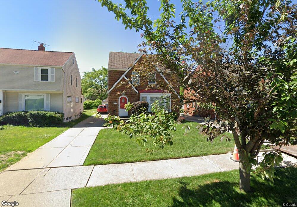
21750 Kennison Ave Euclid, OH 44123
Estimated Value: $154,853 - $173,000
3
Beds
2
Baths
1,324
Sq Ft
$124/Sq Ft
Est. Value
About This Home
This home is located at 21750 Kennison Ave, Euclid, OH 44123 and is currently estimated at $164,713, approximately $124 per square foot. 21750 Kennison Ave is a home located in Cuyahoga County with nearby schools including Arbor Elementary School, Euclid Middle School, and Euclid High School.
Ownership History
Date
Name
Owned For
Owner Type
Purchase Details
Closed on
Aug 30, 2011
Sold by
Beljan Richard C
Bought by
Brooks Anthony D
Current Estimated Value
Home Financials for this Owner
Home Financials are based on the most recent Mortgage that was taken out on this home.
Original Mortgage
$70,174
Outstanding Balance
$49,164
Interest Rate
4.75%
Mortgage Type
FHA
Estimated Equity
$115,549
Purchase Details
Closed on
Dec 6, 1989
Sold by
Beljan Charles and Beljan Ann A
Bought by
Beljan Ann A
Purchase Details
Closed on
Jan 1, 1975
Bought by
Beljan Charles and Beljan Ann A
Create a Home Valuation Report for This Property
The Home Valuation Report is an in-depth analysis detailing your home's value as well as a comparison with similar homes in the area
Home Values in the Area
Average Home Value in this Area
Purchase History
| Date | Buyer | Sale Price | Title Company |
|---|---|---|---|
| Brooks Anthony D | $72,000 | Chicago Title Insurance Co | |
| Beljan Ann A | -- | -- | |
| Beljan Charles | -- | -- |
Source: Public Records
Mortgage History
| Date | Status | Borrower | Loan Amount |
|---|---|---|---|
| Open | Brooks Anthony D | $70,174 |
Source: Public Records
Tax History Compared to Growth
Tax History
| Year | Tax Paid | Tax Assessment Tax Assessment Total Assessment is a certain percentage of the fair market value that is determined by local assessors to be the total taxable value of land and additions on the property. | Land | Improvement |
|---|---|---|---|---|
| 2024 | $3,537 | $51,590 | $9,450 | $42,140 |
| 2023 | $3,140 | $36,440 | $6,790 | $29,650 |
| 2022 | $3,069 | $36,440 | $6,790 | $29,650 |
| 2021 | $3,423 | $36,440 | $6,790 | $29,650 |
| 2020 | $3,472 | $33,740 | $6,300 | $27,440 |
| 2019 | $3,124 | $96,400 | $18,000 | $78,400 |
| 2018 | $3,120 | $33,740 | $6,300 | $27,440 |
| 2017 | $3,349 | $29,930 | $5,250 | $24,680 |
| 2016 | $3,356 | $29,930 | $5,250 | $24,680 |
| 2015 | $3,053 | $29,930 | $5,250 | $24,680 |
| 2014 | $3,053 | $29,930 | $5,250 | $24,680 |
Source: Public Records
Map
Nearby Homes
- 22000 Kennison Ave
- 21561 Maydale Ave
- 290 E 216th St
- 254 E 214th St
- 441 Kenwood Dr Unit M
- 362 E 214th St
- 22301 Milton Dr
- 430 Kenwood Dr Unit C11
- 450 Kenwood Dr Unit E12
- 231 E 210th St
- 461 Kenwood Dr Unit T3
- 470 Kenwood Dr Unit D
- 22751 Fox Ave
- 490 Kenwood Dr Unit B
- 21251 S Lake Shore Blvd
- 21370 S Lake Shore Blvd
- 174 E 212th St
- 521 Kenwood Dr Unit A5
- 21051 S Lake Shore Blvd
- 273 E 208th St
- 21720 Kennison Ave
- 21780 Kennison Ave
- 21784 Kennison Ave
- 21690 Kennison Ave
- 21790 Kennison Ave
- 21660 Kennison Ave
- 21731 Roberts Ave
- 21701 Roberts Ave
- 21761 Roberts Ave
- 21631 Roberts Ave
- 21801 Roberts Ave
- 21800 Kennison Ave
- 21630 Kennison Ave
- 21831 Roberts Ave
- 21611 Roberts Ave
- 21759 Kennison Ave
- 21721 Kennison Ave
- 21781 Kennison Ave
- 21691 Kennison Ave
- 21600 Kennison Ave