Estimated Value: $690,000 - $829,000
3
Beds
2
Baths
1,352
Sq Ft
$547/Sq Ft
Est. Value
About This Home
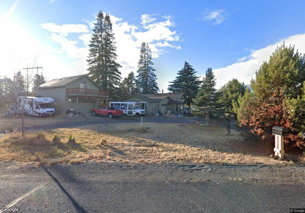
This home is located at 21755 Obsidian Ave, Bend, OR 97702 and is currently estimated at $739,746, approximately $547 per square foot. 21755 Obsidian Ave is a home located in Deschutes County with nearby schools including Silver Rail Elementary School, High Desert Middle School, and Bend Senior High School.
Ownership History
Date
Name
Owned For
Owner Type
Purchase Details
Closed on
Aug 22, 2024
Sold by
Oppenheim Marc D
Bought by
Oppenheim Family Trust and Oppenheim
Current Estimated Value
Purchase Details
Closed on
Jan 27, 2011
Sold by
Pezzopane Dominic and Pezzopane Rosalie M
Bought by
Oppenheim Marc D
Home Financials for this Owner
Home Financials are based on the most recent Mortgage that was taken out on this home.
Original Mortgage
$162,000
Interest Rate
4.71%
Mortgage Type
New Conventional
Purchase Details
Closed on
May 26, 2004
Sold by
Pezzopane Dominic and Pezzopane Rosalie
Bought by
Pezzopane Dominic and Pezzopane Rosalie M
Create a Home Valuation Report for This Property
The Home Valuation Report is an in-depth analysis detailing your home's value as well as a comparison with similar homes in the area
Purchase History
| Date | Buyer | Sale Price | Title Company |
|---|---|---|---|
| Oppenheim Family Trust | -- | Deschutes County Title | |
| Oppenheim Marc D | -- | Western Title & Escrow Co | |
| Pezzopane Dominic | -- | -- |
Source: Public Records
Mortgage History
| Date | Status | Borrower | Loan Amount |
|---|---|---|---|
| Previous Owner | Oppenheim Marc D | $162,000 |
Source: Public Records
Tax History
| Year | Tax Paid | Tax Assessment Tax Assessment Total Assessment is a certain percentage of the fair market value that is determined by local assessors to be the total taxable value of land and additions on the property. | Land | Improvement |
|---|---|---|---|---|
| 2025 | $4,788 | $319,670 | -- | -- |
| 2024 | $4,581 | $310,360 | -- | -- |
| 2023 | $4,311 | $301,330 | $0 | $0 |
| 2022 | $3,976 | $284,040 | $0 | $0 |
| 2021 | $4,000 | $275,770 | $0 | $0 |
| 2020 | $3,777 | $275,770 | $0 | $0 |
| 2019 | $3,670 | $267,740 | $0 | $0 |
| 2018 | $3,133 | $228,600 | $0 | $0 |
| 2017 | $3,051 | $221,950 | $0 | $0 |
| 2016 | $2,898 | $215,490 | $0 | $0 |
| 2015 | $2,817 | $209,220 | $0 | $0 |
| 2014 | $2,726 | $203,130 | $0 | $0 |
Source: Public Records
Map
Nearby Homes
- 61747 Somerset Dr
- 21925 Bear Creek Rd
- 21435 Modoc Ln
- 61059 NE Give Place
- 61073 NE Unity Place
- 22030 Stormy Ln
- 57 NE Give Place
- 61055 NE Give Place
- 21549 NE Gather Place
- 21557 NE Gather Place Unit 72
- 21557 NE Gather Place
- 21553 NE Gather Place Unit 71
- 61083 NE Give Place Unit 65
- 21517 O'Connor Way
- 21426 Livingston Dr Unit 18
- 21495 O'Connor Way
- 21505 O'Connor Way
- 21499O 'Connor Way
- 61077 NE Unity Place
- 21432 Livingston Dr
- 21771 Obsidian Ave
- 21739 Obsidian Ave
- 219000 Obsidian Ave
- 21758 Obsidian Ave
- 21725 Obsidian Ave
- 21780 Obsidian Ave
- 61747 Wickiup Rd
- 21789 Obsidian Ave
- 21714 Obsidian Ave
- 21709 Obsidian Ave
- 61754 Wickiup Rd
- 61767 Wickiup Rd
- 61739 Tomahawk St
- 61760 Tomahawk St
- 21685 Obsidian Ave
- 21815 Obsidian Ave
- 61755 Tomahawk St
- 61538 Ward Rd
- 61765 Tomahawk St
Your Personal Tour Guide
Ask me questions while you tour the home.