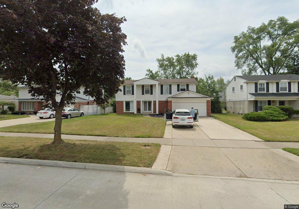
21759 Independence Dr Southfield, MI 48076
Estimated Value: $333,503 - $368,000
3
Beds
4
Baths
2,172
Sq Ft
$160/Sq Ft
Est. Value
About This Home
This home is located at 21759 Independence Dr, Southfield, MI 48076 and is currently estimated at $348,376, approximately $160 per square foot. 21759 Independence Dr is a home located in Oakland County with nearby schools including Alice M. Birney K-8 School, Faxon Academy, and Southfield Christian School.
Ownership History
Date
Name
Owned For
Owner Type
Purchase Details
Closed on
Jan 10, 2018
Sold by
Perkins Jasmine
Bought by
Perkins Rodney
Current Estimated Value
Purchase Details
Closed on
Mar 18, 2014
Sold by
Ross Royalla E
Bought by
Perkins Jasmine
Purchase Details
Closed on
Sep 4, 2009
Sold by
Bank Of New York
Bought by
Ross Royalla E
Home Financials for this Owner
Home Financials are based on the most recent Mortgage that was taken out on this home.
Original Mortgage
$64,528
Interest Rate
4.9%
Mortgage Type
FHA
Purchase Details
Closed on
Sep 25, 2007
Sold by
Mortgage Electronic Registration Systems
Bought by
Bank Of New York and Certificateholders Of Cwabs 2004-01
Purchase Details
Closed on
Sep 4, 2007
Sold by
Smith Andrew and Smith Eugenia
Bought by
Mortgage Electronic Registration Systems
Create a Home Valuation Report for This Property
The Home Valuation Report is an in-depth analysis detailing your home's value as well as a comparison with similar homes in the area
Home Values in the Area
Average Home Value in this Area
Purchase History
| Date | Buyer | Sale Price | Title Company |
|---|---|---|---|
| Perkins Rodney | -- | None Listed On Document | |
| Perkins Rodney | -- | None Listed On Document | |
| Perkins Jasmine | $1,000 | None Available | |
| Ross Royalla E | $65,720 | None Available | |
| Bank Of New York | -- | None Available | |
| Mortgage Electronic Registration Systems | $180,000 | None Available |
Source: Public Records
Mortgage History
| Date | Status | Borrower | Loan Amount |
|---|---|---|---|
| Previous Owner | Ross Royalla E | $64,528 |
Source: Public Records
Tax History
| Year | Tax Paid | Tax Assessment Tax Assessment Total Assessment is a certain percentage of the fair market value that is determined by local assessors to be the total taxable value of land and additions on the property. | Land | Improvement |
|---|---|---|---|---|
| 2025 | $5,810 | $155,410 | $34,520 | $120,890 |
| 2022 | $4,923 | $130,560 | $25,960 | $104,600 |
| 2021 | $5,460 | $119,710 | $21,130 | $98,580 |
| 2020 | $5,314 | $112,280 | $18,060 | $94,220 |
| 2018 | $7,685 | $93,480 | $18,060 | $75,420 |
| 2015 | -- | $71,400 | $0 | $0 |
| 2014 | -- | $58,420 | $0 | $0 |
| 2011 | -- | $58,690 | $0 | $0 |
Source: Public Records
Map
Nearby Homes
- 28400 Valley Forge St
- 28330 Lahser Rd
- 21670 Virginia St
- 22180 Ivanhoe Ln
- 21361 Andover Rd
- 28819 Lahser Rd
- 22448 Hallcroft Trail
- 22430 Chatsford Circuit St
- 28375 Ranchwood Dr
- 20940 Andover Rd
- 22465 Kenwyck Dr
- 28430 Ranchwood Dr
- 28249 Bell Rd
- 28730 Ranchwood Dr
- 22664 W 11 Mile Rd Unit 10
- 23223 Bellwood Dr
- 29370 Stellamar Dr
- 20120 Covington Pkwy
- 27840 Larkmoor St
- 29467 Leemoor Dr
- 21789 Independence Dr
- 21729 Independence Dr
- 21819 Independence Dr
- 21760 Constitution St
- 21790 Constitution St
- 21699 Independence Dr
- 21730 Constitution St
- 21820 Constitution St
- 21849 Independence Dr
- 21790 Independence Dr
- 21760 Independence Dr
- 21700 Constitution St
- 21730 Independence Dr Unit Bldg-Unit
- 21730 Independence Dr
- 21820 Independence Dr
- 21669 Independence Dr
- 21850 Constitution St
- 21700 Independence Dr
- 21879 Independence Dr
- 21670 Constitution St
Your Personal Tour Guide
Ask me questions while you tour the home.